Difference between revisions of "2011-04-30 60 9"
From Geohashing
imported>Relet ([live] On our way to "Way cool" Åsen... woo!) |
m (2020-01-01 update) |
||
| (9 intermediate revisions by 3 users not shown) | |||
| Line 1: | Line 1: | ||
| − | |||
<!-- If you did not specify these parameters in the template, please substitute appropriate values for IMAGE, LAT, LON, and DATE (YYYY-MM-DD format) | <!-- If you did not specify these parameters in the template, please substitute appropriate values for IMAGE, LAT, LON, and DATE (YYYY-MM-DD format) | ||
| Line 18: | Line 17: | ||
__NOTOC__ | __NOTOC__ | ||
== Location == | == Location == | ||
| − | + | In a swamp, in the Veikulåsen Nature Reserve, Norway. | |
== Participants == | == Participants == | ||
| − | + | * [[User:lyx|lyx]] | |
| + | * [[User:relet|relet]] | ||
== Plans == | == Plans == | ||
| − | + | Take the train to Gol, hike towards the hash, camp, hike back. | |
== Expedition == | == Expedition == | ||
| Line 31: | Line 31: | ||
*On our way to "Way cool" Åsen... woo! -- [[User:relet|relet]] [http://www.openstreetmap.org/?lat=60.699776&lon=8.98835&zoom=16&layers=B000FTF @60,6998,8,9884] 12:09, 30 April 2011 (MESZ) | *On our way to "Way cool" Åsen... woo! -- [[User:relet|relet]] [http://www.openstreetmap.org/?lat=60.699776&lon=8.98835&zoom=16&layers=B000FTF @60,6998,8,9884] 12:09, 30 April 2011 (MESZ) | ||
| + | |||
| + | *Norway - always a cool drink next to your way. -- [[User:relet|relet]] 14:16, 30 April 2011 (MESZ) | ||
| + | |||
| + | *<3 Mother Nature! -- [[User:relet|relet]] [http://www.openstreetmap.org/?lat=60.6804084777832&lon=9.057079553604126&zoom=16&layers=B000FTF @60,6804,9,0571] 15:17, 30 April 2011 (MESZ) | ||
| + | |||
| + | *Mission aborted, pretending a cliff thwarted us. Returning to the sunny meadows. :) -- [[User:relet|relet]] [http://www.openstreetmap.org/?lat=60.67700207233429&lon=9.062916040420532&zoom=16&layers=B000FTF @60,6770,9,0629] 16:25, 30 April 2011 (MESZ) | ||
== Tracklog == | == Tracklog == | ||
<!-- if your GPS device keeps a log, you may post a link here --> | <!-- if your GPS device keeps a log, you may post a link here --> | ||
== Photos == | == Photos == | ||
| − | + | {{#vardefine:gaWidth|250}} | |
| − | + | {{#vardefine:gaHeight|187}} | |
| − | + | {{#vardefine:gaLines|2}} | |
| − | + | {{Gallery2| | |
| − | + | {{GalleryItem | File:2011_04_30_60_09_R1062973.JPG | ... }} | |
| − | + | {{GalleryItem | File:2011_04_30_60_09_R1062974.JPG | ... }} | |
| − | + | {{GalleryItem | File:2011_04_30_60_09_R1062976.JPG | ... }} | |
| − | {{ | + | {{GalleryItem | File:2011_04_30_60_09_R1062978.JPG | ... }} |
| − | + | {{GalleryItem | File:2011_04_30_60_09_R1062980.JPG | ... }} | |
| + | {{GalleryItem | File:2011_04_30_60_09_R1062982.JPG | ... }} | ||
| + | {{GalleryItem | File:2011_04_30_60_09_R1062985.JPG | ... }} | ||
| + | {{GalleryItem | File:2011_04_30_60_09_R1062995.JPG | ... }} | ||
| + | {{GalleryItem | File:2011_04_30_60_09_R1063002.JPG | ... }} | ||
| + | {{GalleryItem | File:2011_04_30_60_09_R1063003.JPG | ... }} | ||
| + | {{GalleryItem | File:2011_04_30_60_09_R1063007.JPG | ... }} | ||
| + | {{GalleryItem | File:2011_04_30_60_09_R1063012.JPG | ... }} | ||
| + | {{GalleryItem | File:2011_04_30_60_09_R1063013.JPG | ... }} | ||
| + | {{GalleryItem | File:2011_04_30_60_09_R1063017.JPG | ... }} | ||
| + | {{GalleryItem | File:2011_04_30_60_09_R1063019.JPG | ... }} | ||
| + | {{GalleryItem | File:2011_04_30_60_09_R1063021.JPG | ... }} | ||
| + | {{GalleryItem | File:2011_04_30_60_09_R1063024.JPG | ... }} | ||
| + | {{GalleryItem | File:2011_04_30_60_09_R1063025.JPG | ... }} | ||
| + | {{GalleryItem | File:2011_04_30_60_09_R1063027.JPG | ... }} | ||
| + | {{GalleryItem | File:2011_04_30_60_09_R1063028.JPG | ... }} | ||
| + | {{GalleryItem | File:2011_04_30_60_09_R1063030.JPG | ... }} | ||
| + | {{GalleryItem | File:2011_04_30_60_09_R1063039.JPG | ... }} | ||
| + | }} | ||
| − | |||
| − | |||
| − | |||
| − | |||
| − | |||
| − | |||
| − | |||
| − | |||
| − | |||
| − | |||
| − | |||
[[Category:Expeditions]] | [[Category:Expeditions]] | ||
| − | |||
[[Category:Expeditions with photos]] | [[Category:Expeditions with photos]] | ||
| − | |||
| − | |||
| − | |||
| − | |||
| − | |||
| − | |||
| − | |||
| − | |||
| − | |||
[[Category:Coordinates not reached]] | [[Category:Coordinates not reached]] | ||
| − | + | [[Category:Not reached - Mother Nature]] | |
| − | [[Category:Not reached - Mother Nature]] | + | {{location|NO|30}} |
| − | |||
| − | |||
| − | |||
| − | |||
Latest revision as of 00:26, 16 February 2020
| Sat 30 Apr 2011 in 60,9: 60.6712943, 9.0772488 geohashing.info google osm bing/os kml crox |
Location
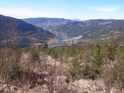
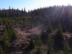
In a swamp, in the Veikulåsen Nature Reserve, Norway.
Participants
Plans
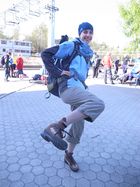
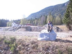
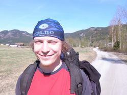
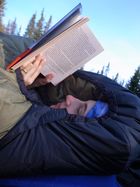
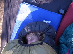
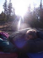
Take the train to Gol, hike towards the hash, camp, hike back.
Expedition
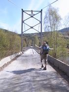
- On our way to "Way cool" Åsen... woo! -- relet @60,6998,8,9884 12:09, 30 April 2011 (MESZ)
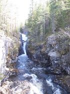
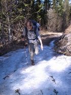
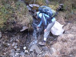
- Norway - always a cool drink next to your way. -- relet 14:16, 30 April 2011 (MESZ)
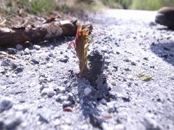
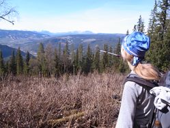
- <3 Mother Nature! -- relet @60,6804,9,0571 15:17, 30 April 2011 (MESZ)
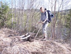
- Mission aborted, pretending a cliff thwarted us. Returning to the sunny meadows. :) -- relet @60,6770,9,0629 16:25, 30 April 2011 (MESZ)
Tracklog
Photos
|
