Difference between revisions of "2012-04-03 59 10"
From Geohashing
imported>Relet ([live] On my way. Yay for wifi in buses.) |
m (2020-01-01 update) |
||
| (12 intermediate revisions by 4 users not shown) | |||
| Line 13: | Line 13: | ||
15 minutes walk from Gulskogen railway station. | 15 minutes walk from Gulskogen railway station. | ||
| + | |||
| + | {{Template:PBGH battleship|lat=59|lon=10|date=2012-04-03}} | ||
== Participants == | == Participants == | ||
| Line 28: | Line 30: | ||
*On my way. Yay for wifi in buses. -- [[User:relet|relet]] [http://www.openstreetmap.org/?lat=60.18611980&lon=10.11989010&zoom=16&layers=B000FTF @60.1861,10.1199] 16:29, 03 april 2012 (CEST) | *On my way. Yay for wifi in buses. -- [[User:relet|relet]] [http://www.openstreetmap.org/?lat=60.18611980&lon=10.11989010&zoom=16&layers=B000FTF @60.1861,10.1199] 16:29, 03 april 2012 (CEST) | ||
| + | |||
| + | *Coordinates reached! -- [[User:relet|relet]] [http://www.openstreetmap.org/?lat=59.73818030&lon=10.15227976&zoom=16&layers=B000FTF @59.7382,10.1523] 18:42, 03 april 2012 (CEST) | ||
| + | |||
| + | *Ok, I left a little something for the geocachers to find, just in case I have to head back before we meet. -- [[User:relet|relet]] [http://www.openstreetmap.org/?lat=59.73843658&lon=10.15264798&zoom=16&layers=B000FTF @59.7384,10.1526] 19:00, 03 april 2012 (CEST) | ||
| + | |||
| + | *No suspicious gps bearers on the way back to gulskogen either. -- [[User:relet|relet]] [http://www.openstreetmap.org/?lat=59.74057740&lon=10.15749810&zoom=16&layers=B000FTF @59.7406,10.1575] 19:33, 03 april 2012 (CEST) | ||
| + | |||
| + | *Reached the spot at 19:45, a bit later than expected. [[User:Jonmarb|Jonmarb]] 15:50, 3 April 2012 (EDT) | ||
| + | |||
| + | Sorry to have missed you! I just had to catch a bus, or take the train four hours later. :D Did you take the small path atop the tunnel entrance? -- [[User:relet|relet]] 15:56, 3 April 2012 (EDT) | ||
| + | |||
| + | Yes. I came up Bjørkelia. It was a beautiful sunset on my way back! [[User:Jonmarb|Jonmarb]] 15:58, 3 April 2012 (EDT) | ||
| + | |||
== Tracklog == | == Tracklog == | ||
| Line 34: | Line 49: | ||
{{#vardefine:gaHeight|187}} | {{#vardefine:gaHeight|187}} | ||
{{#vardefine:gaLines|2}} | {{#vardefine:gaLines|2}} | ||
| + | |||
{{Gallery2| | {{Gallery2| | ||
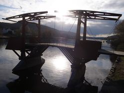
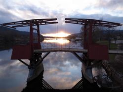
| − | + | {{GalleryItem |File:2012-04-03 59 10 tnR1064823.JPG | relet: The old drawbridge over the river. When the water was warmer, we used to slackline there. }} | |
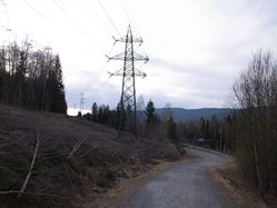
| + | {{GalleryItem |File:2012-04-03 59 10 tnR1064824.JPG | View of the general location of the hash. }} | ||
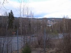
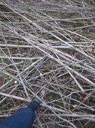
| + | {{GalleryItem |File:2012-04-03 59 10 tnR1064825.JPG | View of Drammen to the right, whatever the sign says. }} | ||
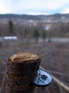
| + | {{GalleryItem |File:2012-04-03 59 10 tnR1064828.JPG | Geohashcoin left on the spot. Cheers, crox. }} | ||
| + | {{GalleryItem |File:2012-04-03 59 10 tnR1064833.JPG | Creepy grin. }} | ||
| + | {{GalleryItem |File:2012-04-03 59 10 tnR1064834.JPG | Fortunately, Vancouver has me well prepared in the art of balancing on logs }} | ||
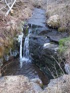
| + | {{GalleryItem |File:2012-04-03 59 10 tnR1064838.JPG | Water trying to look scenic, before disappearing under the highway. }} | ||
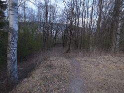
| + | {{GalleryItem |File:2012-04-03 59 10 tnR1064839.JPG | The path through Bjørkelia }} | ||
| + | {{GalleryItem |File:2012-04-03 59 10 tnR1064844.JPG | Drawbridge on the way back. }} | ||
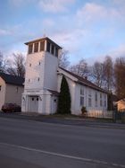
| + | {{GalleryItem |File:TnR1064847.JPG | And a scenic chapel. }} | ||
| + | |||
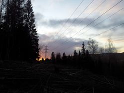
| + | {{GalleryItem |File:20120403 195216.jpg|Jonmarb: View to the west. Nice sunset.}} | ||
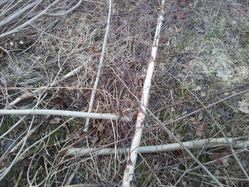
| + | {{GalleryItem |File:20120403 195227.jpg|The location, only 20 meters away from the road}} | ||
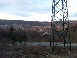
| + | {{GalleryItem |File:20120403 195220.jpg|The view to the north. Gulskogen in front, Åssiden on the others side of the River. }} | ||
}} | }} | ||
== Achievements == | == Achievements == | ||
{{#vardefine:ribbonwidth|800px}} | {{#vardefine:ribbonwidth|800px}} | ||
| − | |||
| − | |||
| − | |||
[[Category:Expeditions]] | [[Category:Expeditions]] | ||
| − | |||
[[Category:Expeditions with photos]] | [[Category:Expeditions with photos]] | ||
| − | |||
| − | |||
| − | |||
[[Category:Coordinates reached]] | [[Category:Coordinates reached]] | ||
| − | + | {{location|NO|30}} | |
| − | |||
| − | |||
| − | |||
| − | |||
| − | |||
| − | |||
Latest revision as of 00:27, 16 February 2020
| Tue 3 Apr 2012 in 59,10: 59.7382037, 10.1523877 geohashing.info google osm bing/os kml crox |
Location
Drammen, in the forest above the highway.
59.738203°, 10.152387°
15 minutes walk from Gulskogen railway station.
Today's battleship location is: B 8
Participants
Plans
- Take the bus to Drammen, ETA 1803 ... Walk.
- Walk all the way... Aprox 10 minutes walk, ETA in the evening. 1900?
Expedition
- On my way. Yay for wifi in buses. -- relet @60.1861,10.1199 16:29, 03 april 2012 (CEST)
- Coordinates reached! -- relet @59.7382,10.1523 18:42, 03 april 2012 (CEST)
- Ok, I left a little something for the geocachers to find, just in case I have to head back before we meet. -- relet @59.7384,10.1526 19:00, 03 april 2012 (CEST)
- No suspicious gps bearers on the way back to gulskogen either. -- relet @59.7406,10.1575 19:33, 03 april 2012 (CEST)
- Reached the spot at 19:45, a bit later than expected. Jonmarb 15:50, 3 April 2012 (EDT)
Sorry to have missed you! I just had to catch a bus, or take the train four hours later. :D Did you take the small path atop the tunnel entrance? -- relet 15:56, 3 April 2012 (EDT)
Yes. I came up Bjørkelia. It was a beautiful sunset on my way back! Jonmarb 15:58, 3 April 2012 (EDT)
Tracklog
Photos
|
