Difference between revisions of "2010-08-01 60 10"
imported>Relet m (Created page with '{{Expedition/relet|date=2010-08-01|lat=60|lon=10}}') |
m |
||
| (20 intermediate revisions by 5 users not shown) | |||
| Line 1: | Line 1: | ||
| − | {{Expedition/relet| | + | {{Advert|image=2010-08-01-60-10-R1060837.jpg}} |
| + | |||
| + | {{meetup graticule | ||
| + | | lat=60 | ||
| + | | lon=10 | ||
| + | | date=2010-08-01 | ||
| + | }} | ||
| + | |||
| + | __NOTOC__ | ||
| + | == Location == | ||
| + | A ''pretty steep'' piece of forest near a road, near Østre Olimb, between Jevnaker and Lunner. | ||
| + | |||
| + | {{PBGH battleship | lat = 60 | lon = 10 | date = 2010-08-01 }} | ||
| + | |||
| + | == Participants == | ||
| + | * [[User:W|W]] | ||
| + | * [[User:eiggen|eiggen]] | ||
| + | * [[User:relet|relet]] | ||
| + | |||
| + | == Plans == | ||
| + | |||
| + | W_ mentioned yesterday evening that they were going to visit my graticule, leaving me no choice but to cycle those 20km to meet them. :D -- [[User:relet|relet]] | ||
| + | |||
| + | == Expedition == | ||
| + | |||
| + | === [[User:eiggen|eiggen]] === | ||
| + | |||
| + | After a short summer vacation in France with no achievable hashpoints in the vicinity of the hotels I was staying at, I felt the urge to geohash again. I noticed that the hashpoint in the [[60,10]] graticule would be fairly close to a large road, so I began investigating on the public transportation system in that region and contacted W about the possible expedition. W was a bit quicker with the research and found out about the [http://en.wikipedia.org/wiki/Lunner Lunner] train station, which was conveniently located about 7 km from the hashpoint. We decided to take the train to Lunner, a journey of approximately one hour. | ||
| + | |||
| + | Once we arrived there, we tried to accomplish our second "running" geohash by jogging the 7 km between the station and the point. Unfortunately, I had overestimated my capacity to recuperate quickly from a 12 km jog I did the day before. We had to do intervals, which, I hope, did not disappoint W too much. | ||
| + | |||
| + | Close to the goal, we saw a bicycle parked all alone on the side of the road. It was the Internet descending on the hashpoint. We met [[User:relet|relet]], who was waiting for us in the woods and proceeded to find the hashpoint with great precision. | ||
| + | |||
| + | The way back was an almost perfect symmetry of the way to get there, but we chose to take some small detours to admire the scenery of rural Norway. Colorful wooden houses next to potato fields planted in valleys carved by the last ice age. Beautiful. | ||
| + | |||
| + | === [[User:relet|relet]] === | ||
| + | |||
| + | Fortunately, I did actually wake up in the morning. Even before my alarm clock did. After throwing some ''rundstykker'' in the oven, both for breakfast and rations. | ||
| + | |||
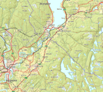
| + | The cycle trip was a bit uneventful, since it was basically the same way I took to [[2010-07-09 60 10|Grymyr]]. Except for the last third, which was uphills in the direction of Lunner. Crawling up the hills, I reached the surroundings of the geohash at 11:00 ''cum tempore''. No trace of W or eiggen, so I parked my bike, and disappeared into the bushes. I briefly considered whether I should attach a sign to my bike: | ||
| + | THE INTERNET IS [ IN ]. | ||
| + | Consultations: 5¢ | ||
| + | Unfortunately, I did not bring my tape, so I discarded the idea. | ||
| + | |||
| + | There was a very convenient trail leading right to a big rock. At the rock, my GPS told me that it was within 8m of the geohash. It showed me some other numbers too, always with an accuracy of d-2m, where d is the distance displayed. I figured, that would be a good place to wait for eventual visitors. | ||
| + | |||
| + | And lo and behold, soon enough I heard voices. They seemed to be discussing for a while, before they discovered my bicycle and the trail. As expected, it were W and eiggen on their training run from Lunner. | ||
| + | |||
| + | === All Together === | ||
| + | |||
| + | We introduced ourselves, and decided to zero in on the geohash together. Everyone ran away in different directions. Eventually, eiggen's and relet's deviced showed sufficiently low numbers near a tree near the rock, with W still scrambling some fifteen meters lower through the bushes, shouting some readings. We decided on a majority vote, and began to write a marker. | ||
| + | |||
| + | == Tracklog == | ||
| + | |||
| + | [http://maps.google.com/maps?t=m&q=http://heimdalsgata.com/geohashing/2010-08-01_60_10/tracks.kml Tracks from the Lunner train station to the hashpoint, and back (eiggen and W)] | ||
| + | |||
| + | == Photos == | ||
| + | {{#vardefine:gaWidth|250}} | ||
| + | {{#vardefine:gaHeight|187}} | ||
| + | {{#vardefine:gaLines|2}} | ||
| + | {{Gallery2| | ||
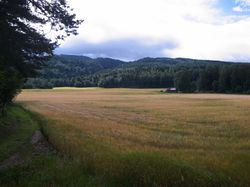
| + | {{GalleryItem | File:2010-08-01-60-10-R1060816.jpg | A random field on the way }} | ||
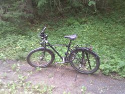
| + | {{GalleryItem | File:2010-08-01_60_10-relet-bike.jpg | relet's bike welcoming eiggen and W to the hashpoint trail }} | ||
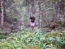
| + | {{GalleryItem | File:2010-08-01-60-10-R1060826.jpg | W pretending to have come running all the way from Lunner }} | ||
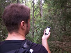
| + | {{GalleryItem | File:2010-08-01-60-10-R1060831.jpg | eiggen zeroing in }} | ||
| + | {{GalleryItem | File:2010-08-01-60-10-R1060834.jpg | Two out of three devices agree on a location }} | ||
| + | {{GalleryItem | File:2010-08-01-60-10-R1060835.jpg | eiggen marking the territory }} | ||
| + | {{GalleryItem | File:2010-08-01-60-10-R1060836.jpg | Group grin }} | ||
| + | {{GalleryItem | File:2010-08-01-60-10-R1060837.jpg | Our marker }} | ||
| + | {{GalleryItem | File:2010-08-01 60 10 route.png | relet's cycle route. }} | ||
| + | }} | ||
| + | |||
| + | == Achievements == | ||
| + | {{#vardefine:ribbonwidth|800px}} | ||
| + | |||
| + | {{Meet-up | ||
| + | | latitude = 60 | ||
| + | | longitude = 10 | ||
| + | | date = 2010-08-01 | ||
| + | | name = eiggen | ||
| + | | other = [[User:relet|relet]] | ||
| + | }} | ||
| + | |||
| + | [[Category:Expeditions]] | ||
| + | [[Category:Expeditions with photos]] | ||
| + | [[Category:Coordinates reached]] | ||
| + | {{location|NO|30}} | ||
Latest revision as of 08:03, 17 February 2020
| Have you seen our geohashing marker? We'd love to hear from you! Click here to say "hi" and tell us what you've seen!
Curious about what geohashing is? Read more! |  |
| Sun 1 Aug 2010 in 60,10: 60.2756420, 10.4991637 geohashing.info google osm bing/os kml crox |
Location
A pretty steep piece of forest near a road, near Østre Olimb, between Jevnaker and Lunner.
Today's battleship location is: E 3
Participants
Plans
W_ mentioned yesterday evening that they were going to visit my graticule, leaving me no choice but to cycle those 20km to meet them. :D -- relet
Expedition
eiggen
After a short summer vacation in France with no achievable hashpoints in the vicinity of the hotels I was staying at, I felt the urge to geohash again. I noticed that the hashpoint in the 60,10 graticule would be fairly close to a large road, so I began investigating on the public transportation system in that region and contacted W about the possible expedition. W was a bit quicker with the research and found out about the Lunner train station, which was conveniently located about 7 km from the hashpoint. We decided to take the train to Lunner, a journey of approximately one hour.
Once we arrived there, we tried to accomplish our second "running" geohash by jogging the 7 km between the station and the point. Unfortunately, I had overestimated my capacity to recuperate quickly from a 12 km jog I did the day before. We had to do intervals, which, I hope, did not disappoint W too much.
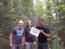
Close to the goal, we saw a bicycle parked all alone on the side of the road. It was the Internet descending on the hashpoint. We met relet, who was waiting for us in the woods and proceeded to find the hashpoint with great precision.
The way back was an almost perfect symmetry of the way to get there, but we chose to take some small detours to admire the scenery of rural Norway. Colorful wooden houses next to potato fields planted in valleys carved by the last ice age. Beautiful.
relet
Fortunately, I did actually wake up in the morning. Even before my alarm clock did. After throwing some rundstykker in the oven, both for breakfast and rations.
The cycle trip was a bit uneventful, since it was basically the same way I took to Grymyr. Except for the last third, which was uphills in the direction of Lunner. Crawling up the hills, I reached the surroundings of the geohash at 11:00 cum tempore. No trace of W or eiggen, so I parked my bike, and disappeared into the bushes. I briefly considered whether I should attach a sign to my bike:
THE INTERNET IS [ IN ].
  Consultations: 5¢
Unfortunately, I did not bring my tape, so I discarded the idea.
There was a very convenient trail leading right to a big rock. At the rock, my GPS told me that it was within 8m of the geohash. It showed me some other numbers too, always with an accuracy of d-2m, where d is the distance displayed. I figured, that would be a good place to wait for eventual visitors.
And lo and behold, soon enough I heard voices. They seemed to be discussing for a while, before they discovered my bicycle and the trail. As expected, it were W and eiggen on their training run from Lunner.
All Together
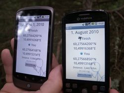
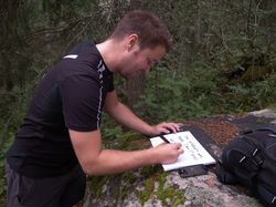
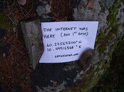
We introduced ourselves, and decided to zero in on the geohash together. Everyone ran away in different directions. Eventually, eiggen's and relet's deviced showed sufficiently low numbers near a tree near the rock, with W still scrambling some fifteen meters lower through the bushes, shouting some readings. We decided on a majority vote, and began to write a marker.
Tracklog
Tracks from the Lunner train station to the hashpoint, and back (eiggen and W)
Photos
|
Achievements
eiggen earned the Meet-up achievement
|
