Difference between revisions of "2013-03-27 39 -77"
imported>OfficeLinebacker ([live picture] My trusty steed [http://www.openstreetmap.org/?lat=39.53555308&lon=-77.10721937&zoom=16&layers=B000FTF @39.5356,-77.1072]) |
m (Replacing http://wiki.xkcd.com/geohashing/2013-03-27_39_-76 with 2013-03-27 39 -76) |
||
| (12 intermediate revisions by 4 users not shown) | |||
| Line 1: | Line 1: | ||
| − | |||
| − | |||
| − | |||
| − | |||
| − | |||
| − | |||
| − | |||
| − | |||
| − | |||
| − | |||
{{meetup graticule | {{meetup graticule | ||
| lat=39 | | lat=39 | ||
| Line 19: | Line 9: | ||
== Location == | == Location == | ||
<!-- where you've surveyed the hash to be --> | <!-- where you've surveyed the hash to be --> | ||
| + | In a thicket near a quarry in Westminster, MD | ||
== Participants == | == Participants == | ||
<!-- who attended: If you link to your wiki user name in this section, your expedition will be picked up by the various statistics generated for geohashing. You may use three tildes ~ as a shortcut to automatically insert the user signature of the account you are editing with. | <!-- who attended: If you link to your wiki user name in this section, your expedition will be picked up by the various statistics generated for geohashing. You may use three tildes ~ as a shortcut to automatically insert the user signature of the account you are editing with. | ||
--> | --> | ||
| + | [[User:OfficeLinebacker|OfficeLinebacker]] ([[User talk:OfficeLinebacker|talk]])OfficeLinebacker | ||
== Plans == | == Plans == | ||
| Line 29: | Line 21: | ||
== Expedition == | == Expedition == | ||
<!-- how it all turned out. your narrative goes here. --> | <!-- how it all turned out. your narrative goes here. --> | ||
| + | Deviated from the GPS directions to navigate to a dirt track I saw in the satellite photos. The sign said something about a quarry--no NO TRESPASSING signs! Success! | ||
| + | Drove a ways on a muddy dirt track. Long grasses an stems tickled the undercarriage of my car. Had to gun it through a couple of deep mud puddles. Once again the 4WD came in handy. I doubt my old Mazda Protege would have made it. At one point the muddy water splashed all over my hood and windshield and later, I noticed small clumps of mud on my roof. Once I parked, a deer path led me right to the spot. | ||
| + | |||
| + | Fairly straightforward. After this expedition, I headed to the [[2013-03-27 39 -76|hashpoint for the Baltimore graticule]]. | ||
| − | |||
== Tracklog == | == Tracklog == | ||
<!-- if your GPS device keeps a log, you may post a link here --> | <!-- if your GPS device keeps a log, you may post a link here --> | ||
| Line 41: | Line 36: | ||
<gallery perrow="5"> | <gallery perrow="5"> | ||
| − | Image:2013-03-27_39_-77_12-15-16-660.jpg | | + | Image:2013-03-27_39_-77_12-15-16-660.jpg | Silly grin [http://www.openstreetmap.org/?lat=39.53572517&lon=-77.10742280&zoom=16&layers=B000FTF @39.5357,-77.1074] |
Image:2013-03-27_39_-77_12-15-36-368.jpg | The spot [http://www.openstreetmap.org/?lat=39.53572537&lon=-77.10742292&zoom=16&layers=B000FTF @39.5357,-77.1074] | Image:2013-03-27_39_-77_12-15-36-368.jpg | The spot [http://www.openstreetmap.org/?lat=39.53572537&lon=-77.10742292&zoom=16&layers=B000FTF @39.5357,-77.1074] | ||
Image:2013-03-27_39_-77_12-17-10-309.jpg | My trusty steed [http://www.openstreetmap.org/?lat=39.53555308&lon=-77.10721937&zoom=16&layers=B000FTF @39.5356,-77.1072] | Image:2013-03-27_39_-77_12-17-10-309.jpg | My trusty steed [http://www.openstreetmap.org/?lat=39.53555308&lon=-77.10721937&zoom=16&layers=B000FTF @39.5356,-77.1072] | ||
| + | |||
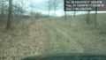
| + | Image:2013-03-27_39_-77_12-21-36-015.jpg | Part of the road there [http://www.openstreetmap.org/?lat=39.53697160&lon=-77.10396938&zoom=16&layers=B000FTF @39.5370,-77.1040] | ||
| + | |||
| + | Image:2013-03-27_39_-77_12-21-55-423.jpg | A mud bog I needed 4WD to get through [http://www.openstreetmap.org/?lat=39.53697257&lon=-77.10397137&zoom=16&layers=B000FTF @39.5370,-77.1040] | ||
| + | |||
| + | Image:2013-03-27_39_-77_12-22-16-195.jpg | The high vegetation scraped the undercarriage of my car here [http://www.openstreetmap.org/?lat=39.53699287&lon=-77.10398268&zoom=16&layers=B000FTF @39.5370,-77.1040] | ||
</gallery> | </gallery> | ||
| Line 52: | Line 53: | ||
<!-- Add any achievement ribbons you earned below, or remove this section --> | <!-- Add any achievement ribbons you earned below, or remove this section --> | ||
| − | |||
| − | |||
| − | |||
| − | |||
| − | |||
| − | |||
| − | |||
| − | |||
| − | |||
| − | |||
| − | |||
[[Category:Expeditions]] | [[Category:Expeditions]] | ||
| − | |||
[[Category:Expeditions with photos]] | [[Category:Expeditions with photos]] | ||
| − | |||
| − | |||
| − | |||
| − | |||
| − | |||
[[Category:Coordinates reached]] | [[Category:Coordinates reached]] | ||
| − | + | {{location|US|MD|CR}} | |
| − | |||
| − | |||
| − | |||
| − | |||
| − | |||
| − | |||
| − | |||
| − | |||
| − | |||
| − | |||
| − | |||
| − | |||
| − | |||
| − | |||
| − | |||
| − | |||
| − | |||
Latest revision as of 09:54, 19 February 2020
| Wed 27 Mar 2013 in 39,-77: 39.5357028, -77.1074312 geohashing.info google osm bing/os kml crox |
Location
In a thicket near a quarry in Westminster, MD
Participants
OfficeLinebacker (talk)OfficeLinebacker
Plans
Expedition
Deviated from the GPS directions to navigate to a dirt track I saw in the satellite photos. The sign said something about a quarry--no NO TRESPASSING signs! Success!
Drove a ways on a muddy dirt track. Long grasses an stems tickled the undercarriage of my car. Had to gun it through a couple of deep mud puddles. Once again the 4WD came in handy. I doubt my old Mazda Protege would have made it. At one point the muddy water splashed all over my hood and windshield and later, I noticed small clumps of mud on my roof. Once I parked, a deer path led me right to the spot.
Fairly straightforward. After this expedition, I headed to the hashpoint for the Baltimore graticule.
Tracklog
Photos

Silly grin @39.5357,-77.1074
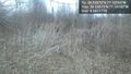
The spot @39.5357,-77.1074
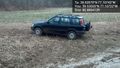
My trusty steed @39.5356,-77.1072
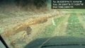
Part of the road there @39.5370,-77.1040
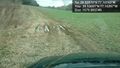
A mud bog I needed 4WD to get through @39.5370,-77.1040
The high vegetation scraped the undercarriage of my car here @39.5370,-77.1040


