Difference between revisions of "2013-10-24 51 9"
imported>GeorgDerReisende (expedition report added) |
m (Replacing http://wiki.xkcd.com/wgh/images/c/c3/2013-10-24_51_9_GeorgDerReisende_map.png with {{filepath:2013-10-24_51_9_GeorgDerReisende_map.png}}) |
||
| (One intermediate revision by one other user not shown) | |||
| Line 57: | Line 57: | ||
<!-- Add any achievement ribbons you earned below, or remove this section --> | <!-- Add any achievement ribbons you earned below, or remove this section --> | ||
| − | {{Tron | latitude = 51 | longitude = 9 | date = 2013-10-24 | tracklog = | + | {{Tron | latitude = 51 | longitude = 9 | date = 2013-10-24 | tracklog = {{filepath:2013-10-24_51_9_GeorgDerReisende_map.png}} | possessive = his | name = GeorgDerReisende }} |
{{Public transport geohash | latitude = 51 | longitude = 9 | date = 2013-10-24 | busline = bus 27 & 51 | name = GeorgDerReisende }} | {{Public transport geohash | latitude = 51 | longitude = 9 | date = 2013-10-24 | busline = bus 27 & 51 | name = GeorgDerReisende }} | ||
| Line 66: | Line 66: | ||
[[Category:Coordinates reached]] | [[Category:Coordinates reached]] | ||
| + | {{location|DE|HE|KS}} | ||
Latest revision as of 12:58, 19 February 2020
| Thu 24 Oct 2013 in 51,9: 51.2386708, 9.3858468 geohashing.info google osm bing/os kml crox |
Location
on or nearby a fieldway south of Baunatal
Participants
Plans
to go there by public transport, may be a Tron achievement
Expedition
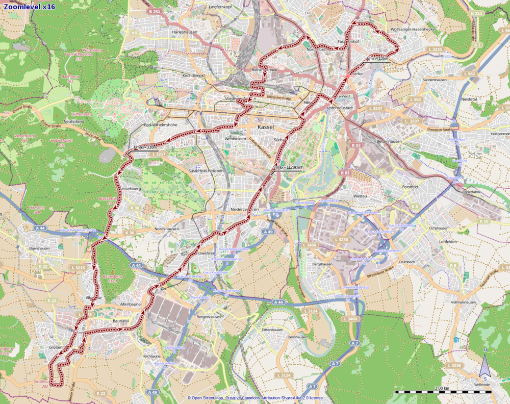
For a first try I started at the bus stop Arnimstraße at 10:24. I walked along Ihringshäuser Straße, stumbled over the rails of the tram, took the bus 27 to Friedenskirche, tram 8 to Bebelplatz, tram 4 to railway station Wilhelmshöhe, walked from there to the bus stop Hasselweg, took the bus 51 to Baunatal-Altenritte. There I had some problems with my Garmin and I noticed, that I had forgotten to program it with the coordinates. Because of all these problems and not finding an internet café, I stopped the adventure and returned home for a second try.
The second try started at the bus stop Arnimstraße at 14:28. I walked along Ihringshäuser Straße, Stifterstraße, Simmershäuser Straße, across Mühlhäuser Platz into Eisenschmiede, where I waited for the bus 27. I took this bus until Virchowstraße, walked to Hasselweg and took the bus 51 until Baunatal-Altenritte. There I walked along Wilhelmhöher Straße, Am Parkstadion, Bahnhofstraße, Niedensteiner Straße to teh fields south of Baunatal. Then I walked to the fields and around the hash along the southern field way. Then I found the hash. As I walked to the hash, the distance marker told me 20 meters, 17, 15, 12, 10, 8, but then suddenly 5 meters behind. So I danced around a little bit and then I found me one meter away.
On the way back I found a bench and made there a rest. Then I walked to the tram station Hünstein, from there I took the tram 5 until Brüder-Grimm-Straße, then tram 6 until Fasanenhof and bus 27 until Arnimstraße.
Tracklog
Photos
Achievements
GeorgDerReisende earned the Tron achievement
|
GeorgDerReisende earned the Public transport geohash achievement
|


