Difference between revisions of "2018-08-30 50 12"
imported>FippeBot m (Location) |
(Report, finally, after 1.5 years) |
||
| Line 15: | Line 15: | ||
== Expedition== | == Expedition== | ||
===[[User:Danatar|Danatar]]=== | ===[[User:Danatar|Danatar]]=== | ||
| + | ''Okay, this report is 1.5 years late (but the gallery was there), mostly because I didn't have time to write it in the weeks after the expedition and then it was like "it's been overdue for so long, it can wait a bit more". Sorry. Now that the wiki is back after the dark ages, I'll finally write it as far as I remember.'' | ||
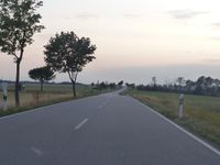
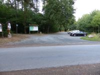
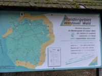
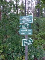
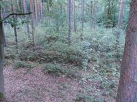
| − | .. | + | I was on my way to Jena where a training would take place the following day. I left the Autobahn A4 at the (*checks tracklog/map*) Schmölln exit, then drove through the countryside, taking at least 2 wrong turns on the way. The last part was through a large piece of forest, then I parked the car on the hikers' parking lot near the hashpoint, directly at the state border between Saxony and Thuringia. Then I walked along a dirt track that went along a few houses. Finally I used some very small paths that went into the forest to get nearer to the hashpoint. I found the spot just a few meters from a raised hunting stand. I took pictures, climbed the stand and returned to the car. |
| + | |||
| + | Next I backtracked through the large piece of forest before taking other country roads towards the west. As this is a very rural and hilly area, the roads were rather twisting. It took a rather long time until I reached the Autobahn A9 at the town Lederhose ("leather pants", like the Bavarian traditional garb). It also got darker during that time, so there was not much fun to be had while driving. From there it was still a bit until I was at the hotel in Jena. | ||
| + | |||
| + | The next day, I visited [[2018-08-31 50 11]] and [[2018-08-31 50 12]]. | ||
| + | |||
| + | In total the expedition led to a detour of 37.5 km, much longer that I had realized before. | ||
| Line 35: | Line 42: | ||
===tracklog=== | ===tracklog=== | ||
| − | + | [http://www.mygpsfiles.com/app/#https://dl.dropboxusercontent.com/sh/l38ubdidvmv439v/AACPvf5HLKwzHind15L5IteJa/2018/2018-08-30_50_11-triton.gpx triton tracklog] | |
| + | |||
[[Category:Expeditions]] | [[Category:Expeditions]] | ||
[[Category:Expeditions with photos]] | [[Category:Expeditions with photos]] | ||
Latest revision as of 12:39, 22 March 2020
| Thu 30 Aug 2018 in Chemnitz: 50.6836777, 12.2694555 geohashing.info google osm bing/os kml crox |
Location
Today's location is the forest near Greiz
Country: Germany; state: Thüringen (Thuringia, EU:DE:TH); district: Greiz; municipality: Mohlsdorf-Teichwolframsdorf
Expedition
Danatar
Okay, this report is 1.5 years late (but the gallery was there), mostly because I didn't have time to write it in the weeks after the expedition and then it was like "it's been overdue for so long, it can wait a bit more". Sorry. Now that the wiki is back after the dark ages, I'll finally write it as far as I remember.
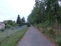
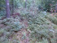
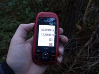
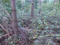
I was on my way to Jena where a training would take place the following day. I left the Autobahn A4 at the (*checks tracklog/map*) Schmölln exit, then drove through the countryside, taking at least 2 wrong turns on the way. The last part was through a large piece of forest, then I parked the car on the hikers' parking lot near the hashpoint, directly at the state border between Saxony and Thuringia. Then I walked along a dirt track that went along a few houses. Finally I used some very small paths that went into the forest to get nearer to the hashpoint. I found the spot just a few meters from a raised hunting stand. I took pictures, climbed the stand and returned to the car.
Next I backtracked through the large piece of forest before taking other country roads towards the west. As this is a very rural and hilly area, the roads were rather twisting. It took a rather long time until I reached the Autobahn A9 at the town Lederhose ("leather pants", like the Bavarian traditional garb). It also got darker during that time, so there was not much fun to be had while driving. From there it was still a bit until I was at the hotel in Jena.
The next day, I visited 2018-08-31 50 11 and 2018-08-31 50 12.
In total the expedition led to a detour of 37.5 km, much longer that I had realized before.
|
