Difference between revisions of "2008-12-27 48 9"
imported>Ekorren (Been there.) |
m (Location correction) |
||
| (2 intermediate revisions by 2 users not shown) | |||
| Line 1: | Line 1: | ||
{{meetup graticule | {{meetup graticule | ||
| − | | map=<map lat="48" lon="9" date=" | + | | map=<map lat="48" lon="9" date="2008-12-27" /> |
| lat=48 | | lat=48 | ||
| lon=9 | | lon=9 | ||
| − | | date= | + | | date=2008-12-27 |
| graticule_name=Stuttgart, Germany | | graticule_name=Stuttgart, Germany | ||
| graticule_link=Stuttgart, Germany}} | | graticule_link=Stuttgart, Germany}} | ||
== About == | == About == | ||
| − | The hash is in | + | The hash is near the village of Dettenhausen in the ''Schönbuch'' forest area, one of the largest forests in southern Germany. |
== Expedition: [[User:Ekorren|Ekorren]] == | == Expedition: [[User:Ekorren|Ekorren]] == | ||
| − | + | Ten kilometers as the bird flies - this was too close not to be tried. Only, ... oops, that's the text from last time. Never mind, back to the uncompleted sentence. Only... there were family obligations. But somehow I managed to get a little bit of free time in the morning. | |
| − | + | So the next question was: Bike or public transport hash? Both versions were estimated to about two hours, both would be convenient until some hundred metres before the hash, both wouldn't cost anything as a daypass was needed for the afternoon anyway. For two reasons the decision fell to public transport: First, I was lazy. Second, this keeps the symmetry on my expedition list. | |
| − | + | There is that bus stop at an intersection in the middle of the forest. I've taken that bus line countless times before, I can't remember anyone getting on or off the bus any time before. But it was only 1 km from the hash, and the map showed a convenient way from there near to it, so this time I would. | |
| − | + | A few minutes past ten, after being hold up several times, I ran and tried for a new record time to get to the bus station. I failed with breaking the record, mostly because of a building site on the fastest road, but still got there in time to catch the 828 bus direction airport / fair. Validated my ticket and told the driver I'll ''really'' want to get off at ''Kälberstelle''. He was surprised but promised not to forget to stop there. | |
| − | + | {{quote|center|That someone gets off at that stop, that happens maybe once in ten years|Bus driver on RBS line 828}} | |
| + | He kept his promise, and about 10:30 I left the bus and started walking along the road. The map had shown a way leaving to the left into the forest, so after a few hundred metres I realized that I must have been walking a few hundred metres too far. And that there definitely hadn't been a way to the left. So I switched to cross country mode, climbed down into the valley and searched for another way. I found an idyllic frozen pond, but then also a way which didn't go in entirely wrong direction, but neither went very near to the hash. So I switched back to cross country, which was eased a bit by frozen ground - it would have been very muddy otherwise. | ||
| − | + | What somehow obstacled that trip now was poor GPS reception. Although the sky was mostly visible, the GPS frequently lost most satellites. I've no idea why - can only guess that there was some major weather induced problem up in the clouds, as ice and snow can obscure reception. Anyway, it got a bit better, but not really good afterwards. | |
| − | + | Finally I reached the area where the hash should be, heavily guarded by thorny underwoods. searched for a realistic place in there and left my marker. The clock clearly indicated that it was past 11 now, so the 11:00 bus I had had slight hopes to catch wouldn't be an option unless there was some possibility to revert time a bit. I couldn't find one, and the next bus wouldn't be before 12:00. So I searched for another path back to paved ways - which, after a short raptor encounter, I found. Then I walked into the next village rather than going back to the intersection, and took the bus back from there. | |
| − | |||
| − | |||
<gallery perrow="3"> | <gallery perrow="3"> | ||
| − | Image: | + | Image:2008-12-27_48_9_Busstop.jpg|Bus stop |
| − | Image: | + | Image:2008-12-27_48_9_ExclamationMark.jpg|! |
| − | Image: | + | Image:2008-12-27_48_9_Raptor.jpg|Raptor attack! |
| − | Image: | + | Image:2008-12-27_48_9_HashForest.jpg|In there |
| − | Image: | + | Image:2008-12-27_48_9_Marker.jpg|Here |
| − | |||
</gallery> | </gallery> | ||
| Line 42: | Line 40: | ||
[[Category:Coordinates reached]] | [[Category:Coordinates reached]] | ||
[[Category:Expeditions with photos]] | [[Category:Expeditions with photos]] | ||
| + | {{location|DE|BW|BB}} | ||
Latest revision as of 19:51, 16 May 2020
| Sat 27 Dec 2008 in Stuttgart, Germany: 48.5988770, 9.0776342 geohashing.info google osm bing/os kml crox |
About
The hash is near the village of Dettenhausen in the Schönbuch forest area, one of the largest forests in southern Germany.
Expedition: Ekorren
Ten kilometers as the bird flies - this was too close not to be tried. Only, ... oops, that's the text from last time. Never mind, back to the uncompleted sentence. Only... there were family obligations. But somehow I managed to get a little bit of free time in the morning.
So the next question was: Bike or public transport hash? Both versions were estimated to about two hours, both would be convenient until some hundred metres before the hash, both wouldn't cost anything as a daypass was needed for the afternoon anyway. For two reasons the decision fell to public transport: First, I was lazy. Second, this keeps the symmetry on my expedition list.
There is that bus stop at an intersection in the middle of the forest. I've taken that bus line countless times before, I can't remember anyone getting on or off the bus any time before. But it was only 1 km from the hash, and the map showed a convenient way from there near to it, so this time I would.
A few minutes past ten, after being hold up several times, I ran and tried for a new record time to get to the bus station. I failed with breaking the record, mostly because of a building site on the fastest road, but still got there in time to catch the 828 bus direction airport / fair. Validated my ticket and told the driver I'll really want to get off at Kälberstelle. He was surprised but promised not to forget to stop there.
| “ | That someone gets off at that stop, that happens maybe once in ten years
|
” |
—Bus driver on RBS line 828
| ||
He kept his promise, and about 10:30 I left the bus and started walking along the road. The map had shown a way leaving to the left into the forest, so after a few hundred metres I realized that I must have been walking a few hundred metres too far. And that there definitely hadn't been a way to the left. So I switched to cross country mode, climbed down into the valley and searched for another way. I found an idyllic frozen pond, but then also a way which didn't go in entirely wrong direction, but neither went very near to the hash. So I switched back to cross country, which was eased a bit by frozen ground - it would have been very muddy otherwise.
What somehow obstacled that trip now was poor GPS reception. Although the sky was mostly visible, the GPS frequently lost most satellites. I've no idea why - can only guess that there was some major weather induced problem up in the clouds, as ice and snow can obscure reception. Anyway, it got a bit better, but not really good afterwards.
Finally I reached the area where the hash should be, heavily guarded by thorny underwoods. searched for a realistic place in there and left my marker. The clock clearly indicated that it was past 11 now, so the 11:00 bus I had had slight hopes to catch wouldn't be an option unless there was some possibility to revert time a bit. I couldn't find one, and the next bus wouldn't be before 12:00. So I searched for another path back to paved ways - which, after a short raptor encounter, I found. Then I walked into the next village rather than going back to the intersection, and took the bus back from there.
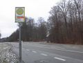
Bus stop
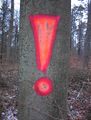
!
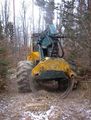
Raptor attack!
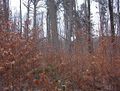
In there
Here


