Difference between revisions of "2009-03-06 30 -87"
From Geohashing
imported>Bos |
m (Location correction) |
||
| (2 intermediate revisions by 2 users not shown) | |||
| Line 1: | Line 1: | ||
| − | |||
{{meetup graticule | {{meetup graticule | ||
| map=<map lat="30" lon="-87" date="2009-03-06" /> | | map=<map lat="30" lon="-87" date="2009-03-06" /> | ||
| Line 9: | Line 8: | ||
}} | }} | ||
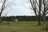
| − | Eduman and Morbieous made the long haul to the top of their graticule. Quick and easy walk to the point from the road. The area is your typical farmers field. | + | [[User:Eduman|Eduman]] and [[User:Morbieous|Morbieous]] made the long haul to the top of their graticule. Quick and easy walk to the point from the road. The area is your typical farmers field. |
| + | |||
| + | |||
| + | |||
| + | |||
<gallery widths="160px" align=center> | <gallery widths="160px" align=center> | ||
| Line 21: | Line 24: | ||
[[Category:Coordinates reached]] | [[Category:Coordinates reached]] | ||
[[Category:Expeditions with photos]] | [[Category:Expeditions with photos]] | ||
| + | {{location|US|FL|ES}} | ||
Latest revision as of 19:52, 16 May 2020
| Fri 6 Mar 2009 in Pensacola: 30.9879685, -87.4497860 geohashing.info google osm bing/os kml crox |
Eduman and Morbieous made the long haul to the top of their graticule. Quick and easy walk to the point from the road. The area is your typical farmers field.
