Difference between revisions of "2009-04-30 -33 149"
imported>Ephphatha (New page: {{meetup graticule | lat=-33 | lon=149 | date=2009-04-30 | graticule_name=Bathurst | graticule_link=Bathurst, Australia }} ==Location== The hash falls in a field near Bathurst Airport. ==...) |
m (More specific location) |
||
| (2 intermediate revisions by 2 users not shown) | |||
| Line 21: | Line 21: | ||
==Photos== | ==Photos== | ||
| − | |||
| − | |||
<gallery widths="160px" align=center> | <gallery widths="160px" align=center> | ||
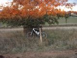
| + | Image:2009-04-30_-33_149_P4300001.jpg|My bike resting against the (wrong) tree. | ||
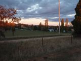
| + | Image:2009-04-30_-33_149_P4300002.jpg|The suburb/village of Raglan. The right tree is the one on the right. | ||
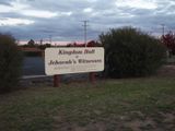
| + | Image:2009-04-30_-33_149_P4300004.jpg|Holy hash honorable mention? The hall is about 100 metres away, rough guess. | ||
| + | Image:2009-04-30_-33_149_P4300005.jpg|If only the sun had set a bit further south. | ||
</gallery> | </gallery> | ||
| − | + | ||
[[Category:Expeditions]] | [[Category:Expeditions]] | ||
[[Category:Expeditions with photos]] | [[Category:Expeditions with photos]] | ||
[[Category:Coordinates reached]] | [[Category:Coordinates reached]] | ||
| + | {{location|AU|NSW|BT}} | ||
Latest revision as of 11:43, 1 August 2020
| Thu 30 Apr 2009 in Bathurst: -33.4212775, 149.6448926 geohashing.info google osm bing/os kml crox |
Contents
Location
The hash falls in a field near Bathurst Airport.
Attendees
Report
Closest hash I think I've ever seen. I figured I might as well try a no batteries hash, with a twist. I was going to take my GPS and just not set a destination in it. Turns out my memory is pretty bloody close, but I still missed the exact point by a tree-unit.
The ride was easy enough from uni to the highway. I left after a lecture though, so I was riding during peak hour. The highway was... nerve wracking to say the least. There is a great system of bike paths in Bathurst. It goes from the traffic lights closest to the Evans bridge, to the other side of the bridge. From then on I had to ride on the side of the highway. Fast forward to reaching the hash point (I don't like riding with traffic), it was opposite the Jehovah's Witness hall in Raglan. Up the driveway, count 8 trees, then proceed half a tree-unit west and I should be right on the hash. I was busting for a loo at this point so I didn't even get my compass out. I just ran for it, snapped a couple of photos, then ran back and tried to get home before bad things happened :P. Really should've gone before I left uni. Anyway, once I got home and checked my GPS I realised I'd gone one tree too far and was about 4 metres north-north-east.
Total time elapsed: 1:12
Total distance traveled: 19.5km


