Difference between revisions of "2012-08-02 -37 143"
imported>Snaplatitude (→Expedition) |
m (More specific location) |
||
| (12 intermediate revisions by 3 users not shown) | |||
| Line 1: | Line 1: | ||
| − | -- | + | [[IMAGE:2012-08-02_-37_143_16-37-20-056.jpg|thumb|left]] |
{{meetup graticule | {{meetup graticule | ||
| lat=-37 | | lat=-37 | ||
| Line 6: | Line 6: | ||
}} | }} | ||
| − | |||
| − | |||
== Location == | == Location == | ||
| − | + | Ross Creek State Forest, Smythesdale. | |
== Participants == | == Participants == | ||
| − | [[User:Snaplatitude|Snaplatitude]] and a lady friend | + | * [[User:Snaplatitude|Snaplatitude]] and a |
| + | * lady friend | ||
== Expedition == | == Expedition == | ||
| Line 21: | Line 20: | ||
Well we headed south through Sebastopol and out towards Skipton, all was going well, our next turn to take was a left-hand turn onto Race Road, as we approached what appeared to be it we read the sign as saying Spratling's road, this couldn't be it we thought, so we continued, realising shortly that it WAS it. Fortunate for my fatigued self there was another left hand turn only 500 metres ahead, it looked a little hairy but my inhibitions were limited due to fatigue. | Well we headed south through Sebastopol and out towards Skipton, all was going well, our next turn to take was a left-hand turn onto Race Road, as we approached what appeared to be it we read the sign as saying Spratling's road, this couldn't be it we thought, so we continued, realising shortly that it WAS it. Fortunate for my fatigued self there was another left hand turn only 500 metres ahead, it looked a little hairy but my inhibitions were limited due to fatigue. | ||
| − | Well, let me tell you, Incolls Road, as it was called, turned out to be QUITE hairy. As we progressed we found ourselves in a brand new car, on an ever-narrowing road, with mud-puddles getting bigger and deeper every 20 metres(see photo below). This was a peculiar little track, and for some strange reason we weren't the only people who had chosen to take a luxury sedan up Incolls Road apparently. There, between two significant mud-puddles was a rather fancy modern black Mercedes. Empty, but clean, like it had never left the showroom. Weird. | + | Well, let me tell you, Incolls Road, as it was called, turned out to be QUITE hairy. As we progressed we found ourselves in a brand new car, on an ever-narrowing road, with mud-puddles getting bigger and deeper every 20 metres(see photo below). This was a peculiar little track, and for some strange reason we weren't the only people who had chosen to take a luxury sedan up Incolls Road apparently. There, between two significant mud-puddles was a rather fancy modern black Mercedes. Empty, but clean, like it had never left the showroom. Weird. |
| + | |||
As we continued and the track got hairer and the puddles got deeper we found another car, an old 90s ford towing a trailer full of (possibly legal) firewood, the two aboriginal fellows inside seemed about as shocked to see us as we were to see them. they appeared to be stuck at a particular cross-roads (cross-muddy-tracks) and so were we. Our choices were left, which was over-grown and covered in branches, straight ahead which had divots more than a foot deep riddled throughout it, or turn back and try to get back to the main road through that last particularly rough mud-puddle where we nearly got bogged. The aboriginal fellows headed left through the overgrown track, and we maneuvered the car around and headed back through the mud. On the way past two large powerful kangaroos hopped across our path. | As we continued and the track got hairer and the puddles got deeper we found another car, an old 90s ford towing a trailer full of (possibly legal) firewood, the two aboriginal fellows inside seemed about as shocked to see us as we were to see them. they appeared to be stuck at a particular cross-roads (cross-muddy-tracks) and so were we. Our choices were left, which was over-grown and covered in branches, straight ahead which had divots more than a foot deep riddled throughout it, or turn back and try to get back to the main road through that last particularly rough mud-puddle where we nearly got bogged. The aboriginal fellows headed left through the overgrown track, and we maneuvered the car around and headed back through the mud. On the way past two large powerful kangaroos hopped across our path. | ||
| − | Back on the main road we retraced our steps to this mis-labeled Race Road/Spratlings Road, which was, thankfully, much smoother and safer, but once again | + | Back on the main road we retraced our steps to this mis-labeled Race Road/Spratlings Road, which was, thankfully, much smoother and safer, but once again Google maps had stuffed us around. (or once again my fatigue from not sleeping had rendered my map-reading abilities defunct) |
We passed the turnoff where the overgrown left hand turn earlier would've taken us to, and several other roads that were marked on the map but seemed oddly missing in the real world. | We passed the turnoff where the overgrown left hand turn earlier would've taken us to, and several other roads that were marked on the map but seemed oddly missing in the real world. | ||
| − | Just as I was about to give up hope and mark this one down as a "hash failed, mother natures bitch" hash due to the mud and lack of access, we found another way just by randomly driving around local roads, and we found an even easier way home when we saw waht a nice condition the road we were looking for was in. We jumped out of the car and ran (walked carefully looking at natures lovely gifts and watching out for | + | Just as I was about to give up hope and mark this one down as a "hash failed, mother natures bitch" hash due to the mud and lack of access, we found another way just by randomly driving around local roads, and we found an even easier way home when we saw waht a nice condition the road we were looking for was in. We jumped out of the car and ran (walked carefully looking at natures lovely gifts and watching out for mine shafts) to the hashpoint. |
Once again I cannot express in words my relief and jubilation at finally successfully completing a geohash! | Once again I cannot express in words my relief and jubilation at finally successfully completing a geohash! | ||
| + | |||
| + | *edit from the future* looking back, the google-maps bit for this whole area IS wacky, it wasn't just my fatigue. There's a label saying Skipton just near Smythesdale. Silly! | ||
== Photos == | == Photos == | ||
| Line 48: | Line 50: | ||
{{GalleryItem | File:2012-08-02_-37_143_16-57-19-531.jpg | a big muddy puddle we nearly got bogged in }} | {{GalleryItem | File:2012-08-02_-37_143_16-57-19-531.jpg | a big muddy puddle we nearly got bogged in }} | ||
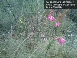
| − | {{GalleryItem | File:2012-08-02_-37_143_16-58-38-263.jpg | pink and yellow | + | {{GalleryItem | File:2012-08-02_-37_143_16-58-38-263.jpg | pink and yellow wildflowers }} |
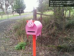
{{GalleryItem | File:2012-08-02_-37_143_16-59-41-560.jpg | Delightful pig letterbox }} | {{GalleryItem | File:2012-08-02_-37_143_16-59-41-560.jpg | Delightful pig letterbox }} | ||
| Line 55: | Line 57: | ||
== Achievements == | == Achievements == | ||
{{#vardefine:ribbonwidth|800px}} | {{#vardefine:ribbonwidth|800px}} | ||
| − | |||
| + | {{land geohash | ||
| + | |||
| + | | latitude = -37 | ||
| + | | longitude = 143 | ||
| + | | date = 2012-08-02 | ||
| + | | name = [[User:Snaplatitude|Snaplatitude]] | ||
| + | |||
| + | }} | ||
| − | |||
| − | |||
| − | |||
| − | |||
| − | |||
| − | |||
| − | |||
| − | |||
[[Category:Expeditions]] | [[Category:Expeditions]] | ||
| − | |||
[[Category:Expeditions with photos]] | [[Category:Expeditions with photos]] | ||
| − | |||
| − | |||
| − | |||
| − | |||
| − | |||
[[Category:Coordinates reached]] | [[Category:Coordinates reached]] | ||
| − | + | [[Category:Land geohash achievement]] | |
| − | + | {{location|AU|VIC|GP}} | |
| − | |||
| − | [[Category: | ||
| − | |||
| − | |||
| − | |||
| − | |||
| − | |||
| − | |||
| − | |||
| − | |||
| − | |||
| − | |||
| − | |||
| − | |||
| − | |||
| − | |||
Latest revision as of 12:19, 1 August 2020
| Thu 2 Aug 2012 in -37,143: -37.6565392, 143.7140576 geohashing.info google osm bing/os kml crox |
Location
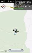
Ross Creek State Forest, Smythesdale.
Participants
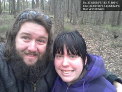
- Snaplatitude and a
- lady friend
Expedition
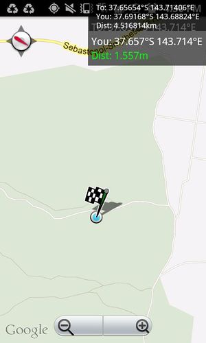
CELEBRATION! Finally got a hash in my local graticule that wasn't on some farmer's private property! As soon as I found this out I knew I had to complete it, I've tried and failed so many times that I needed at least one successful hash to keep my spirits up. Today was it! Despite the many opposing forces we still made it, and I feel so chuffed! So, I was massively tired and practically falling asleep at the wheel, we missed some vital turn-offs and ended up nearly bogging the 2 day old brand new off the factory floor work car, and google maps is completely inaccurate for this area (note: the missing of the turnoffs and the google-maps issues may have been slightly aided by my fatigue.)
Well we headed south through Sebastopol and out towards Skipton, all was going well, our next turn to take was a left-hand turn onto Race Road, as we approached what appeared to be it we read the sign as saying Spratling's road, this couldn't be it we thought, so we continued, realising shortly that it WAS it. Fortunate for my fatigued self there was another left hand turn only 500 metres ahead, it looked a little hairy but my inhibitions were limited due to fatigue.
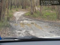
Well, let me tell you, Incolls Road, as it was called, turned out to be QUITE hairy. As we progressed we found ourselves in a brand new car, on an ever-narrowing road, with mud-puddles getting bigger and deeper every 20 metres(see photo below). This was a peculiar little track, and for some strange reason we weren't the only people who had chosen to take a luxury sedan up Incolls Road apparently. There, between two significant mud-puddles was a rather fancy modern black Mercedes. Empty, but clean, like it had never left the showroom. Weird.
As we continued and the track got hairer and the puddles got deeper we found another car, an old 90s ford towing a trailer full of (possibly legal) firewood, the two aboriginal fellows inside seemed about as shocked to see us as we were to see them. they appeared to be stuck at a particular cross-roads (cross-muddy-tracks) and so were we. Our choices were left, which was over-grown and covered in branches, straight ahead which had divots more than a foot deep riddled throughout it, or turn back and try to get back to the main road through that last particularly rough mud-puddle where we nearly got bogged. The aboriginal fellows headed left through the overgrown track, and we maneuvered the car around and headed back through the mud. On the way past two large powerful kangaroos hopped across our path.
Back on the main road we retraced our steps to this mis-labeled Race Road/Spratlings Road, which was, thankfully, much smoother and safer, but once again Google maps had stuffed us around. (or once again my fatigue from not sleeping had rendered my map-reading abilities defunct) We passed the turnoff where the overgrown left hand turn earlier would've taken us to, and several other roads that were marked on the map but seemed oddly missing in the real world.
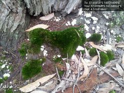
Just as I was about to give up hope and mark this one down as a "hash failed, mother natures bitch" hash due to the mud and lack of access, we found another way just by randomly driving around local roads, and we found an even easier way home when we saw waht a nice condition the road we were looking for was in. We jumped out of the car and ran (walked carefully looking at natures lovely gifts and watching out for mine shafts) to the hashpoint.
Once again I cannot express in words my relief and jubilation at finally successfully completing a geohash!
- edit from the future* looking back, the google-maps bit for this whole area IS wacky, it wasn't just my fatigue. There's a label saying Skipton just near Smythesdale. Silly!
Photos
|
Achievements
Snaplatitude earned the Land geohash achievement
|
