Difference between revisions of "2012-08-19 50 -120"
imported>FippeBot m (Location) |
m (More specific location) |
||
| Line 38: | Line 38: | ||
[[Category:Expeditions with photos]] | [[Category:Expeditions with photos]] | ||
[[Category:Coordinates reached]] | [[Category:Coordinates reached]] | ||
| − | {{location|CA|BC}} | + | {{location|CA|BC|TN}} |
Revision as of 23:57, 9 August 2020
| Sun 19 Aug 2012 in 50,-120: 50.2624920, -120.0300963 geohashing.info google osm bing/os kml crox |
Location
Just off Douglas Lake Road between Salmon Lake and Rush Lake
Planning
After reaching an easy geohash point a few days ago I checked the points for this weekend. The Sunday one looked promising and we hadn't been that way for a long long time. Decided it might be fun to try for a Tron Achievement.
Expedition
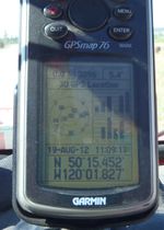
Checked the route on Google maps. Wrote down and entered co-ordinates into GPS. Filled water bottle. Well, Rhonda's dad did that, and we were on our way. Beautiful day for a drive. Things were going very well, and I thought we must be awfully close to the hashpoint when I asked Rhonda's dad to stop so I could have closer look at GPS. Oops.
this is how close we got When we realised I had the wrong coordinates
Entered the wrong co-ordinates. These are the ones for yesterday. Well if we can get hold of Rhonda, all is not lost. She can give us today's co-ordinates. Hmmm, no cel service up here. Ok plan B enjoy the drive and keep track of phone in case there is a pocket of service. 7-10 k later we found service and phoned Rhonda. She laughed at her parents, but looked up the co-ordinates anyhow. U-turn back and we did find the hashpoint. No tron achievement this time though. To complete the Tron achievement I was going to have Rhonda's dad drop me off on Rose Hill road, so I could walk home via the gas line trail. Part of the challenges of living in a community that has only one road in or out.
Once we got back to the spot on the road that was closest to the point we started walking, but of course we went on the wrong side of the creek. I suppose had I studied the satellite map a little closer I would have realized this but alas this was not so. Got across the dry creek/ravine and then the rest of the going was easy. Including the route back to the Jeep, conveniently located right where we needed it.
The road that google maps pointed to as an alternate route was the one we had decided to use to complete the circle. Only one problem. The first section of this route was old logging roads, and sometimes it was unclear whether we were actually on the right route. A couple of backtracks later we did enter highway 5A at the Peter Hope road as indicated on the map. Phew. Took slightly longer than anticipated. Yup, sounds like geohashing.
Pictures
Achievements
- Land Geohash


