Difference between revisions of "2013-03-12 45 -76"
imported>AndrewM (→Plans) |
m (More specific location) |
||
| (5 intermediate revisions by 2 users not shown) | |||
| Line 27: | Line 27: | ||
== Expedition == | == Expedition == | ||
| − | + | This was my first ever geohash, as well as my first time riding this early in the season, so I had to get a few things sorted out first. I had plenty of warm athletic clothing from cross-country skiing, so that wasn't much of an issue. It didn't take me too long to figure out how to set my garmin to track a point, so I set it to the hash coordinates and got going. | |
| + | |||
| + | I rode to the point along the road that was closest to the hash, got off, and started walking through the slushy field. At this point, I realized something a bit more sturdy than running shoes would have been a good idea. Oh well, the geohash was just under 100 meters from the road, so it was a easy walk regardless. | ||
== Photos == | == Photos == | ||
| − | < | + | <gallery perrow="4"> |
| − | Image: | + | Image:2013-03-12_45_-76_marker.jpg|The Internet was here. |
| − | -- | + | Image:2013-03-12_45_-76_town.jpg|The town of Dunrobin, as seen from the geohash. |
| − | + | Image:2013-03-12_45_-76_road.jpg|The road near the geohash. | |
| + | Image:2013-03-12_45_-76_me.jpg|Maybe not a stupid grin, but a stupid something. | ||
</gallery> | </gallery> | ||
== Achievements == | == Achievements == | ||
{{#vardefine:ribbonwidth|800px}} | {{#vardefine:ribbonwidth|800px}} | ||
| − | + | {{land geohash | |
| + | |||
| + | | latitude = 45 | ||
| + | | longitude = -76 | ||
| + | | date = 2013-03-12 | ||
| + | | name = AndrewM | ||
| + | |||
| + | }} | ||
| + | {{bicycle geohash | ||
| − | + | | latitude = 45 | |
| − | + | | longitude = -76 | |
| − | + | | date = 2013-03-12 | |
| + | | name = AndrewM | ||
| + | | distance = 14km | ||
| + | | bothways = true (optional) | ||
| − | + | }} | |
| − | |||
| − | |||
| − | |||
| − | |||
[[Category:Expeditions]] | [[Category:Expeditions]] | ||
| − | |||
[[Category:Expeditions with photos]] | [[Category:Expeditions with photos]] | ||
| − | |||
| − | |||
| − | |||
| − | |||
| − | |||
[[Category:Coordinates reached]] | [[Category:Coordinates reached]] | ||
| − | + | {{location|CA|ON|OT}} | |
| − | |||
| − | |||
| − | |||
| − | |||
| − | |||
| − | |||
| − | |||
| − | |||
| − | |||
| − | |||
| − | |||
| − | |||
| − | |||
| − | |||
| − | |||
| − | |||
| − | |||
Latest revision as of 23:59, 9 August 2020
| Tue 12 Mar 2013 in 45,-76: 45.4269208, -76.0285898 geohashing.info google osm bing/os kml crox |
Location
A field on Dunrobin Road, just outside of the town of Dunrobin.
Participants
Plans
After deciding that the late season skiing was no longer much good, I checked the map for today's hash point. I saw that it was in an easily accessible location not to far from my house, so I figured out how to use my garmin for this and went for an early season bike ride.
Expedition
This was my first ever geohash, as well as my first time riding this early in the season, so I had to get a few things sorted out first. I had plenty of warm athletic clothing from cross-country skiing, so that wasn't much of an issue. It didn't take me too long to figure out how to set my garmin to track a point, so I set it to the hash coordinates and got going.
I rode to the point along the road that was closest to the hash, got off, and started walking through the slushy field. At this point, I realized something a bit more sturdy than running shoes would have been a good idea. Oh well, the geohash was just under 100 meters from the road, so it was a easy walk regardless.
Photos
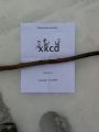
The Internet was here.
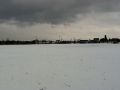
The town of Dunrobin, as seen from the geohash.
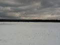
The road near the geohash.
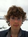
Maybe not a stupid grin, but a stupid something.


Achievements
AndrewM earned the Land geohash achievement
|
AndrewM earned the Bicycle geohash achievement
|