Difference between revisions of "2013-03-17 45 -76"
From Geohashing
imported>AndrewM (→Achievements) |
m (More specific location) |
||
| (2 intermediate revisions by 2 users not shown) | |||
| Line 27: | Line 27: | ||
== Photos == | == Photos == | ||
| − | + | ||
| − | |||
| − | |||
<gallery perrow="5"> | <gallery perrow="5"> | ||
| + | Image:2013-03-17_45_-76_garmin.jpg|I didn't get the screen with the coordinates on it, but I did get this. | ||
| + | Image:2013-03-17_45_-76_marker.jpg|My marker. | ||
| + | Image:2013-03-17_45_-76_hills.jpg|The view north to the Gatineau hills. | ||
| + | Image:2013-03-17_45_-76_tracks.jpg|My path walking and trying to folllow the arrow. | ||
| + | Image:2013-03-17_45_-76_me.jpg|Me at the geohash. | ||
</gallery> | </gallery> | ||
| Line 37: | Line 40: | ||
[[Category:Expeditions with photos]] | [[Category:Expeditions with photos]] | ||
[[Category:Coordinates reached]] | [[Category:Coordinates reached]] | ||
| + | {{location|CA|ON|OT}} | ||
Latest revision as of 00:00, 10 August 2020
| Sun 17 Mar 2013 in 45,-76: 45.4637178, -76.0939330 geohashing.info google osm bing/os kml crox |
Location
A field off of woodkilton, near kinburn side road.
Participants
Expedition
I headed out for today's geohash, which was about 8k from my house, by bike at about 4pm. It was about -5 degrees Celsius, and there was a fairly strong headwind as I headed out. Eventually I did get to the point on woodkilton closest the the hash, and as the map predicted it was directly behind a house. I went a bit further to the edge of the field and walked along a fence until the point was directly perpendicular to the fence, then finally walked out into the open field and found the geohash.
Photos
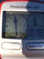
I didn't get the screen with the coordinates on it, but I did get this.
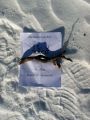
My marker.
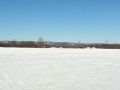
The view north to the Gatineau hills.
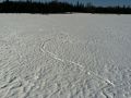
My path walking and trying to folllow the arrow.
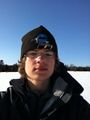
Me at the geohash.


