Difference between revisions of "File:2009-05-16 49 -121.gps.JPG"
From Geohashing
imported>Robyn (I have some better GPS shots, but they were taken at 3:30 and I need to prove being at the geohash for 4 p.m. My precision is pretty much always 3 m, so I know this is within the circle. It tended to be a little further here, because the steep cliff creat) |
m (Replacing Category:GPS receivers with Category:GNSS receivers) |
||
| (2 intermediate revisions by 2 users not shown) | |||
| Line 1: | Line 1: | ||
I have some better GPS shots, but they were taken at 3:30 and I need to prove being at the geohash for 4 p.m. My precision is pretty much always 3 m, so I know this is within the circle. It tended to be a little further here, because the steep cliff created a GPS shadow. | I have some better GPS shots, but they were taken at 3:30 and I need to prove being at the geohash for 4 p.m. My precision is pretty much always 3 m, so I know this is within the circle. It tended to be a little further here, because the steep cliff created a GPS shadow. | ||
| + | |||
[[Category:Meetup in 49 -121]] | [[Category:Meetup in 49 -121]] | ||
[[Category:Meetup on 2009-05-16]] | [[Category:Meetup on 2009-05-16]] | ||
| + | [[Category:GNSS receivers]] | ||
Latest revision as of 19:26, 21 September 2020
I have some better GPS shots, but they were taken at 3:30 and I need to prove being at the geohash for 4 p.m. My precision is pretty much always 3 m, so I know this is within the circle. It tended to be a little further here, because the steep cliff created a GPS shadow.
File history
Click on a date/time to view the file as it appeared at that time.
| Date/Time | Thumbnail | Dimensions | User | Comment | |
|---|---|---|---|---|---|
| current | 16:21, 30 January 2020 | 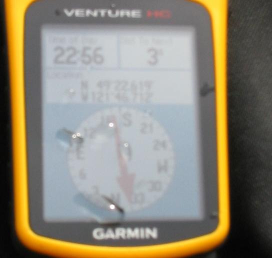 | 544 × 515 (21 KB) | Maintenance script (talk | contribs) |
- You cannot overwrite this file.
File usage
The following page links to this file: