Difference between revisions of "2015-07-28 47 16"
imported>Crankl ([live] Reached) |
m (Linking to The Dance™) |
||
| (9 intermediate revisions by 2 users not shown) | |||
| Line 1: | Line 1: | ||
| − | |||
| − | |||
| − | |||
| − | |||
| − | |||
| − | |||
| − | |||
| − | |||
| − | |||
| − | |||
{{meetup graticule | {{meetup graticule | ||
| lat=47 | | lat=47 | ||
| Line 15: | Line 5: | ||
}} | }} | ||
| − | + | == Location == | |
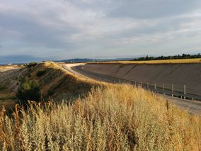
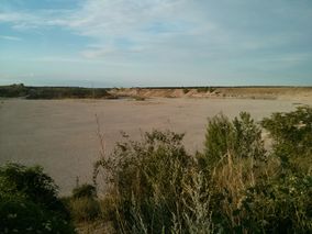
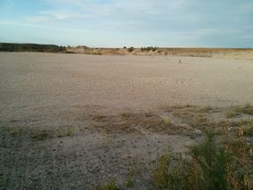
| − | + | [[Image:2015-07-28_47-16_view2.jpg | thumb | left | Crateria.]] North of Wr. Neustadt in the middle of an old gravel pit. Looked like an impact crater to us ;) | |
| − | |||
| − | |||
== Participants == | == Participants == | ||
| − | + | * [[User:Crankl|Crankl]] | |
| − | + | * [[User:B2c|B2c]] | |
| + | |||
== Plans == | == Plans == | ||
| − | + | This was another spontaneous expedition. After a long day at work, Crankl and B2c decided to take on their favorite adventure generator and head out of the hot, sticky city. [[User:Micsnare|Micsnare]] was still indisposed, so it was just the two of them this time around. | |
| + | |||
== Expedition == | == Expedition == | ||
| − | + | Out of a hunch they checked today's hashpoint and where intrigued by its look and the complete absence of any meaningful description on google maps. They quickly packed up their hashquipment and met at the hashcave around 6:30pm. As holiday season was in full effect and traffic was light, they were able to leave the city quickly via the A2 and reached the settlement 'Maria Theresia' north of Wiener Neustadt after about half an hour later. After overlooking several abandoned gravel pits they parked the car near the northernmost pit and started progressing towards the hashpoint. Although some signs prohibited access because of 'construction work' the hashers took the liberty of entering the completely empty and abandoned pit, do [[The Dance™|the dance]], take some pictures, be liable for their children's actions and finally leave this forsaken place. Chalked up another one! | |
| + | Original posts to this page: | ||
*Reached -- [[User:Crankl|Crankl]] ([[User talk:Crankl|talk]]) [http://www.openstreetmap.org/?lat=47.88384270&lon=16.27598977&zoom=16&layers=B000FTF @47.8838,16.2760] 19:34, 28 July 2015 (GMT+02:00) | *Reached -- [[User:Crankl|Crankl]] ([[User talk:Crankl|talk]]) [http://www.openstreetmap.org/?lat=47.88384270&lon=16.27598977&zoom=16&layers=B000FTF @47.8838,16.2760] 19:34, 28 July 2015 (GMT+02:00) | ||
| + | *Woot, coordinates reached ;) -- [[User:B2c|B2c]] ([[User talk:B2c|talk]]) [http://www.openstreetmap.org/?lat=47.88383917&lon=16.27599056&zoom=16&layers=B000FTF @47.8838,16.2760] 13:34, 28 July 2015 (EDT) | ||
| + | |||
== Tracklog == | == Tracklog == | ||
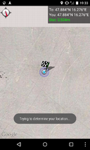
| − | + | [[Image:2015-07-28_47-16-tracklog.jpg]] | |
== Photos == | == Photos == | ||
| − | < | + | <gallery caption="Photo Gallery" widths="320px" heights="213px" perrow="3"> |
| − | Image: | + | Image:2015-07-28_47-16_gmaps.jpg | It looks intriguing from atop. |
| − | -- | + | Image:2015-07-28_47-16_b17.jpg | The federal road B17 leading to the hashpoint. |
| − | + | Image:2015-07-28_47-16_cranklhill.jpg | Crankl surveying the hashpoint. | |
| + | Image:2015-07-28_47-16_crateria1.jpg | Better not go there. | ||
| + | Image:2015-07-28_47-16_sign1.jpg | Somewhen someone might have wanted to build something here. Didn't happen. | ||
| + | Image:2015-07-28_47-16_sign2.jpg | Whole mountains must have been turned to gravel here. (Bergpolizei == Mountain Police ;) | ||
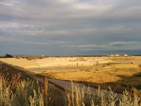
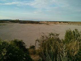
| + | Image:2015-07-28_47-16_view1.jpg | View to a hash. | ||
| + | Image:2015-07-28_47-16_view2.jpg | This one's for [[User:Micsnare|Micsnare]]: Closing in. | ||
| + | Image:2015-07-28_47-16_view3.jpg | Why does this remind me of [http://xkcd.com/505/ XKCD-505]? | ||
| + | Image:2015-07-28_47-16_onhash.jpg | Crankl finished [[The Dance™|the dance]]. On point. | ||
| + | Image:2015-07-28_47-16_grin.jpg | Stupid grin (tm). Blinded by the lights. | ||
| + | Image:2015-07-28_47-16_proof.png | Proof. No more proof this time :p | ||
</gallery> | </gallery> | ||
| − | |||
| − | |||
| − | |||
| − | |||
| − | |||
| − | |||
| − | |||
| − | |||
| − | |||
| − | |||
| − | |||
| − | |||
| − | |||
| − | |||
| − | |||
[[Category:Expeditions]] | [[Category:Expeditions]] | ||
| − | |||
[[Category:Expeditions with photos]] | [[Category:Expeditions with photos]] | ||
| − | |||
| − | |||
| − | |||
| − | |||
| − | |||
[[Category:Coordinates reached]] | [[Category:Coordinates reached]] | ||
| − | + | {{location|AT|NÖ|WB}} | |
| − | |||
| − | |||
| − | |||
| − | |||
| − | |||
| − | |||
| − | |||
| − | |||
| − | |||
| − | |||
| − | |||
| − | |||
| − | |||
| − | |||
| − | |||
| − | |||
| − | |||
Latest revision as of 17:04, 14 November 2020
| Tue 28 Jul 2015 in 47,16: 47.8838339, 16.2759987 geohashing.info google osm bing/os kml crox |
Contents
[hide]Location

North of Wr. Neustadt in the middle of an old gravel pit. Looked like an impact crater to us ;)
Participants
Plans
This was another spontaneous expedition. After a long day at work, Crankl and B2c decided to take on their favorite adventure generator and head out of the hot, sticky city. Micsnare was still indisposed, so it was just the two of them this time around.
Expedition
Out of a hunch they checked today's hashpoint and where intrigued by its look and the complete absence of any meaningful description on google maps. They quickly packed up their hashquipment and met at the hashcave around 6:30pm. As holiday season was in full effect and traffic was light, they were able to leave the city quickly via the A2 and reached the settlement 'Maria Theresia' north of Wiener Neustadt after about half an hour later. After overlooking several abandoned gravel pits they parked the car near the northernmost pit and started progressing towards the hashpoint. Although some signs prohibited access because of 'construction work' the hashers took the liberty of entering the completely empty and abandoned pit, do the dance, take some pictures, be liable for their children's actions and finally leave this forsaken place. Chalked up another one!
Original posts to this page:
- Reached -- Crankl (talk) @47.8838,16.2760 19:34, 28 July 2015 (GMT+02:00)
- Woot, coordinates reached ;) -- B2c (talk) @47.8838,16.2760 13:34, 28 July 2015 (EDT)
Tracklog

Photos
- Photo Gallery
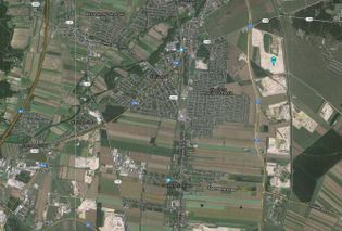
It looks intriguing from atop.
The federal road B17 leading to the hashpoint.
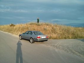
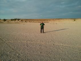
Crankl surveying the hashpoint.
Better not go there.
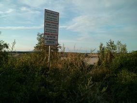
Somewhen someone might have wanted to build something here. Didn't happen.
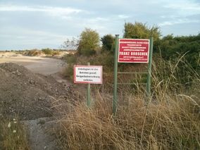
Whole mountains must have been turned to gravel here. (Bergpolizei == Mountain Police ;)
View to a hash.
This one's for Micsnare: Closing in.
Why does this remind me of XKCD-505?
Crankl finished the dance. On point.
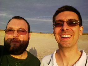
Stupid grin (tm). Blinded by the lights.
Proof. No more proof this time :p


