Difference between revisions of "2020-06-30 -37 145"
m (More specific location) |
|||
| Line 3: | Line 3: | ||
| lon=145 | | lon=145 | ||
| date=2020-06-30 | | date=2020-06-30 | ||
| − | | graticule_name=Melbourne | + | | graticule_name=Melbourne East |
| − | | graticule_link=Melbourne, Australia}} | + | | graticule_link=Melbourne East, Australia}} |
== Expeditions == | == Expeditions == | ||
Latest revision as of 17:12, 28 January 2021
| Tue 30 Jun 2020 in Melbourne East: -37.6820519, 145.0991574 geohashing.info google osm bing/os kml crox |
Expeditions
Location
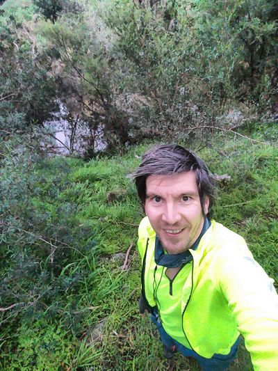
On the bank of the Plenty River in Plenty Gorge Park.
Participants
Expedition
I took advantage of a pretty flexible work situation to jump on the bike a bit before 3pm. The location looked awesome: a reasonable distance (about 48km round trip), in Plenty Gorge Park close to a mountain bike trail, near a river but not actually in it.
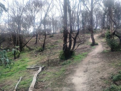
Riding there was fairly straightforward: straight up the St Georges Rd trail into a cold headwind. I entered the park at the earliest point, to maximise the amount of mountain bike trail. It was great! I'm a little bit out of practice so took it pretty gentle, walking a few particularly rocky or slippery sections, while listening to a podcast about de-cluttering. As I got closer, I noticed that the trails were no longer on OSM, so I had to keep checking to see if I was getting closer.
Eventually I found myself 11 metres from the point - but at the top of a very steep, overgrown embankment. It was almost a cliff. I considered backtracking to a bridge to be able to walk along the river. However, I carefully stumbled and slipped my way down the embankment, leaving my helmet on for safety. As soon as I was down, I checked the app and was already at 1.5m. Success!
The ride home was also great. I went a different way, along the Plenty River Trail, which felt completely unfamiliar. Lots of amazing bushland, birds, etc. Pretty excellent all up!
This user earned the Bicycle geohash achievement
|
This user earned the OpenStreetMap achievement
|

