Difference between revisions of "2019-08-04 62 29"
imported>Kripakko |
|||
| (5 intermediate revisions by 3 users not shown) | |||
| Line 14: | Line 14: | ||
== Plans == | == Plans == | ||
| − | The hashpoint is in an easily accessible place, and there is a series of night geocaches nearby. I can do a trip in the night and get a midnight geohash and find all the caches. | + | The hashpoint is in an easily accessible place, and there is a series of night geocaches nearby. I can do a trip in the night and get a midnight geohash and find all the caches. |
| + | |||
| + | For those who are interested, here is the geocache series on geocaching.com map: [https://www.geocaching.com/map/?lat=62.61965&lng=29.98145&zoom=11]. The hashpoint is inside the loop of mystery caches. | ||
== Expedition == | == Expedition == | ||
| − | + | I left from home at about 10 o'clock, so I would have ample time to find some geocaches on the way to the hashpoint. I parked my bicycle at 62.61742, 29.96916 and continued on foot. After finding the first six caches of the "Pimeä pikkujoulu" ("Dark christmas party"{{ref label|1}}) series, the time was about half past eleven, and I started walking towards the hashpoint. Since I had half an hour to walk 310 metres, I stopped often to take photographs of some perhaps interesting flora. The photos did not turn out great because I had to use my forehead lamp for illumination. The night was dark enough that ambient lighting (nautical twilight) was not nearly strong enough for the camera, but I could mostly see enough to walk without extra light. | |
| + | |||
| + | I reached the hashpoint at ten minutes to midnight. After walking a few circles, I ended up at a tree stump where my GPS reciever seemed to think the point was located. I marked the hashpoint by writing on the stump with a permanent marker and took some more photos at and after midnight. At about 0:10, I left and continued with the geocache series. | ||
| + | |||
| + | This area used to be forest and has been cut down recently. I am pretty sure that I have been close to this point during some orienteering training, but I cannot prove it. And I think that it would not really be a déjà vu anyway because the terrain has changed so much. | ||
== Photos == | == Photos == | ||
| − | |||
| − | |||
| − | |||
<gallery perrow="5"> | <gallery perrow="5"> | ||
| + | 2019-08-04_62_29_01-bogbilberry.jpg | Bog bilberry. | ||
| + | 2019-08-04_62_29_02-lingonberry.jpg | Lingonberry. | ||
| + | 2019-08-04_62_29_03-heather.jpg | Flowering heather. | ||
| + | 2019-08-04_62_29_04-crowberry.jpg | Crowberry. | ||
| + | 2019-08-04_62_29_05-bilberry.jpg | Bilberry. | ||
| + | 2019-08-04_62_29_06-cowwheat.jpg | Flowering cow wheat. | ||
| + | 2019-08-04_62_29_07-lichen.jpg | Grey reindeer lichen. | ||
| + | 2019-08-04_62_29_08-gpsr.jpg | Hashpoint reached... though it is still a few minutes to midnight. | ||
| + | 2019-08-04_62_29_09-marker1.jpg | Geohash marker and GPS reciever at midnight. | ||
| + | 2019-08-04_62_29_10-marker2.jpg | Geohash marker from further away. | ||
| + | 2019-08-04_62_29_11-landscape1.jpg | Landscape at the hashpoint. | ||
| + | 2019-08-04_62_29_12-landscape2.jpg | More landscape at the hashpoint. | ||
| + | 2019-08-04_62_29_13-landscape3.jpg | Even more landscape at the hashpoint. | ||
| + | 2019-08-04_62_29_14-dark.jpg | Attempt at taking a wider landscape photo... obviously not what the camera is meant to do. | ||
| + | 2019-08-04_62_29_15-selfie.jpg | Selfie at the hashpoint. | ||
</gallery> | </gallery> | ||
| Line 41: | Line 59: | ||
| date = 2019-08-04 | | date = 2019-08-04 | ||
| name = Kripakko | | name = Kripakko | ||
| − | | distance = | + | | distance = 25.6 km |
| bothways = true | | bothways = true | ||
}} | }} | ||
| Line 50: | Line 68: | ||
| date = 2019-08-04 | | date = 2019-08-04 | ||
| name = Kripakko | | name = Kripakko | ||
| − | }} | + | }} |
| − | + | == Footnote == | |
| − | |||
| − | |||
| − | + | {{note label|1|The names of the caches are essentially meaningless. The caches are reflector puzzles and so are best found in the dark.}} | |
| − | + | == Retro expedition == | |
| − | |||
| − | |||
| − | |||
| − | + | [[File:2021-06-10 62 30 07-retrohash.jpg|200px|thumb|left|Visiting the retrohash. There might be tiny bits of blue ink where the word "geohashing" was written, but I might just be seeing things.]][[File:2021-06-10 62 30 08-loggingarea.jpg|400px|thumb|right|A part of the huge open logging area. I could not see all the elevation differences last time in the dark.]] | |
| + | |||
| + | Returning from the [[2021-06-10 62 30]] expedition, I visited this point interested in seeing if my marker was still there. It was not. Or maybe there were tiny bits of ink that I could only see in the photograph. Anyway, this time the sun was shining, and I could actually see everything around myself. The vegetation had not really changed from what I remember, but the elevation differences in some places surprised me, especially where I took the second photo. | ||
| − | |||
[[Category:Expeditions]] | [[Category:Expeditions]] | ||
| − | |||
[[Category:Expeditions with photos]] | [[Category:Expeditions with photos]] | ||
| − | |||
| − | |||
| − | |||
| − | |||
| − | |||
[[Category:Coordinates reached]] | [[Category:Coordinates reached]] | ||
| − | + | [[Category:Retro meetup]] | |
| − | + | [[Category:Retro coordinates reached]] | |
| − | + | {{location|FI|13}} | |
| − | |||
| − | |||
| − | |||
| − | [[Category: | ||
| − | |||
| − | |||
| − | [[Category: | ||
| − | |||
| − | |||
| − | |||
| − | |||
| − | |||
| − | |||
| − | |||
| − | |||
Latest revision as of 16:21, 10 June 2021
| Sun 4 Aug 2019 in 62,29: 62.6201318, 29.9826939 geohashing.info google osm bing/os kml crox |
Location
On an open logging area in Kerolankangas, Kontiolahti.
Participants
Plans
The hashpoint is in an easily accessible place, and there is a series of night geocaches nearby. I can do a trip in the night and get a midnight geohash and find all the caches.
For those who are interested, here is the geocache series on geocaching.com map: [1]. The hashpoint is inside the loop of mystery caches.
Expedition
I left from home at about 10 o'clock, so I would have ample time to find some geocaches on the way to the hashpoint. I parked my bicycle at 62.61742, 29.96916 and continued on foot. After finding the first six caches of the "Pimeä pikkujoulu" ("Dark christmas party"[1]) series, the time was about half past eleven, and I started walking towards the hashpoint. Since I had half an hour to walk 310 metres, I stopped often to take photographs of some perhaps interesting flora. The photos did not turn out great because I had to use my forehead lamp for illumination. The night was dark enough that ambient lighting (nautical twilight) was not nearly strong enough for the camera, but I could mostly see enough to walk without extra light.
I reached the hashpoint at ten minutes to midnight. After walking a few circles, I ended up at a tree stump where my GPS reciever seemed to think the point was located. I marked the hashpoint by writing on the stump with a permanent marker and took some more photos at and after midnight. At about 0:10, I left and continued with the geocache series.
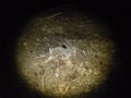
This area used to be forest and has been cut down recently. I am pretty sure that I have been close to this point during some orienteering training, but I cannot prove it. And I think that it would not really be a déjà vu anyway because the terrain has changed so much.
Photos
Bog bilberry.
Lingonberry.

Flowering heather.
Crowberry.
Bilberry.
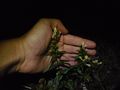
Flowering cow wheat.
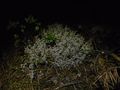
Grey reindeer lichen.

Hashpoint reached... though it is still a few minutes to midnight.
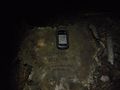
Geohash marker and GPS reciever at midnight.
Geohash marker from further away.
Landscape at the hashpoint.

More landscape at the hashpoint.
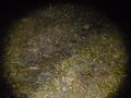
Even more landscape at the hashpoint.

Attempt at taking a wider landscape photo... obviously not what the camera is meant to do.
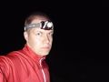
Selfie at the hashpoint.


Achievements
Kripakko earned the Land geohash achievement
|
Kripakko earned the Bicycle geohash achievement
|
Kripakko earned the Midnight Geohash achievement
|
Footnote
- ^ The names of the caches are essentially meaningless. The caches are reflector puzzles and so are best found in the dark.
Retro expedition


Returning from the 2021-06-10 62 30 expedition, I visited this point interested in seeing if my marker was still there. It was not. Or maybe there were tiny bits of ink that I could only see in the photograph. Anyway, this time the sun was shining, and I could actually see everything around myself. The vegetation had not really changed from what I remember, but the elevation differences in some places surprised me, especially where I took the second photo.