Difference between revisions of "2008-05-24 42 -88"
From Geohashing
imported>Thomcat m |
m (fix, sorry) |
||
| (3 intermediate revisions by 3 users not shown) | |||
| Line 9: | Line 9: | ||
*'''When:''' [[2008-05-24|Saturday, May 24th]], 4pm | *'''When:''' [[2008-05-24|Saturday, May 24th]], 4pm | ||
| − | *'''Where:''' | + | *'''Where:''' {{egl|2008-05-24|42|-88|text=42.126648°, -88.547534° (near Melms Road)}} |
*[http://www.google.com/maps?f=d&hl=en&geocode=&saddr=&daddr=42.126648%C2%B0,+-88.547534%C2%B0&sll=40.105544,-88.21211&sspn=0.007779,0.020084&ie=UTF8&z=16 Driving Directions from Google Maps] | *[http://www.google.com/maps?f=d&hl=en&geocode=&saddr=&daddr=42.126648%C2%B0,+-88.547534%C2%B0&sll=40.105544,-88.21211&sspn=0.007779,0.020084&ie=UTF8&z=16 Driving Directions from Google Maps] | ||
| Line 26: | Line 26: | ||
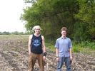
Image:2008-05-24_42_-88 DavidEGrayson and Noah.jpg|[[User:DavidEGrayson|DavidEGrayson]] and Noah | Image:2008-05-24_42_-88 DavidEGrayson and Noah.jpg|[[User:DavidEGrayson|DavidEGrayson]] and Noah | ||
</gallery> | </gallery> | ||
| − | |||
| − | |||
[[Category:Expeditions]] | [[Category:Expeditions]] | ||
[[Category:Expeditions with photos]] | [[Category:Expeditions with photos]] | ||
| + | [[Category:Coordinates reached]] | ||
| + | {{location|US|IL|KE}} | ||
Latest revision as of 18:43, 18 January 2022
| Sat 24 May 2008 in 42,-88: 42.1266480, -88.5475331 geohashing.info google osm bing/os kml crox |
This page is about the official meetup on 2008-05-24 in the Schaumburg, IL graticule.
- When: Saturday, May 24th, 4pm
- Where: 42.126648°, -88.547534° (near Melms Road)
- Driving Directions from Google Maps
Description
Beautiful sunny day. We met on Melms road, walked south across a fallow field, and then ventured south across a wooded creek to get the point.
Parties who reached the point
In order of arrival:
- Shakedown and Katie
- DavidEGrayson and cousin Noah
- Bill
Pictures
Noah and Bill
DavidEGrayson and Noah

