Difference between revisions of "2022-01-24 51 9"
From Geohashing
(expedition report for Vinsebeck) |
m (Location) |
||
| Line 40: | Line 40: | ||
[[Category:Coordinates reached]] | [[Category:Coordinates reached]] | ||
| + | {{location|DE|NW|HX}} | ||
Latest revision as of 10:42, 25 January 2022
| Mon 24 Jan 2022 in 51,9: 51.8415265, 9.0381209 geohashing.info google osm bing/os kml crox |
Location
The hash lay beside the road between Bergheim and Vinsebeck.
Participants
Plans
Looking for the hash and some other places.
Expedition
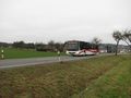
Public transport in the area is a form of zigzag lines and irregular timetables. But with three trains and a bus to the hash and a bus and three trains home I could make it.
Photos

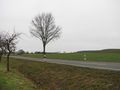
arrived at Vinsebeck
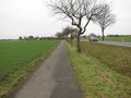
the hash lay between the ditch and the road
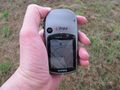
proof 1
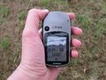
proof 2
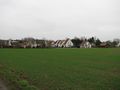
looking north
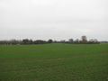
east
south
west

the geohasher


