Difference between revisions of "2022-02-10 -38 146"
(→Expedition) |
m (Location) |
||
| Line 53: | Line 53: | ||
[[Category:Expeditions with photos]] | [[Category:Expeditions with photos]] | ||
[[Category:Coordinates reached]] | [[Category:Coordinates reached]] | ||
| + | {{location|AU|VIC|BB}} | ||
Latest revision as of 23:42, 9 February 2022
| Thu 10 Feb 2022 in -38,146: -38.0746440, 146.2748786 geohashing.info google osm bing/os kml crox |
Location
Just off a dirt track north of Moe.
Participants
Expedition
A quick morning jaunt. I had a serious dose of FOMO in missing yesterday's Melbourne hash that almost every other Australian geohasher had reached - so I was keen to have a go of whatever turned up. Fortunately, the algorithm shined favourably upon me, and it took only a few minutes to satisfy myself that it was reachable and ridable.
I headed out first thing, still in that not-quite-daylight you get on summer mornings, wending through Newborough for variety before heading out north on the Moe-Walhalla Road. I had scoped a few alternate routes; there were ways to avoid most of the bitumen, but I didn't plan to spend all day out today - the main road won out on time considerations.
I eventually turned off onto a smaller farm road, and then a dirt track, which became more of a sandy track in parts - the cause of a few rapid dismounts as my wheels spun out under me.
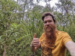
Into the forest, and off onto a well-overgrown side track, waving a stick in front of me as I rode to avoid being coated in spiderwebs, then a 30 metre bush-bash to the hash.
Back the way I came - resisting temptation to take any adventurous but lengthy detours.
Tracklog
Photos
Achievements
Matt earned the Bicycle geohash achievement
|


