Difference between revisions of "2008-05-30 39 -105"
imported>Mgashwood (New page: {{meetup graticule | map=<map lat="39" lon="-105" date="2008-05-30" /> | lat=39 | lon=-105 | date=2008-05-30 }} [[Image:20080530-The_Proof.jpg|thumb|250 px|May 30 - Here, in the dark...]...) |
m |
||
| (6 intermediate revisions by 4 users not shown) | |||
| Line 12: | Line 12: | ||
= Summary = | = Summary = | ||
| − | The | + | The [[Denver West, Colorado|Denver West]] location today ({{egl|2008-05-30|39|-106|text=39.853102°,-105.244603°}}) was reached by one person: Me. The coordinates ended up on some property near a leg of the Union Pacific Railroad. |
I left Golden around 8:00pm (because I didn't find out the DOW numbers were wrong this morning until 7 tonight) and drove North towards Boulder. I arrived at the intersection of HWY 93 and HWY 72 around 8:20 and scoped out the best place to start my trip. I decided to park at one of the gates leading into the UP Railroad property ([http://maps.google.com/maps?f=q&hl=en&geocode=&q=39.858873,+-105.234729&ie=UTF8&ll=39.85899,-105.234776&spn=0.004859,0.01001&t=h&z=17&iwloc=addr Gate]). | I left Golden around 8:00pm (because I didn't find out the DOW numbers were wrong this morning until 7 tonight) and drove North towards Boulder. I arrived at the intersection of HWY 93 and HWY 72 around 8:20 and scoped out the best place to start my trip. I decided to park at one of the gates leading into the UP Railroad property ([http://maps.google.com/maps?f=q&hl=en&geocode=&q=39.858873,+-105.234729&ie=UTF8&ll=39.85899,-105.234776&spn=0.004859,0.01001&t=h&z=17&iwloc=addr Gate]). | ||
| Line 22: | Line 22: | ||
== Geohashers == | == Geohashers == | ||
Total: 1 | Total: 1 | ||
| − | *Mike | + | *[[User:Mgashwood|Mike]] |
== Pictures == | == Pictures == | ||
| Line 35: | Line 35: | ||
[[Category:Expeditions]] | [[Category:Expeditions]] | ||
[[Category:Expeditions with photos]] | [[Category:Expeditions with photos]] | ||
| + | [[Category:Coordinates reached]] | ||
| + | [[Category:Expedition without GPS]] | ||
| + | {{location|US|CO|JE}} | ||
Latest revision as of 17:34, 19 March 2022
| Fri 30 May 2008 in 39,-105: 39.8531026, -105.2446022 geohashing.info google osm bing/os kml crox |

39.853102°,-105.244603°
Summary
The Denver West location today (39.853102°,-105.244603°) was reached by one person: Me. The coordinates ended up on some property near a leg of the Union Pacific Railroad.
I left Golden around 8:00pm (because I didn't find out the DOW numbers were wrong this morning until 7 tonight) and drove North towards Boulder. I arrived at the intersection of HWY 93 and HWY 72 around 8:20 and scoped out the best place to start my trip. I decided to park at one of the gates leading into the UP Railroad property (Gate).
From here, I crossed into the field South West of the gate and walked along an old road. After I crossed a dirt bridge and reached the top of a hill, I checked the map again. However, it was so dark by that time, I had trouble making out any prominate features. Using only the topo map from Google, I walked around the base of a giant hill until I hit the spot I believed was the location (around 9:15pm). Took a few pictures (mostly me or the ground at my feet) and then climbed the big hill until I reached the train tracks on top.
I then followed the tracks until I got back to the car. I had to stop and hide under a tree while two trains passed each other. I also decided to place a penny on the tracks for the second train to flatten. When I reached my car, another train passed by, following the tracks under the road, approximately 100 ft from my car. By this time, it was just after 11, so I crawled in my car and drove home.
Geohashers
Total: 1
Pictures
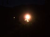
(Horrible) Train Picture 
The Ground at my Feet 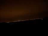
The Lights of Denver from the Top of the Hill 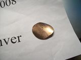
My Earnings of the Night


