Difference between revisions of "2022-04-15 -36 146"
From Geohashing
m (Location) |
|||
| Line 34: | Line 34: | ||
[[Category:Expeditions with photos]] | [[Category:Expeditions with photos]] | ||
[[Category:Coordinates reached]] | [[Category:Coordinates reached]] | ||
| + | {{location|AU|VIC|WG}} | ||
Revision as of 01:42, 15 April 2022
| Fri 15 Apr 2022 in -36,146: -36.5309590, 146.3588973 geohashing.info google osm bing/os kml crox |
Location
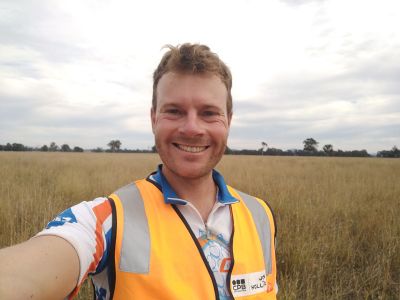
In a paddock not far off the Wangaratta-Whitfield Road.
Participants
Plans
Felix's plan was to ignore this geohash, as he attempted a 130km bike ride from Wangaratta to a lodge on top of Mt Hotham.
Expedition
Something went wrong. It's unclear how the plan failed exactly, but somehow Felix ended up right at the hash at 11:12am local time.
