Difference between revisions of "2022-12-15 -38 146"
From Geohashing
Felix Dance (talk | contribs) (Created page with "{{meetup graticule | lat=-38 | lon=146 | date=2022-12-15 }} __NOTOC__ == Location == Just off the Morewell-Thorpdale Rd between Morewell and Thorpdale. == Participants == *[...") |
m (Location correction) |
||
| (One intermediate revision by one other user not shown) | |||
| Line 28: | Line 28: | ||
| date = 2022-12-15 | | date = 2022-12-15 | ||
| name = [[User:Mdixon4|Matt]] | | name = [[User:Mdixon4|Matt]] | ||
| − | | distance = | + | | distance = 35 kms |
| bothways = true | | bothways = true | ||
| image = Geohash 2022-08-17 -38 146 01 Matt.jpg | | image = Geohash 2022-08-17 -38 146 01 Matt.jpg | ||
| Line 37: | Line 37: | ||
[[Category:Expeditions with photos]] | [[Category:Expeditions with photos]] | ||
[[Category:Coordinates reached]] | [[Category:Coordinates reached]] | ||
| − | {{location|AU|VIC| | + | {{location|AU|VIC|LA}} |
Latest revision as of 04:52, 15 December 2022
| Thu 15 Dec 2022 in -38,146: -38.2807413, 146.2772040 geohashing.info google osm bing/os kml crox |
Location
Just off the Morewell-Thorpdale Rd between Morewell and Thorpdale.
Participants
Expedition
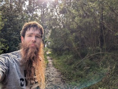
Matt rode out to this hash and announced it to our geohashing group. A break in our geohashing drought.
-Report by Felix Dance.
Photos
Achievements
Matt earned the Bicycle geohash achievement
|
