Difference between revisions of "2023-02-10 58 5"
From Geohashing
(An expedition message sent via Geohash Droid for Android.) |
(→Photos) |
||
| (9 intermediate revisions by the same user not shown) | |||
| Line 14: | Line 14: | ||
== Location == | == Location == | ||
<!-- where you've surveyed the hash to be --> | <!-- where you've surveyed the hash to be --> | ||
| + | On a field at Mæland farm, Vigrestad, Hå, Norway | ||
== Participants == | == Participants == | ||
<!-- who attended: If you link to your wiki user name in this section, your expedition will be picked up by the various statistics generated for geohashing. You may use three tildes ~ as a shortcut to automatically insert the user signature of the account you are editing with. | <!-- who attended: If you link to your wiki user name in this section, your expedition will be picked up by the various statistics generated for geohashing. You may use three tildes ~ as a shortcut to automatically insert the user signature of the account you are editing with. | ||
--> | --> | ||
| + | *[[User:Pica42|Pica42]] | ||
== Plans == | == Plans == | ||
| Line 24: | Line 26: | ||
== Expedition == | == Expedition == | ||
<!-- how it all turned out. your narrative goes here. --> | <!-- how it all turned out. your narrative goes here. --> | ||
| + | |||
| + | Last time I went out to find a geohash my car ended up with engine failure. It was the turbo that was defective. Now the car was repaired so I thought I would try to find a new geohash. I had only driven about 7 km when I got another error so I drove back to the garage for a check. There they found another defective part in the engine, a repair that would cost around 1,380 Euros. | ||
| + | |||
| + | My wife said she could drive me to find today's geohash, a trip of about 30 km each way. After we had parked, it was only about 200 meters to walk to the hash, in rainy weather. | ||
== Tracklog == | == Tracklog == | ||
| Line 33: | Line 39: | ||
--> | --> | ||
<gallery perrow="5"> | <gallery perrow="5"> | ||
| + | |||
| + | Image:2023-02-10_58_5_Pica42_1676033866413.jpg|Vigrestad [https://openstreetmap.org/?mlat=58.59146160&mlon=5.67213590&zoom=16 @58.5915,5.6721] | ||
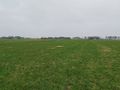
| + | Image:1676035229060.jpg|thumb|View to the east | ||
| + | Image:10-02-2023-1676035283417W.jpg|thumb|View to the west. | ||
| + | |||
</gallery> | </gallery> | ||
| Line 39: | Line 50: | ||
<!-- Add any achievement ribbons you earned below, or remove this section --> | <!-- Add any achievement ribbons you earned below, or remove this section --> | ||
| − | + | {{land geohash |name=[[User:Pica42|Pica42]] |date=2023-02-10 |latitude=58 |longitude=5 }} | |
| − | |||
| − | |||
| − | [[ | ||
| − | |||
| − | |||
| − | |||
| − | |||
| − | |||
| − | |||
| − | |||
| − | |||
| − | |||
| − | |||
| − | |||
[[Category:Expeditions]] | [[Category:Expeditions]] | ||
| − | |||
[[Category:Expeditions with photos]] | [[Category:Expeditions with photos]] | ||
| − | |||
| − | |||
| − | |||
| − | |||
| − | |||
[[Category:Coordinates reached]] | [[Category:Coordinates reached]] | ||
| − | + | {{location|NO|11}} | |
| − | |||
| − | |||
| − | |||
| − | |||
| − | |||
| − | |||
| − | |||
| − | |||
| − | |||
| − | |||
| − | |||
| − | |||
| − | |||
| − | |||
| − | |||
| − | |||
| − | |||
Latest revision as of 17:11, 10 February 2023
| Fri 10 Feb 2023 in 58,5: 58.5915020, 5.6721512 geohashing.info google osm bing/os kml crox |
Location
On a field at Mæland farm, Vigrestad, Hå, Norway
Participants
Plans
Expedition
Last time I went out to find a geohash my car ended up with engine failure. It was the turbo that was defective. Now the car was repaired so I thought I would try to find a new geohash. I had only driven about 7 km when I got another error so I drove back to the garage for a check. There they found another defective part in the engine, a repair that would cost around 1,380 Euros.
My wife said she could drive me to find today's geohash, a trip of about 30 km each way. After we had parked, it was only about 200 meters to walk to the hash, in rainy weather.
Tracklog
Photos
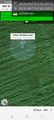
Vigrestad @58.5915,5.6721

View to the east
View to the west.


Achievements
Pica42 earned the Land geohash achievement
|