Difference between revisions of "2023-06-30 30 -97"
From Geohashing
Enjoythecode (talk | contribs) (→Expedition) |
m (Location) |
||
| (3 intermediate revisions by one other user not shown) | |||
| Line 29: | Line 29: | ||
Pretty straightforward drive the location with the wonderful surprise of getting to play at the playground upon reaching the hash. We had a lot of fun swinging and recording ourselves in 10x timelapse :) The hash was also home to some cacti, and I spent more seconds than was necessary thinking of a way to merge the words "geohash" and "cactus", to no satisfying result, unfortunately. | Pretty straightforward drive the location with the wonderful surprise of getting to play at the playground upon reaching the hash. We had a lot of fun swinging and recording ourselves in 10x timelapse :) The hash was also home to some cacti, and I spent more seconds than was necessary thinking of a way to merge the words "geohash" and "cactus", to no satisfying result, unfortunately. | ||
| − | |||
| − | |||
| − | |||
== Photos == | == Photos == | ||
<gallery perrow="5"> | <gallery perrow="5"> | ||
| + | |||
Image:20230630_30_-97_sinanAtSwing.jpeg| found a swing nearby! | Image:20230630_30_-97_sinanAtSwing.jpeg| found a swing nearby! | ||
Image:2023-06-30_30_-97_enjoythecode_1688143077426.jpg|we made it! [https://openstreetmap.org/?mlat=30.29859420&mlon=-97.89059250&zoom=16 @30.2986,-97.8906] | Image:2023-06-30_30_-97_enjoythecode_1688143077426.jpg|we made it! [https://openstreetmap.org/?mlat=30.29859420&mlon=-97.89059250&zoom=16 @30.2986,-97.8906] | ||
| + | |||
| + | Image:20230630_30_-97_geocacti.jpg| geocacti! | ||
</gallery> | </gallery> | ||
| Line 44: | Line 44: | ||
{{#vardefine:ribbonwidth|100%}} | {{#vardefine:ribbonwidth|100%}} | ||
<!-- Add any achievement ribbons you earned below, or remove this section --> | <!-- Add any achievement ribbons you earned below, or remove this section --> | ||
| − | + | {{land geohash | latitude = 30 | longitude = -97 | date = 2023-06-30 | name = enjoythecode and ebru | image = 2023-06-30_30_-97_enjoythecode_1688143077426.jpg }} | |
__NOTOC__ | __NOTOC__ | ||
| − | |||
| − | |||
| − | |||
| − | |||
| − | |||
| − | |||
| − | |||
| − | |||
| − | |||
| − | |||
| − | |||
| − | |||
[[Category:Expeditions]] | [[Category:Expeditions]] | ||
| − | |||
[[Category:Expeditions with photos]] | [[Category:Expeditions with photos]] | ||
| − | |||
| − | |||
| − | |||
| − | |||
| − | |||
[[Category:Coordinates reached]] | [[Category:Coordinates reached]] | ||
| − | + | {{location|US|TX|TV}} | |
| − | |||
| − | |||
| − | |||
| − | |||
| − | |||
| − | |||
| − | |||
| − | |||
| − | |||
| − | |||
| − | |||
| − | |||
| − | |||
| − | |||
| − | |||
| − | |||
| − | |||
Latest revision as of 04:42, 1 July 2023
| Fri 30 Jun 2023 in 30,-97: 30.2986500, -97.8905648 geohashing.info google osm bing/os kml crox |
Location
Near a playground in Barton Creek West, Austin, TX, USA.
Participants
Plans
Expedition
Pretty straightforward drive the location with the wonderful surprise of getting to play at the playground upon reaching the hash. We had a lot of fun swinging and recording ourselves in 10x timelapse :) The hash was also home to some cacti, and I spent more seconds than was necessary thinking of a way to merge the words "geohash" and "cactus", to no satisfying result, unfortunately.
Photos

found a swing nearby!

we made it! @30.2986,-97.8906
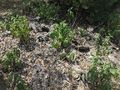
geocacti!


Achievements
enjoythecode and ebru earned the Land geohash achievement
|