Difference between revisions of "2023-07-18 58 5"
(An expedition message sent via Geohash Droid for Android.) |
(→Expedition) |
||
| (25 intermediate revisions by the same user not shown) | |||
| Line 12: | Line 12: | ||
| date=2023-07-18 | | date=2023-07-18 | ||
}}<!-- edit as necessary --> | }}<!-- edit as necessary --> | ||
| + | |||
| + | [[Image:20230718 58 5 Me.jpg|thumb|left]] | ||
== Location == | == Location == | ||
<!-- where you've surveyed the hash to be --> | <!-- where you've surveyed the hash to be --> | ||
| + | |||
| + | Near the mountain Dormelinuten not far from Lutsivatnet in Sandnes municipality, Norway. | ||
== Participants == | == Participants == | ||
<!-- who attended: If you link to your wiki user name in this section, your expedition will be picked up by the various statistics generated for geohashing. You may use three tildes ~ as a shortcut to automatically insert the user signature of the account you are editing with. | <!-- who attended: If you link to your wiki user name in this section, your expedition will be picked up by the various statistics generated for geohashing. You may use three tildes ~ as a shortcut to automatically insert the user signature of the account you are editing with. | ||
--> | --> | ||
| + | |||
| + | *[[User:Pica42|Pica42]] | ||
== Plans == | == Plans == | ||
| Line 24: | Line 30: | ||
== Expedition == | == Expedition == | ||
<!-- how it all turned out. your narrative goes here. --> | <!-- how it all turned out. your narrative goes here. --> | ||
| + | |||
| + | Today's trip was a wet pleasure. Right from the start it was light rain that came in showers. The path was wet and in some places quite tiring to walk. In many places the path did not look like a path but more like a swamp. Fortunately, I was equipped with waterproof shoes and a good waterproof jacket. | ||
| + | I made several stops on the trip, stopping to eat blueberries of which there was quite a lot. | ||
| + | |||
| + | After I got home I discovered that I had an average heart rate of 151 bpm and a maximum heart rate of 184 bpm on the trip. | ||
== Tracklog == | == Tracklog == | ||
<!-- if your GPS device keeps a log, you may use Template:Tracklog, post a link here, or both --> | <!-- if your GPS device keeps a log, you may use Template:Tracklog, post a link here, or both --> | ||
| + | |||
| + | {{tracklog |activity 11587367120xx.gpx}} | ||
== Photos == | == Photos == | ||
| Line 33: | Line 46: | ||
--> | --> | ||
<gallery perrow="5"> | <gallery perrow="5"> | ||
| + | |||
| + | Image:2023-07-18_58_5_Pica42_1689679199825.jpg|Alsvik [https://openstreetmap.org/?mlat=58.86338840&mlon=5.87658500&zoom=16 @58.8634,5.8766] | ||
| + | Image:20230718 58 5 03.jpg|thumb|Photo from the trail | ||
| + | Image:20230718 58 5 04.jpg|thumb|Photo from the trail | ||
| + | Image:20230718 58 5 05.jpg|thumb|Photo from the trail | ||
| + | Image:20230718 58 5 W.jpg|thumb|View to the west | ||
| + | Image:20230718 58 5 S.jpg|thumb|View to the south | ||
| + | Image:20230718 58 5 N.jpg|thumb|View to the north | ||
| + | Image:20230718 133604.jpg|thumb|Blueberry | ||
| + | Image:20230718 58 5 06.jpg|thumb|Photo from the trail | ||
| + | Image:20230718 58 5 07.jpg|thumb|Photo from the trail | ||
| + | Image:20230718 58 5 08.jpg|thumb|Photo from the trail | ||
| + | Image:20230718 58 5 09.jpg|thumb|Photo from the trail | ||
| + | Image:20230718 58 5 10.jpg|thumb|The path goes under a fallen tree | ||
| + | Image:20230718 58 5 11.jpg|thumb|The feet were well prepared for the trip | ||
| + | |||
| + | |||
</gallery> | </gallery> | ||
| Line 39: | Line 69: | ||
<!-- Add any achievement ribbons you earned below, or remove this section --> | <!-- Add any achievement ribbons you earned below, or remove this section --> | ||
| − | + | {{land geohash |name=[[User:Pica42|Pica42]] |date=2023-07-18 |latitude=58 |longitude=5 }} | |
| − | |||
| − | |||
| − | [[ | ||
| − | |||
| − | |||
| − | |||
| − | |||
| − | |||
| − | |||
| − | |||
| − | |||
| − | |||
| − | |||
| − | |||
[[Category:Expeditions]] | [[Category:Expeditions]] | ||
| − | |||
[[Category:Expeditions with photos]] | [[Category:Expeditions with photos]] | ||
| − | |||
| − | |||
| − | |||
| − | |||
| − | |||
[[Category:Coordinates reached]] | [[Category:Coordinates reached]] | ||
| + | {{location|NO|11}} | ||
| − | + | __NOTOC__ | |
| − | |||
| − | |||
| − | |||
| − | |||
| − | |||
| − | |||
| − | |||
| − | |||
| − | |||
| − | |||
| − | |||
| − | |||
| − | |||
| − | |||
| − | |||
| − | |||
Latest revision as of 14:30, 19 July 2023
| Tue 18 Jul 2023 in 58,5: 58.8633826, 5.8765444 geohashing.info google osm bing/os kml crox |

Location
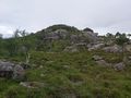
Near the mountain Dormelinuten not far from Lutsivatnet in Sandnes municipality, Norway.
Participants
Plans
Expedition
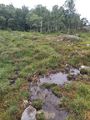
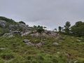
Today's trip was a wet pleasure. Right from the start it was light rain that came in showers. The path was wet and in some places quite tiring to walk. In many places the path did not look like a path but more like a swamp. Fortunately, I was equipped with waterproof shoes and a good waterproof jacket. I made several stops on the trip, stopping to eat blueberries of which there was quite a lot.
After I got home I discovered that I had an average heart rate of 151 bpm and a maximum heart rate of 184 bpm on the trip.
Tracklog
Photos

Alsvik @58.8634,5.8766
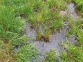
Photo from the trail
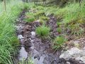
Photo from the trail
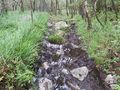
Photo from the trail
View to the west
View to the south
View to the north
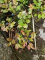
Blueberry
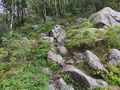
Photo from the trail
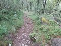
Photo from the trail
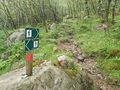
Photo from the trail
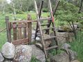
Photo from the trail
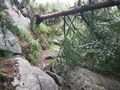
The path goes under a fallen tree
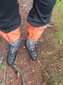
The feet were well prepared for the trip


Achievements
Pica42 earned the Land geohash achievement
|