Difference between revisions of "2023-07-29 58 5"
From Geohashing
(→Photos) |
(→Tracklog) |
||
| (9 intermediate revisions by the same user not shown) | |||
| Line 12: | Line 12: | ||
| date=2023-07-29 | | date=2023-07-29 | ||
}}<!-- edit as necessary --> | }}<!-- edit as necessary --> | ||
| + | [[Image:20230729 100654.jpg|thumb|left]] | ||
== Location == | == Location == | ||
<!-- where you've surveyed the hash to be --> | <!-- where you've surveyed the hash to be --> | ||
| Line 31: | Line 32: | ||
== Tracklog == | == Tracklog == | ||
<!-- if your GPS device keeps a log, you may use Template:Tracklog, post a link here, or both --> | <!-- if your GPS device keeps a log, you may use Template:Tracklog, post a link here, or both --> | ||
| + | |||
| + | Today's trip was quite nice, 20 °C, mostly cloudy and no wind. From where I parked to the hash point, it was about 1 km one way. My wife stayed in the car to look after it. | ||
| + | |||
| + | I had to take a small detour due to mud and cow shit, but the rest of the way there were no major problems. My mobile phone had a bit of trouble finding the zero point but I got pretty close. I look forward to the next time there is a geohash near where I live. | ||
== Photos == | == Photos == | ||
| Line 43: | Line 48: | ||
Image:20230729 100003.jpg|thumb|On my way to the hash I heard someone following me so I turned around and took this photo | Image:20230729 100003.jpg|thumb|On my way to the hash I heard someone following me so I turned around and took this photo | ||
Image:20230729 100054.jpg|thumb|There is no doubt who is the boss here | Image:20230729 100054.jpg|thumb|There is no doubt who is the boss here | ||
| − | + | Image:20230729 58-5 SW.jpg|thumb|View to the southwest | |
| − | + | Image:20230729 58 5 SE.jpg|thumb|View to the southeast | |
| − | + | Image:20230729 58 5 NE.jpg|thumb|View to the northeast | |
| − | + | Image:20230729 58-5 NV.jpg|thumb|View to the northwest | |
| − | + | Image:20230729 102336.jpg|thumb|Finally, three pictures of some of my four-legged friends who came towards me when I was almost back at the car. | |
| − | + | Image:20230729_102353.jpg | |
| + | Image:20230729_102422.jpg | ||
</gallery> | </gallery> | ||
| Line 55: | Line 61: | ||
<!-- Add any achievement ribbons you earned below, or remove this section --> | <!-- Add any achievement ribbons you earned below, or remove this section --> | ||
| − | + | {{land geohash |name=[[User:Pica42|Pica42]] |date=2023-07-29 |latitude=58 |longitude=5 }} | |
| − | |||
| − | |||
| − | [[ | ||
| − | |||
| − | |||
| − | |||
| − | |||
| − | |||
| − | |||
| − | |||
| − | |||
| − | |||
| − | |||
| − | |||
[[Category:Expeditions]] | [[Category:Expeditions]] | ||
| − | |||
[[Category:Expeditions with photos]] | [[Category:Expeditions with photos]] | ||
| − | |||
| − | |||
| − | |||
| − | |||
| − | |||
[[Category:Coordinates reached]] | [[Category:Coordinates reached]] | ||
| + | {{location|NO|11}} | ||
| − | + | __NOTOC__ | |
| − | |||
| − | |||
| − | |||
| − | |||
| − | |||
| − | |||
| − | |||
| − | |||
| − | |||
| − | |||
| − | |||
| − | |||
| − | |||
| − | |||
| − | |||
| − | |||
Latest revision as of 17:39, 29 July 2023
| Sat 29 Jul 2023 in 58,5: 58.7030055, 5.7463360 geohashing.info google osm bing/os kml crox |
Location
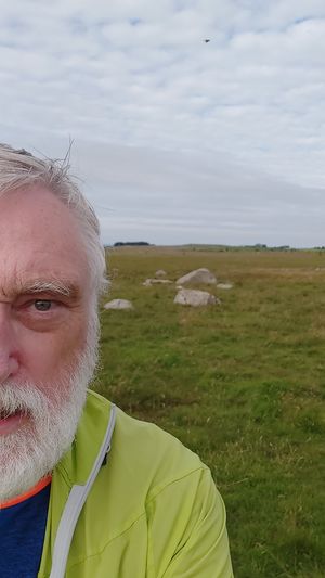
On a cow pasture at Lende in Time municipality, Rogaland, Norway
Participants
Plans
Expedition
Tracklog
Today's trip was quite nice, 20 °C, mostly cloudy and no wind. From where I parked to the hash point, it was about 1 km one way. My wife stayed in the car to look after it.
I had to take a small detour due to mud and cow shit, but the rest of the way there were no major problems. My mobile phone had a bit of trouble finding the zero point but I got pretty close. I look forward to the next time there is a geohash near where I live.
Photos
Lende @58.7030,5.7463
Achievements
Pica42 earned the Land geohash achievement
|


