Difference between revisions of "2023-08-16 51 13"
(Report complete with gallery and tracklog and juggernaut achievement) |
|||
| (One intermediate revision by the same user not shown) | |||
| Line 8: | Line 8: | ||
== Location == | == Location == | ||
| − | Today's location is directly next to the ''[[wikipedia:Zwinger (Dresden)|Zwinger]]'', a Baroque | + | Today's location is directly next to the ''[[wikipedia:Zwinger (Dresden)|Zwinger]]'', a Baroque palatial complex built 1710-1728 and one of the most important historic locations in Dresden. In the part of the building nearest to the hashpoint, the ''[[wikipedia:Gemäldegalerie Alte Meister|"Old Masters" art gallery]]'' is situated. On the other side of the hashpoint you can find the [[wikipedia:Semperoper|''Semperoper'' opera house]], another very important building. |
Country: Germany; state: Sachsen (Saxony, EU:DE:SN); district: Dresden; Stadtbezirk: Altstadt; Stadtteil (city district): Innere Altstadt | Country: Germany; state: Sachsen (Saxony, EU:DE:SN); district: Dresden; Stadtbezirk: Altstadt; Stadtteil (city district): Innere Altstadt | ||
| Line 20: | Line 20: | ||
I think I have not been to the exact spot before, but I've been to the Zwinger (last time was on 2023-06-15, with a guest) and to the Semperoper (last time was on 2023-06-16 for a ballet). During the intermission, we had a drink less than 50 meters from the hashpoint. | I think I have not been to the exact spot before, but I've been to the Zwinger (last time was on 2023-06-15, with a guest) and to the Semperoper (last time was on 2023-06-16 for a ballet). During the intermission, we had a drink less than 50 meters from the hashpoint. | ||
| − | The [[Juggernaut achievement]] is doable, although one corner is very close to the allowed distance from the | + | The [[Juggernaut achievement]] is doable, although one corner is very close to the maximum allowed deviation from the straight line. The distance between the hashpoint and my home is about 2880 meters (+-20, depending on which corner of the plot you use) and the Juggernaut achievement allows a deviation of 1:20, i.e. 144 meters in my case. The corner Comeniusstraße/Canalettostraße should be about 140 meters from the direct line. Perhaps I can cross through the school yard to avoid that corner. You can expect History<sup>TM</sup> and Art<sup>WTF</sup> and Architecture<sup>OMGsomuchofit</sup> along the route. |
=== Expedition === | === Expedition === | ||
| − | + | ''(#number) indicates the respective picture from the gallery'' | |
| − | |||
| + | I started walking along Wallotstraße in the direction of the hashpoint. Since my plan was to get the Juggernaut achievement (again), I always tried to stay as close as possible to the direct line between my house and the hashpoint, even when there was more than enough margin left. After crossing Fetscherstraße, I took the tracks behind some mid-sized appartment buildings (#1, #2). After passing the Saint Joseph Hospital, the most dangerous part was ahead of me, regarding the Juggernaut achievement. I entered the schoolyard from the east through the open gate and walked along one building, then between another building and the sports ground. Nobody else was there. Then I reached a fence on the western side of the schoolyard, dang. Since climbing schoolyard fences is not a good idea, I went back a bit and walked around that last building, but the small gate on the southern corner of the building – leading to the parking lot – was locked. I left the schoolyard by the open southern gate. I was still not past the evil corner, so I just hoped for the best and walked around it (#3). Past it I quickly went towards the direct line again, you can't be too careful with GPS jitter. On the other side of the school ground, I saw a gate in the fence which I hadn't seen from inside. Imagining a Juggernaut-crippling error in my route planning, I checked it, but at least it was locked as well. | ||
| − | ... | + | Ahead of me lay lots of big appartment buildings. I walked along the side of the next one, right on the meadow (#4), then over the meadow of the vocational school as well. Through the courtyard of an apartment complex (#5), past another one, then along another school (lots of schools in this part apparently), finally I reached the large road just next to the Old Town. I crossed both the road and the meadow between the lanes directly where they appeared before me (#6), far from any traffic lights. Across the big parking lot in front of the main police station, then I was in Rampische Straße (#7) which led me directly to the ''[[wikipedia:Frauenkirche, Dresden|Frauenkirche]]'' (="Church of Our Lady") (#8), which is right on the direct line between the hashpoint and my home. The eastern end of the historic ''[[wikipedia:Fürstenzug|Fürstenzug]]'' (="Procession of Princes") porcelain mural (#9) is also on that line. Of course I walked along it, towards the cathedral (#10). There is an covered overpass leading from the [[wikipedia:Dresden Castle|Royal Palace]] to the cathedral, so that the king and court can easily go to mass (the electors Augustus II and III converted to Catholicism to be able to become kings of Poland, but the rest of the country stayed Protestant; this cathedral was built as the first Catholic church in the land of the Protestant Reformation). My direct Juggernaut line clips the northern wall of the Royal Palace and the southernmost corner of the cathedral, going right through that overpass (#11). Then I stood in front of the ''Zwinger'' and the ''Semperoper'' (#12). After crossing Theater Square, I found out that there is a café's outdoor area at the hashpoint (#13). This would certainly complicate the GPS dance. |
| + | |||
| + | I went inside and picked out a piece of cake. I chose the traditional Saxon ''[[wikipedia:Eierschecke|Eierschecke]]'' cake, since I was in such a historic spot; it's also a very touristy spot, indicated by a price tag of 4.90 € per slice. Then I sat down at the table which I guestimated to be nearest to the spot (#14). While I waited for and then ate the cake (which was tasty), the hashpoint danced back and forth through the café, according to the GPS unit (#15, #16). I didn't get the perfect coordinates, but I was able to snap a screenshot of the geohashdroid app with a distance of less than one meter on the way to the toilet (#17). Hooray, coordinates reached! I forgot to take a picture of myself though. | ||
*Coordinates reached! -- [[User:Danatar|Danatar]] ([[User talk:Danatar|talk]]) [https://openstreetmap.org/?mlat=51.05394790&mlon=13.73409200&zoom=16 @51.0539,13.7341] 13:18, 16 August 2023 (GMT+02:00) | *Coordinates reached! -- [[User:Danatar|Danatar]] ([[User talk:Danatar|talk]]) [https://openstreetmap.org/?mlat=51.05394790&mlon=13.73409200&zoom=16 @51.0539,13.7341] 13:18, 16 August 2023 (GMT+02:00) | ||
| − | ... | + | Then I started my return journey. I took some slightly different streets, usually just on the other side of a block. The route was straighter and shorter without all those zigzags. |
| + | |||
| + | I walked 3.5 km to the hashpoint and 3.3 km on the way back, making this a Walk geohash. | ||
{{gallery|width=200|height=200|lines=2 | {{gallery|width=200|height=200|lines=2 | ||
| − | |Image:2023-08-16_51_13_rueck_wallot1.jpg|along backyard track | + | |Image:2023-08-16_51_13_rueck_wallot1.jpg|(#1)along backyard track |
| − | |Image:2023-08-16_51_13_rueck_wallot2.jpg|across a meadow | + | |Image:2023-08-16_51_13_rueck_wallot2.jpg|(#2)across a meadow |
| − | |Image:2023-08-16_51_13_rueck_juggernautknapp.jpg|dangerous part | + | |Image:2023-08-16_51_13_rueck_juggernautknapp.jpg|(#3)dangerous part for juggernaut (picture taken on way back) |
| − | |Image:2023-08-16_51_13_rueck_beiSP1.jpg|along side of building (picture taken on way back) | + | |Image:2023-08-16_51_13_rueck_beiSP1.jpg|(#4)along side of building (picture taken on way back) |
| − | |Image:2023-08-16_51_13_hin_gruen.jpg|through a courtyard | + | |Image:2023-08-16_51_13_hin_gruen.jpg|(#5)through a courtyard |
| − | |Image:2023-08-16_51_13_hin_petersburger.jpg|straight across road towards ''Frauenkirche'' | + | |Image:2023-08-16_51_13_hin_petersburger.jpg|(#6)straight across the road, towards ''Frauenkirche'' |
| − | |Image:2023-08-16_51_13_hin_nebenpolizei.jpg| | + | |Image:2023-08-16_51_13_hin_nebenpolizei.jpg|(#7) |
| − | |Image:2023-08-16_51_13_hin_frauenkirche.jpg|right past ''Frauenkirche'' | + | |Image:2023-08-16_51_13_hin_frauenkirche.jpg|(#8)right past ''Frauenkirche'' |
|Image:2023-08-16_51_13_rueck_frauenkirche.jpg|better view of ''Frauenkirche'' (on way back) | |Image:2023-08-16_51_13_rueck_frauenkirche.jpg|better view of ''Frauenkirche'' (on way back) | ||
| − | |Image:2023-08-16_51_13_hin_fuerstenzug.jpg|along ''Fürstenzug'' | + | |Image:2023-08-16_51_13_hin_fuerstenzug.jpg|(#9)along ''Fürstenzug'' mural |
| − | |Image:2023-08-16_51_13_hin_hofkirche.jpg|past the cathedral | + | |Image:2023-08-16_51_13_hin_hofkirche.jpg|(#10)past the cathedral |
| − | |Image:2023-08-16_51_13_hin_uebergang.jpg|rainproof (and | + | |Image:2023-08-16_51_13_hin_uebergang.jpg|(#11)rainproof (and plebs-proof) royal shortcut between palace and cathedral |
| − | |Image:2023-08-16_51_13_hin_zwingersemper.jpg|not far now, looking at ''Zwinger'' and ''Semperoper'' | + | |Image:2023-08-16_51_13_hin_zwingersemper.jpg|(#12)not far now, looking at ''Zwinger'' and ''Semperoper'' |
|Image:2023-08-16_51_13_rueck_hofkircheschloss.jpg|looking back at cathedral and palace | |Image:2023-08-16_51_13_rueck_hofkircheschloss.jpg|looking back at cathedral and palace | ||
| − | |Image:2023-08-16_51_13_hin_pano1.jpg|panorama | + | |Image:2023-08-16_51_13_hin_pano1.jpg|touristy panorama |
| − | |Image:2023-08-16_51_13_near1.jpg| | + | |Image:2023-08-16_51_13_near1.jpg|(#13)almost there |
| − | |Image:2023-08-16_51_13_near2.jpg|view from the café's stairs, spot somewhere here | + | |Image:2023-08-16_51_13_near2.jpg|view from the café's stairs, spot is somewhere here |
| − | |Image:2023-08-16_51_13_gps1.jpg|waiting for the spot to come to me | + | |Image:2023-08-16_51_13_gps1.jpg|(#14)waiting for the spot to come to me |
| − | |Image:2023-08-16_51_13_gps2.jpg|GPS near the spot | + | |Image:2023-08-16_51_13_gps2.jpg|(#15)GPS near the spot |
| − | |Image:2023-08-16_51_13_gps3.jpg|GPS in identical but different location | + | |Image:2023-08-16_51_13_gps3.jpg|(#16)GPS near the spot, in identical but different location |
| − | |Image:2023-08-16_51_13_geohashdroid.jpg|geohashdroid | + | |Image:2023-08-16_51_13_geohashdroid.jpg|(#17)geohashdroid got nearest |
|Image:2023-08-16_51_13_pano2.jpg|panorama near the hashpoint | |Image:2023-08-16_51_13_pano2.jpg|panorama near the hashpoint | ||
|Image:2023-08-16_51_13_rueck_zwingerinnen.jpg|construction/restoration inside the ''Zwinger'' | |Image:2023-08-16_51_13_rueck_zwingerinnen.jpg|construction/restoration inside the ''Zwinger'' | ||
| − | |||
}} | }} | ||
| − | ===tracklog=== | + | Concerning the Juggernaut achievement: The maximum deviation from the direct line was at the corner Comeniusstraße/Canalettostraße. Depending on which part of my home is used as the starting point, the deviation according to the tracklog was 132 m (middle of the building used; range from 115 m at the southernmost corner of the plot to 139 m at northernmost corner of the building). But the tracklog is off a bit in that area. When the real location of the sidewalk is used, the deviation is 142 m (range 126-148), or 0.0493, just barely below 1:20. Phew! Near ''Frauenkirche'', the GPS tracklog is way off my real route, but even there the deviation is still only 139 m (55 m in reality). |
| − | {{tracklog | | + | |
| + | {{gallery|width=200|height=200|lines=2 | ||
| + | |Image:2023-08-16_51_13_juggernaut0.jpg|tracklog and direct juggernaut line | ||
| + | |Image:2023-08-16_51_13_juggernaut1.jpg|132m max deviation of tracklog | ||
| + | |Image:2023-08-16_51_13_juggernaut2.jpg|142m max deviation of real route (thin blue line) | ||
| + | |Image:2023-08-16_51_13_juggernaut3.jpg|GPS accuracy error still near enough (thin blue line is real route) | ||
| + | }}{{ | ||
| + | Ribbon |icon = Juggernaut.png |color = darkviolet |user = [[User:Danatar|Danatar]] |achievement = [[Juggernaut achievement]] |action = reaching a geohash in a straight line (with a deviation of 0.0493) on [[2023-08-16 51 13|2023-08-16]] |category = Juggernaut achievement | image = 2023-08-16_51_13_juggernaut0.jpg}} | ||
| + | |||
| + | |||
| + | ===tracklog=== | ||
| + | {{tracklog | 2023-08-16 51 13 hinundrueck-triton.gpx}} | ||
[[Category:Expeditions]] | [[Category:Expeditions]] | ||
Latest revision as of 10:43, 17 August 2023
| Wed 16 Aug 2023 in Dresden: 51.0539522, 13.7341169 geohashing.info google osm bing/os kml crox |
Location
Today's location is directly next to the Zwinger, a Baroque palatial complex built 1710-1728 and one of the most important historic locations in Dresden. In the part of the building nearest to the hashpoint, the "Old Masters" art gallery is situated. On the other side of the hashpoint you can find the Semperoper opera house, another very important building.
Country: Germany; state: Sachsen (Saxony, EU:DE:SN); district: Dresden; Stadtbezirk: Altstadt; Stadtteil (city district): Innere Altstadt
Weather: clouded, warm and muggy
Danatar
Planning
This location should be very easy to reach, as long as there are no construction works blocking it. I'll visit it either in the morning or in the early afternoon.
I think I have not been to the exact spot before, but I've been to the Zwinger (last time was on 2023-06-15, with a guest) and to the Semperoper (last time was on 2023-06-16 for a ballet). During the intermission, we had a drink less than 50 meters from the hashpoint.
The Juggernaut achievement is doable, although one corner is very close to the maximum allowed deviation from the straight line. The distance between the hashpoint and my home is about 2880 meters (+-20, depending on which corner of the plot you use) and the Juggernaut achievement allows a deviation of 1:20, i.e. 144 meters in my case. The corner Comeniusstraße/Canalettostraße should be about 140 meters from the direct line. Perhaps I can cross through the school yard to avoid that corner. You can expect HistoryTM and ArtWTF and ArchitectureOMGsomuchofit along the route.
Expedition
(#number) indicates the respective picture from the gallery
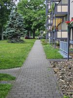
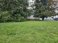
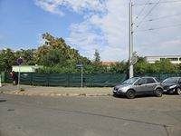
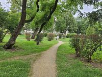
I started walking along Wallotstraße in the direction of the hashpoint. Since my plan was to get the Juggernaut achievement (again), I always tried to stay as close as possible to the direct line between my house and the hashpoint, even when there was more than enough margin left. After crossing Fetscherstraße, I took the tracks behind some mid-sized appartment buildings (#1, #2). After passing the Saint Joseph Hospital, the most dangerous part was ahead of me, regarding the Juggernaut achievement. I entered the schoolyard from the east through the open gate and walked along one building, then between another building and the sports ground. Nobody else was there. Then I reached a fence on the western side of the schoolyard, dang. Since climbing schoolyard fences is not a good idea, I went back a bit and walked around that last building, but the small gate on the southern corner of the building – leading to the parking lot – was locked. I left the schoolyard by the open southern gate. I was still not past the evil corner, so I just hoped for the best and walked around it (#3). Past it I quickly went towards the direct line again, you can't be too careful with GPS jitter. On the other side of the school ground, I saw a gate in the fence which I hadn't seen from inside. Imagining a Juggernaut-crippling error in my route planning, I checked it, but at least it was locked as well.
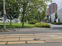
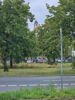
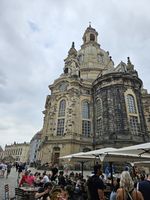
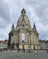
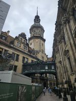
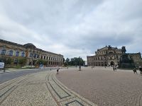
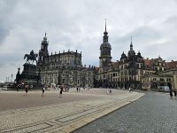
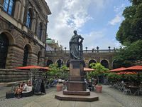
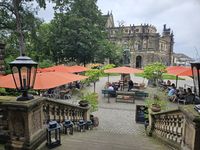
Ahead of me lay lots of big appartment buildings. I walked along the side of the next one, right on the meadow (#4), then over the meadow of the vocational school as well. Through the courtyard of an apartment complex (#5), past another one, then along another school (lots of schools in this part apparently), finally I reached the large road just next to the Old Town. I crossed both the road and the meadow between the lanes directly where they appeared before me (#6), far from any traffic lights. Across the big parking lot in front of the main police station, then I was in Rampische Straße (#7) which led me directly to the Frauenkirche (="Church of Our Lady") (#8), which is right on the direct line between the hashpoint and my home. The eastern end of the historic Fürstenzug (="Procession of Princes") porcelain mural (#9) is also on that line. Of course I walked along it, towards the cathedral (#10). There is an covered overpass leading from the Royal Palace to the cathedral, so that the king and court can easily go to mass (the electors Augustus II and III converted to Catholicism to be able to become kings of Poland, but the rest of the country stayed Protestant; this cathedral was built as the first Catholic church in the land of the Protestant Reformation). My direct Juggernaut line clips the northern wall of the Royal Palace and the southernmost corner of the cathedral, going right through that overpass (#11). Then I stood in front of the Zwinger and the Semperoper (#12). After crossing Theater Square, I found out that there is a café's outdoor area at the hashpoint (#13). This would certainly complicate the GPS dance.
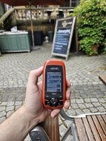
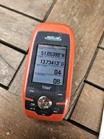
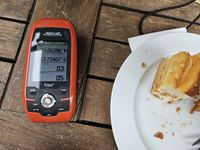
I went inside and picked out a piece of cake. I chose the traditional Saxon Eierschecke cake, since I was in such a historic spot; it's also a very touristy spot, indicated by a price tag of 4.90 € per slice. Then I sat down at the table which I guestimated to be nearest to the spot (#14). While I waited for and then ate the cake (which was tasty), the hashpoint danced back and forth through the café, according to the GPS unit (#15, #16). I didn't get the perfect coordinates, but I was able to snap a screenshot of the geohashdroid app with a distance of less than one meter on the way to the toilet (#17). Hooray, coordinates reached! I forgot to take a picture of myself though.
- Coordinates reached! -- Danatar (talk) @51.0539,13.7341 13:18, 16 August 2023 (GMT+02:00)
Then I started my return journey. I took some slightly different streets, usually just on the other side of a block. The route was straighter and shorter without all those zigzags.
I walked 3.5 km to the hashpoint and 3.3 km on the way back, making this a Walk geohash.
|
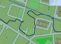
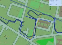
Concerning the Juggernaut achievement: The maximum deviation from the direct line was at the corner Comeniusstraße/Canalettostraße. Depending on which part of my home is used as the starting point, the deviation according to the tracklog was 132 m (middle of the building used; range from 115 m at the southernmost corner of the plot to 139 m at northernmost corner of the building). But the tracklog is off a bit in that area. When the real location of the sidewalk is used, the deviation is 142 m (range 126-148), or 0.0493, just barely below 1:20. Phew! Near Frauenkirche, the GPS tracklog is way off my real route, but even there the deviation is still only 139 m (55 m in reality).
|
Danatar earned the Juggernaut achievement
|
tracklog
