Difference between revisions of "2023-11-25 58 5"
From Geohashing
(→Photos) |
(→Achievements) |
||
| (2 intermediate revisions by the same user not shown) | |||
| Line 29: | Line 29: | ||
== Expedition == | == Expedition == | ||
<!-- how it all turned out. your narrative goes here. --> | <!-- how it all turned out. your narrative goes here. --> | ||
| + | It was a cold day so the windows of the car had to be scraped of ice before I could drive to find today's geohash. Since it was early in the day, there weren't many people out on the roads, so I wasn't disturbed in my hunt for the geohash. | ||
== Tracklog == | == Tracklog == | ||
| Line 42: | Line 43: | ||
Image:20231125 58 5 S.jpg|thumb|View to the south | Image:20231125 58 5 S.jpg|thumb|View to the south | ||
Image:20231125 58 5 SE.jpg|thumb|View to the southeast | Image:20231125 58 5 SE.jpg|thumb|View to the southeast | ||
| − | + | Image:20231125 58 5 N.jpg|thumb|View to the north | |
| − | |||
</gallery> | </gallery> | ||
| Line 50: | Line 50: | ||
<!-- Add any achievement ribbons you earned below, or remove this section --> | <!-- Add any achievement ribbons you earned below, or remove this section --> | ||
| − | + | {{land geohash |name=[[User:Pica42|Pica42]] |date=2023-11-25 |latitude=58 |longitude=5 }} | |
| − | |||
| − | |||
| − | [[ | ||
| − | |||
| − | |||
| − | |||
| − | |||
| − | |||
| − | |||
| − | |||
| − | |||
| − | |||
| − | |||
| − | |||
[[Category:Expeditions]] | [[Category:Expeditions]] | ||
| − | |||
[[Category:Expeditions with photos]] | [[Category:Expeditions with photos]] | ||
| − | |||
| − | |||
| − | |||
| − | |||
| − | |||
[[Category:Coordinates reached]] | [[Category:Coordinates reached]] | ||
| + | {{location|NO|11}} | ||
| − | + | __NOTOC__ | |
| − | |||
| − | |||
| − | |||
| − | |||
| − | |||
| − | |||
| − | |||
| − | |||
| − | |||
| − | |||
| − | |||
| − | |||
| − | |||
| − | |||
| − | |||
Latest revision as of 18:05, 25 November 2023
| Sat 25 Nov 2023 in 58,5: 58.8983984, 5.7353101 geohashing.info google osm bing/os kml crox |

Location
In the Gausel district, Stavanger, Norway
Participants
Plans
Expedition
It was a cold day so the windows of the car had to be scraped of ice before I could drive to find today's geohash. Since it was early in the day, there weren't many people out on the roads, so I wasn't disturbed in my hunt for the geohash.
Tracklog
Photos

Gausel

View to the south
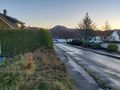
View to the southeast
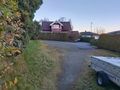
View to the north


Achievements
Pica42 earned the Land geohash achievement
|