Difference between revisions of "2024-01-11 -38 144"
(Blanked the page) (Tag: Blanking) |
m (Location) |
||
| (5 intermediate revisions by 2 users not shown) | |||
| Line 1: | Line 1: | ||
| + | {{meetup graticule|date=2024-01-11|lat=-38|lon=144}} | ||
| + | ==Location== | ||
| + | On the edge of a management track, in Long Point Reserve, Mornington Peninsula, Victoria, Australia. | ||
| + | ==Participants== | ||
| + | *[[User:Stevage|Stevage]] | ||
| + | |||
| + | ==Expedition== | ||
| + | === Preamble === | ||
| + | For two days, I was looking after my favourite niece, who we'll call Minnie. She's 5, and full of adventure and enthusiasm and cheerful energy. | ||
| + | |||
| + | On day one, I took her to the Briars, which has a wildlife sanctuary, historic homestead, nursery, cafe and a few other things. I was intending to take on a walk through the wildlife sanctuary, but as we started I noticed a sign advertising a geocaching adventure, billed as a "treasure hunt". I'd never actually done a geocache before, and had to faff about with a few apps to make it work. Annoyingly, they'd given the coordinates in old-school degree-minute-second notation, and hadn't actually registered the geocaches online. Despite a mishap caused by me mistyping a coordinate, we eventually found all 7 points and had a good old time. | ||
| + | |||
| + | === Driving === | ||
| + | |||
| + | Day two, I thought I'd take her for a walk along some cliffs and maybe to a beach. I was deliberating between Somers and Cape Shanck and settled on the former, mostly because the drive was slightly shorter. And then, on a whim, I checked the geohash, "just in case". | ||
| + | |||
| + | Wow. It could not have been more perfect. Very close to the direct route to Cape Shanck, in a nature reserve, and (according to Google), you could drive straight up to it. | ||
| + | |||
| + | I wasn't quite sure how to explain what geohashing was to Minnie, but I basically said we were going to do another treasure hunt, except this one was for grown-ups, and there wouldn't be a box with an animal stamp when we got there. She was cautiously enthusiastic. | ||
| + | |||
| + | Entering the nature reserve, I saw a couple of signs that did not look promising. One warned of clay target shooting, with some very specific information about which direction the shooters would be shooting. Another warned of archers, with very specific information about what times this might be happening and who to contact if you wanted to run the gauntlet. It was a very well defended geohash! | ||
| + | |||
| + | But then I realised that I had turned off the correct track, and turned back. I now saw that there was a gate between us and the geohash, so we'd have to walk about 400m. Even better! Now we'd get an actual walk, a great little distance for a warm up walk. | ||
| + | |||
| + | We got out, and I brought out my new sunbrella, since it was a sunny day, and I yearn to destroy the sun. | ||
| + | |||
| + | === Walking === | ||
| + | |||
| + | We stepped carefully over one of those barriers that lets horses cross but is difficult for trail bikes. A horse stile perhaps? Minnie asked me why it had railings along the side, and I couldn't actually think of an answer. | ||
| + | |||
| + | I showed her the geohashing app, and we counted down the distance. It was interesting to see that although she can read numbers, and understands numbers in the hundreds, she couldn't connect a series of digits like 385 into "three hundred and eighty five". | ||
| + | |||
| + | On the other hand, as usual, I was very impressed by her ability to understand maps. Ever since she was a bit less than 4 she's been interested to look at any mapping app and somehow intuitively grasped what it means - how the blue dot is where we are, and could see where we were trying to get to. | ||
| + | |||
| + | We paused every 50 meters or so to look at the app and see the number. There were ant holes everywhere! She asked me whether they were bullants, and whether "normal ants" are just baby ants that haven't grown up into bullants yet. I was pretty sure they weren't, but to be honest, there's an awful lot about ants I don't know. I was also very confused that there were so many ant holes, but we didn't see a single ant. | ||
| + | |||
| + | We met a walker coming the other way, with a pretty boisterous dog on a leash. I asked Minnie if she wanted to pat the dog, but she looked a bit intimidated. I think I would have been, too! | ||
| + | |||
| + | Once we got to 40 meters, we counted down every meter, until we were about 3 meters. | ||
| + | |||
| + | Minnie looked into the bush to the side of the track. "I think we have to go in there?" | ||
| + | |||
| + | I wasn't sure if she'd be keen on bush bashing, but for a 5 year old, it's actually much easier. She could walk straight under branches I had to push aside. | ||
| + | |||
| + | In a couple of steps, we found the place. She didn't seem at all disappointed there was no box, and asked what we do now. So we took some photos, and started back. | ||
| + | |||
| + | === Going on === | ||
| + | |||
| + | She asked which way the car was, and whether I was sure. Ok, so maybe the sense of direction isn't quite as strong as I thought. | ||
| + | |||
| + | Then we went off and did an amazing walk at Cape Shanck, and got some lunch, and went paddleboarding, and it was all quite marvellous, really. | ||
| + | |||
| + | At some point in the afternoon, I remembered that this was my 100th successful geohash! I'd been hoping for something a bit special to bring up the ton, but without even meaning to, I'd found everything I could have hoped for. Thanks for the adventure, Minnie! | ||
| + | |||
| + | |||
| + | ==Photos== | ||
| + | <gallery heights="300px" mode="packed"> | ||
| + | File:PXL_20240111_010423881.jpg | ||
| + | File:PXL_20240111_005516676.jpg | ||
| + | File:PXL_20240111_005231248.jpg | ||
| + | File:PXL_20240111_010745390.jpg | ||
| + | </gallery> | ||
| + | |||
| + | ==Achievements== | ||
| + | {{#vardefine:ribbonwidth|100%}} | ||
| + | {{Drag-along|latitude=-38|longitude=144|date=2024-01-11|name=Stevage|partner=his 5 year old niece}} | ||
| + | |||
| + | __NOTOC__ | ||
| + | [[Category:Expeditions]] | ||
| + | [[Category:Coordinates reached]] | ||
| + | [[Category:Expeditions with photos]] | ||
| + | {{location|AU|VIC|MP}} | ||
Latest revision as of 00:42, 18 January 2024
| Thu 11 Jan 2024 in -38,144: -38.4537326, 144.9192272 geohashing.info google osm bing/os kml crox |
Location
On the edge of a management track, in Long Point Reserve, Mornington Peninsula, Victoria, Australia.
Participants
Expedition
Preamble
For two days, I was looking after my favourite niece, who we'll call Minnie. She's 5, and full of adventure and enthusiasm and cheerful energy.
On day one, I took her to the Briars, which has a wildlife sanctuary, historic homestead, nursery, cafe and a few other things. I was intending to take on a walk through the wildlife sanctuary, but as we started I noticed a sign advertising a geocaching adventure, billed as a "treasure hunt". I'd never actually done a geocache before, and had to faff about with a few apps to make it work. Annoyingly, they'd given the coordinates in old-school degree-minute-second notation, and hadn't actually registered the geocaches online. Despite a mishap caused by me mistyping a coordinate, we eventually found all 7 points and had a good old time.
Driving
Day two, I thought I'd take her for a walk along some cliffs and maybe to a beach. I was deliberating between Somers and Cape Shanck and settled on the former, mostly because the drive was slightly shorter. And then, on a whim, I checked the geohash, "just in case".
Wow. It could not have been more perfect. Very close to the direct route to Cape Shanck, in a nature reserve, and (according to Google), you could drive straight up to it.
I wasn't quite sure how to explain what geohashing was to Minnie, but I basically said we were going to do another treasure hunt, except this one was for grown-ups, and there wouldn't be a box with an animal stamp when we got there. She was cautiously enthusiastic.
Entering the nature reserve, I saw a couple of signs that did not look promising. One warned of clay target shooting, with some very specific information about which direction the shooters would be shooting. Another warned of archers, with very specific information about what times this might be happening and who to contact if you wanted to run the gauntlet. It was a very well defended geohash!
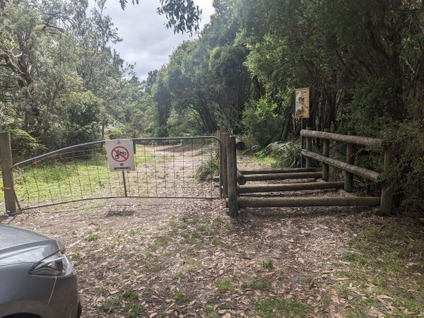
But then I realised that I had turned off the correct track, and turned back. I now saw that there was a gate between us and the geohash, so we'd have to walk about 400m. Even better! Now we'd get an actual walk, a great little distance for a warm up walk.
We got out, and I brought out my new sunbrella, since it was a sunny day, and I yearn to destroy the sun.
Walking
We stepped carefully over one of those barriers that lets horses cross but is difficult for trail bikes. A horse stile perhaps? Minnie asked me why it had railings along the side, and I couldn't actually think of an answer.
I showed her the geohashing app, and we counted down the distance. It was interesting to see that although she can read numbers, and understands numbers in the hundreds, she couldn't connect a series of digits like 385 into "three hundred and eighty five".
On the other hand, as usual, I was very impressed by her ability to understand maps. Ever since she was a bit less than 4 she's been interested to look at any mapping app and somehow intuitively grasped what it means - how the blue dot is where we are, and could see where we were trying to get to.
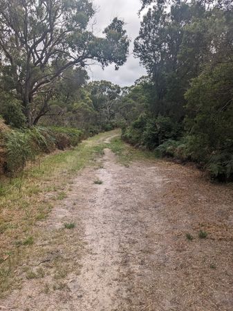
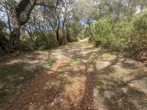
We paused every 50 meters or so to look at the app and see the number. There were ant holes everywhere! She asked me whether they were bullants, and whether "normal ants" are just baby ants that haven't grown up into bullants yet. I was pretty sure they weren't, but to be honest, there's an awful lot about ants I don't know. I was also very confused that there were so many ant holes, but we didn't see a single ant.
We met a walker coming the other way, with a pretty boisterous dog on a leash. I asked Minnie if she wanted to pat the dog, but she looked a bit intimidated. I think I would have been, too!
Once we got to 40 meters, we counted down every meter, until we were about 3 meters.
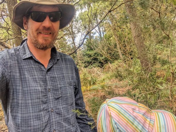
Minnie looked into the bush to the side of the track. "I think we have to go in there?"
I wasn't sure if she'd be keen on bush bashing, but for a 5 year old, it's actually much easier. She could walk straight under branches I had to push aside.
In a couple of steps, we found the place. She didn't seem at all disappointed there was no box, and asked what we do now. So we took some photos, and started back.
Going on
She asked which way the car was, and whether I was sure. Ok, so maybe the sense of direction isn't quite as strong as I thought.
Then we went off and did an amazing walk at Cape Shanck, and got some lunch, and went paddleboarding, and it was all quite marvellous, really.
At some point in the afternoon, I remembered that this was my 100th successful geohash! I'd been hoping for something a bit special to bring up the ton, but without even meaning to, I'd found everything I could have hoped for. Thanks for the adventure, Minnie!
Photos
Achievements
Stevage earned the Drag-along achievement
|


