Difference between revisions of "2024-03-17 55 -4"
m |
m |
||
| Line 26: | Line 26: | ||
== Photos == | == Photos == | ||
| − | + | <gallery> | |
| + | File:2024-03-17 55 -4 HalfProof1.jpeg | Closest I could get the circle to go | ||
| + | File:2024-03-17 55 -4 HalfProof2.jpeg | From further back | ||
| + | File:2024-03-17 55 -4 Bereal.jpeg | Bereal photo by the beach | ||
| + | File:2024-03-17 55 -4 B-side.jpeg | Other side of the Bereal | ||
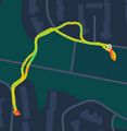
| + | File:2024-03-17 55 -4 Route.jpeg | Route taken to the point | ||
| + | </gallery> | ||
== Achievements == | == Achievements == | ||
Revision as of 21:35, 17 March 2024
| Sun 17 Mar 2024 in 55,-4: 55.6140593, -4.6268826 geohashing.info google osm bing/os kml crox |
Contents
Location
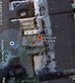
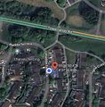
Outside of a house on Pladda Terrace, Irvine.
Participants
Plans
KerrMcF
I plan to go home after volunteering to prepare for this expedition before leaving to pick up Daniel and drive to Irvine. We'll park on a nearby street and walk to the point, then head back to the car. We might stay in Irvine for a while, but I'll drive Daniel back before driving home.
Expedition
KerrMcF
This was my first time driving the new car for a longer distance, as so far it had only been used for shorter journeys. I got home shortly after 2pm and changed before leaving at 2:40pm to pick up Daniel. I'd done this part of the drive before, so it wasn't anything new, and the car handled it very well. I picked up Daniel and we began the journey to Irvine.
Now, these roads I hadn't driven before, but it wasn't an issue. Google Maps helped a lot, and we parked nearby at around 3:45pm. I'd told Daniel about the nature of the point on the drive there, and he was a little wary. We wouldn't need to go into anyone's property, but hanging around outside of someone's front door is a slightly worrying thought. The walk to the point was short, and we did manage to reach it, but we had issues with the GPS.
Initially, from the pavement, the point was barely outside of our circle. We headed closer to the actual point, but our position moved further away. Presumably, the row of houses was messing with the GPS. I've taken a screenshot of the closest I was able to get the circle to be after realising that it wasn't picking our position up correctly.
We decided that as this was quite a short expedition we would drive to the nearby beach and hang out there for a while. We didn't take any photos at the point as one of the neighbours was watching us and we felt this would be quite suspicious, so I took my Bereal on a hill next to the beach. We wore green for our expedition as it was St. Patrick's Day and as such I was finally able to show support for the half-proposed holiday achievement after I failed to do so at 2024-02-20 56 -3. It began to rain lightly so we headed back to the car and drove back home.
I'm quite annoyed that the GPS wasn't working properly. We definitely reached the point, we had no reason not to do so, but it refused to show this on the map.
Photos
Achievements
KerrMcF and Daniel earned the Land geohash achievement
|
KerrMcF and Daniel earned the Holiday Achievement
|
Daniel earned the Two to the N achievement
|
Progress
| Council Area | Postcode | NUTS | Centicule | New Achievements |
|---|---|---|---|---|
| North Ayrshire | KA(11) | UKM93 | 66 | Holiday achievement |


