Difference between revisions of "User:Taner"
From Geohashing
imported>Taner m (fix) |
m (per Renaming Proposal) |
||
| (2 intermediate revisions by one other user not shown) | |||
| Line 12: | Line 12: | ||
[[Image:Arrow2.png|12px]] [[2011-07-01 -37 144]] - A plot of land in Little River<br/> | [[Image:Arrow2.png|12px]] [[2011-07-01 -37 144]] - A plot of land in Little River<br/> | ||
[[Image:Arrow2.png|12px]] [[2011-07-03 -38 144]] - 300 metres into the sea at Clifton Springs<br/> | [[Image:Arrow2.png|12px]] [[2011-07-03 -38 144]] - 300 metres into the sea at Clifton Springs<br/> | ||
| + | [[Image:Arrow2.png|12px]] [[2015-09-24 56 26]] - Forested area in Latvia<br/> | ||
== Geohash Achievements == | == Geohash Achievements == | ||
| Line 45: | Line 46: | ||
| graticule = Melbourne West, Australia | | graticule = Melbourne West, Australia | ||
| ranknumber = 1 | | ranknumber = 1 | ||
| − | | s=true }} | + | | s=true | name = Taner }} |
| + | {{Graticule unlocked | latitude = 56 | longitude = 26 | date = 2015-09-24 | name = Taner }} | ||
[[Category:Geohashers in -37,144]] | [[Category:Geohashers in -37,144]] | ||
[[Category:Geohashers in Australia]] | [[Category:Geohashers in Australia]] | ||
Latest revision as of 02:25, 20 March 2024
About Me

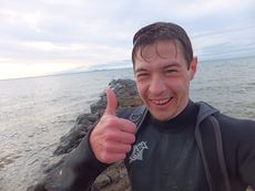
Taner at 2011-07-03 -38 144 geohash
One can never have enough hobbies, so I decided to try out geohashing after hearing about it from fellow Melbourne geohasher Felix Dance.
I don't know what I plan to do with this pursuit but after my first and very enjoyable expedition, I'm sure there will be more.
Expeditions
![]() 2011-06-29 -37 144 - A plot of land on Long Forest Rd
2011-06-29 -37 144 - A plot of land on Long Forest Rd
![]() 2011-07-01 -37 144 - A plot of land in Little River
2011-07-01 -37 144 - A plot of land in Little River
![]() 2011-07-03 -38 144 - 300 metres into the sea at Clifton Springs
2011-07-03 -38 144 - 300 metres into the sea at Clifton Springs
![]() 2015-09-24 56 26 - Forested area in Latvia
2015-09-24 56 26 - Forested area in Latvia
Geohash Achievements
Taner earned the Land geohash achievement
|
Taner earned the Bicycle geohash achievement
|
Taner earned the Midnight Geohash achievement
|
Taner earned the Camping geohash achievement
|
Taner earned the Drowned Rat Geohash Achievement
|
Taner earned the Water geohash achievement
|
Taner achieved level 1 of the Minesweeper Geohash achievement
|
Taner earned the Graticule Unlocked Achievement
|
Categories:
- Geohashers
- Geohashers in their 30s
- Geohashers in -37,144
- Land geohash achievement
- Bicycle geohash achievement
- Midnight geohash achievement
- Camping geohash achievement
- Drowned rat geohash achievement
- Water geohash achievement
- Pirates
- Minesweeper geohash achievement
- Graticule unlocked achievement
- Geohashers in Australia