Difference between revisions of "User:Kydlt"
imported>Kydlt |
m (per Renaming Proposal) |
||
| (37 intermediate revisions by 2 users not shown) | |||
| Line 46: | Line 46: | ||
There is a expedition page for this trip, with photos, that Jim put up. I am still working on the posting thing. I am sure that it isn't as hard as I am making it. | There is a expedition page for this trip, with photos, that Jim put up. I am still working on the posting thing. I am sure that it isn't as hard as I am making it. | ||
| − | {{ | + | {{Graticule unlocked |
| latitude = 45 | | latitude = 45 | ||
| longitude = -119 | | longitude = -119 | ||
| Line 138: | Line 138: | ||
[[2011-10-16 45 -122|'''2011-10-16''' '''45 -122''']] | [[2011-10-16 45 -122|'''2011-10-16''' '''45 -122''']] | ||
| − | Looks like a trip to the Washougal River today | + | Looks like a trip to the Washougal River today. It's one of those trips that make me wonder how up to date are the on-line aerial photos: Are there houses there now ? Is there water to cross or not ? But this is why one must take the trip. Made it, no problemo. |
| + | |||
| + | [[2011-10-21 38 -84|'''2011-10-21''' ''' 38 -84''']] | ||
| + | |||
| + | I think the fix is in for a puppet master hash back in the homeland. Sister Barb will be my marionette, taking a detour to pull off I-75 at the reststop outside Georgetown on her way home. It's just right there. | ||
| + | SHE MADE IT !! | ||
| + | |||
| + | [[2011-11-05 45 -121|'''2011-11-05''' ''' 45 -121''']] | ||
| + | |||
| + | Did a little quicky about 20 miles away, above Carson, below Stabler just off Wind River Rd. | ||
| + | |||
| + | [[2011-11-10 45 -121|'''2011-11-10''' '''45 -121''']] | ||
| + | |||
| + | Another Fail around Home Valley, WA. | ||
| + | |||
| + | [[2011-11-13 45 -122|'''2011-11-13''' '''45 -122''']] | ||
| + | |||
| + | Close to the children's house in SE Portland, biked to the hash with my grandson & granddaughter. Family fun !! | ||
| + | |||
| + | [[2012-01-02 33 -111|'''2012-01-02''' '''33 -111''']] | ||
| + | |||
| + | In AZ, took a chance to expand my geohash extent. | ||
| + | Made it ! | ||
| + | |||
| + | [[2012-01-07 45 -122|'''2012-01-07''' '''45 -122''']] | ||
| + | |||
| + | Down to Gresham, maybe meet Jim. | ||
| + | I got there just before 14:00, Jim just after. I forgot to take a photo of me. Then we had a beer at the brew pub in Gresham. A good day. | ||
| + | |||
| + | [[2012-01-10 45 -122|'''2012-01-10''' '''45 -122''']] | ||
| + | |||
| + | Looked easier than it was. | ||
| + | |||
| + | [[2012-01-26 44 -117|'''2012-01-26''' '''44 -117''']] | ||
| + | |||
| + | A lucky strike. We were driving to Boise and making good time in good weather. The hash was about 500 feet into a field and about 2 miles off the freeway. | ||
| + | |||
| + | {{Graticule unlocked | ||
| + | | latitude = 44 | ||
| + | | longitude = -117 | ||
| + | | date = 2012-01-26 | ||
| + | | name = [[User:Kydlt|Kydlt]] | ||
| + | }} | ||
| + | |||
| + | [[2012-01-30 45 -118|'''2012-01-30''' '''45 -118''']] | ||
| + | |||
| + | A 2nd lucky strike. We were driving home from Boise and making good time in good weather. The hash was about 1500 feet into a field and about 13 miles off the freeway. | ||
| + | |||
| + | {{Graticule unlocked | ||
| + | | latitude = 45 | ||
| + | | longitude = -118 | ||
| + | | date = 2012-01-30 | ||
| + | | name = [[User:Kydlt|Kydlt]] | ||
| + | }} | ||
| + | |||
| + | |||
| + | [[2012-02-07 45 -121|'''2012-02-07''' '''45 -121''']] | ||
| + | |||
| + | A drive-by, 8 miles from my home. | ||
| + | |||
| + | [[2012-02-20 45 -122|'''2012-02-20''' '''45 -122''']] | ||
| + | |||
| + | Another gimmy. Just off Powell Blvd on the track at a home for special children. I am on the ipad today, so I don't know how to do so many of the things that I have finally learned to do to post my results. My gps software with my DeLorme GPS doesn't work with this, and even posting photos is a challenge. | ||
| + | |||
| + | [[2012-04-07 43 -2|'''2012-04-07''' '''43 -2''']] | ||
| + | |||
| + | My first Spanish attempt ended 1 Km south of the target. | ||
| + | |||
| + | [[2012-04-10 42 -4|'''2012-04-10''' '''42 -4''']] | ||
| + | |||
| + | Palencia, Spain. My 1st in Europe, 1st with my son, & maybe a virgin. (the hash, not the son.) An adventure in a far away land. SUPRISE ! Spain is full of virgins. | ||
| + | |||
| + | {{Graticule unlocked | ||
| + | | latitude = 42 | ||
| + | | longitude = -4 | ||
| + | | date = 2012-04-10 | ||
| + | | name = [[User:Kydlt|Kydlt]] | ||
| + | }} | ||
| + | |||
| + | [[2012-04-19 37 -4|'''2012-04-19''' '''37 -4''']] | ||
| + | |||
| + | My 2nd in Europe, Cordoba, Spain graticle. My son finally got excited about being there. Spain has 2 fewer virgins. Please correct me if I'm wrong. | ||
| + | |||
| + | {{Graticule unlocked | ||
| + | | latitude = 37 | ||
| + | | longitude = -4 | ||
| + | | date = 2012-04-19 | ||
| + | | name = [[User:Kydlt|Kydlt]] | ||
| + | }} | ||
| + | |||
| + | [[2012-05-30 45 -121|'''2012-05-30''' '''45 -121''']] | ||
| + | [[2012-05-30 44 -117|'''2012-05-30''' '''44 -117''']] | ||
| + | |||
| + | An interesting geohash day. I barely missed, after a fashion, the Baker City, OR hash, and made The Dalles hash. More soon. | ||
| + | |||
| + | [[2012-06-10 46 -121|'''2012-06-10''' '''46 -121''']] | ||
| + | |||
| + | FAIL Hit the snowline before the hash. | ||
| + | |||
| + | [[2012-06-11 45 -121|'''2012-06-11''' '''45 -121''']] | ||
| + | |||
| + | FAIL Not enough time to do the hike, not enough road to do the drive. | ||
| + | |||
| + | [[2012-06-26 45 -122|'''2012-06-26''' '''45 -122''']] | ||
| + | |||
| + | A drive by in the middle of Burnside St. | ||
| + | |||
| + | [[2012-07-01 45 -121|'''2012-07-01''' '''45 -121''']] | ||
| + | |||
| + | Kate & I take a short walk north of Willard WA. | ||
| + | |||
| + | [[2012-07-04 45 -122|'''2012-07-04''' '''45 -122''']] | ||
| + | |||
| + | We didn't make it to the hash in the lake fed by both Oneonta and Horsetail Creeks, as the blackberries drew blood. | ||
| + | |||
| + | [[2012-07-06 45 -122|'''2012-07-06''' '''45 -122]] | ||
| + | |||
| + | A drive by in Vancouver, WA. | ||
| + | |||
| + | [[2012-08-18 40 -124|'''2012-08-18''' '''40 -124]] | ||
| + | |||
| + | A walk on the Eel River beach | ||
| + | |||
| + | {{Graticule unlocked | ||
| + | | latitude = 40 | ||
| + | | longitude = -124 | ||
| + | | date = 2012-08-18 | ||
| + | | name = [[User:Kydlt|Kydlt]] | ||
| + | }} | ||
| + | |||
| + | [[2012-08-23 42 -123|'''2012-08-23''' '''42 -123]] | ||
| + | |||
| + | A drive by in Kirby, OR. | ||
| + | |||
| + | [[2012-09-07 45 -121|'''2012-09-07''' '''45 -121]] | ||
| + | |||
| + | Just a mile from home, BUT | ||
| + | {{No trespassing | ||
| + | |||
| + | | latitude = 45 | ||
| + | | longitude = -121 | ||
| + | | date = 2012-09-07 | ||
| + | | name = kydlt | ||
| + | | distance = 300 ft | ||
| + | }} | ||
| + | Thanks Jiml for the corrections. I don't know what is more dangerous, my lack of wiki coding knowledge or my poor typing/proofreading skills. | ||
| + | |||
| + | [[2012-09-24 45 -122|'''2012-09-24''' '''45 -122]] | ||
| + | |||
| + | FAIL Too many thorns. | ||
| + | |||
| + | [[2012-10-04 45 -121|'''2012-10-04''' '''45 -121]] | ||
| + | |||
| + | FAIL I could have jumped there. That would have been my last hash. But I did get to hike up Bunker Hill, and it felt like an honest workout. | ||
Latest revision as of 02:55, 20 March 2024
Hello,
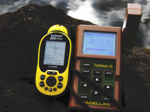
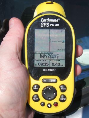
I am a newbie at geohashing, but have been using GPS since the mid 90's (Magellen Trailmate, pre XL).
Also I am new to the Columbia Gorge area, having lived in Humboldt the last 28 years.  So I have an
entire new wilderness to explore and what a better way to decide where to go.  And with grandchildren
in Portland I often find myself down there. Right now finding my way around this interface is more
challenging than being lost in the woods.
 See you there.
dennislee
My first geohash today. I was coming home to Stevenson, WA from Humboldt in NoCal and stopped outside Salem OR, in the bottom corner of the Portland graticule at 45.029225°, -122.973691. 1/2 way from the equator to the pole. When leaving my hotel this morning in Grants Pass I checked for spots along the way. This one was right off I-5. So a quick exit and a short walk on a muddy field, & there I was. Now all I have to do is learn how to post this info. There are some photos somewhere.
An almost hash. In The Dalles (Can we change this graticule name?) graticule @ 45.783529,-121.670077. Now where did I put that photo?
On the bikepath just North of PDX. Michael5000 left a note. I left too early to meet Jiml
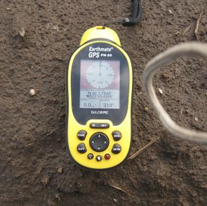
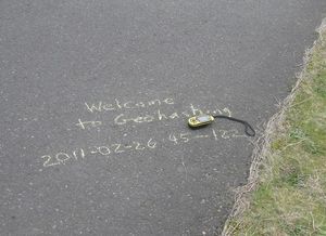
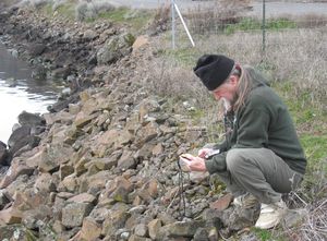
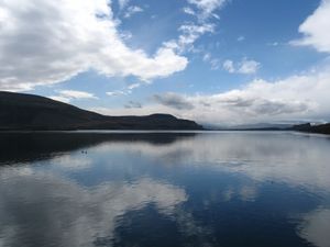
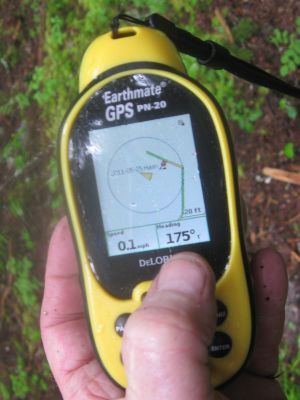
These pictures are of a hash achieved on March 2, 2011. Due to my lack of skill in posting they have shown up here. It was at 45°39.7231', -121°2.2802 but that was just south of where I am, i.e. out in the river. I need to learn how to group photos so they don't go down in a row.
Good drizzly morning. I found myself in Hermiston this morning so I think I will go on a little trip down to 45.596227°, -119.537443°.
MADE IT OK a pretty easy one to get to. Except for going up to a farm house to ask permission, and try to explain what the hell I was doing. I am terrified of that kind of thing. It seems to be a virgin graticule. After lunch I face more hard work : Wiki posting self-lessons.
YeeeeHah.
There is a expedition page for this trip, with photos, that Jim put up. I am still working on the posting thing. I am sure that it isn't as hard as I am making it.
Kydlt earned the Graticule Unlocked Achievement
|
The grandchildren are coming up today, so I might try a trip with the 6 yr old. Another "just a drive" trip, with just a few hundred feet of walking. Why don't these 'easy' ones happen on hookup Saturday ?. I am hoping to perhaps find some of the 45,-121 geoCASH folks will join in.
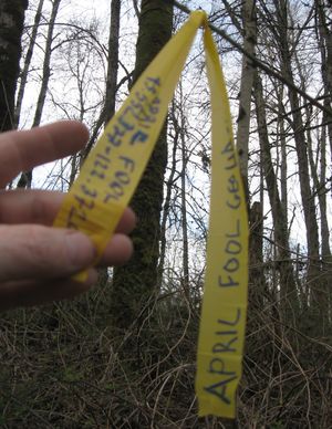
Being an April fool I jumped into the bushes at the Sandy River Delta park. I was kind of surprised that no one else was there as it is just east of Portland. The hash was only 250ish feet off either path, but it was right through the briars either way. A real post tonight or tomorrow or sometime.
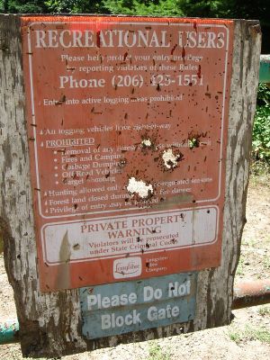
Near miss. Tried for the Moses Lake, Washington (47,-119) hash today. Missed by less than 1/4 mile, defeated by a no trespassing sign.
Made it to today's hash in 49,-119, Kelowna, British Columbia. My 1st international. But I have just arrived home now after driving south all day, so more later.
I am thinking of going out to today's 'The Dalles' hash. It is in a county park in the town of Hood River, about an hour and 1/2 East of Portland. Anybody want to meet me there ? It is still cool and damp in Stevenson so I am waiting for the afternoon to look at the weather. Even if I don't make the trip, I am practicing my Wiki editing, so at least there is that. MADE IT !
Another easy hash on the way home from the dentist. And as with most of them in 45 -121 it was a beautiful drive and a short wet walk.
Another easy fail. Foiled by leaving my NW wilderness parking permit in the other car.
Today's Portland Geohash looks like it's getting a visit. However, I have to use the right date when I code my page or I drive the wiki monitors crazy with my multiple edits. Sorry guys, I did read my preview but I didn't catch it until I had to figure out why it didn't link to the days page.
Made it before noon. Will probably go by again on my way home.
Today's hash was a 17 KM (each way) detour on my way home from the dentist, so I went for it. It was close to the road, but 5.5KM was gravel. Then a short walk up a logging road and just a little crosscountry. Saw Mt. Adams on the way up the White Salmon River, and Mt. Hood on the way down. Don't get much prettier.
Today it was a short drive and a walk up a logging rd, and only the tiniest bit of x-country. Right up Rock Creek, the creek that feeds Rock Cove, on the W side of Stevenson. And I found a waterfall to set under.
I'm heading into Portland today, and the hash is in an undeveloped lot just South of IKEA. See ya there, maybe. kydlt
My plan is going to the Skamania Elementry School ballfield's deep center field. I'm running out of time, so I'll fix up the page later. If I don't go there on the way to my granddaughter's b'day I will on the way home. kydlt
2nd try on way home was better. I got within 25 ft or so. Still outside the gate, but in left field where the hash really was.
Today looks like a fun one. Right up near Panther Creek Falls, but in the next drainage over, the S. Fork of Mouse Creek. If any of you Portland folks come out I'll buy you a beer @ Walking Man in Stevenson. (limit 4, the acct dept made me put that in here.)
I wonder if this will ever happen again: You go right past my place on the way to this hash. So I guess I will run on up the hill. I wasn't going to go out today, but it's only 6 miles. But I never made it. About 2 hrs to go up that less than 6 miles, and stopped by terrain and weather 1/4 mile from hash.
This one should be easy. At the East end of Cascade Locks, on the RR tracks by the Bear M. pellet factory driveway. Let's see how bad it really is. My trackrecord hasn't been so good lately.
Screwed my posting up. But I got close enough for the guys working in the orchard to tell me to go away. Now I have to go be a granddad, I'll fix it later (unless one of my guardian angels do it 1st.) Now it's latter, and the page looks better. Zzzzzz
Looks like a trip to the Washougal River today. It's one of those trips that make me wonder how up to date are the on-line aerial photos: Are there houses there now ? Is there water to cross or not ? But this is why one must take the trip. Made it, no problemo.
I think the fix is in for a puppet master hash back in the homeland. Sister Barb will be my marionette, taking a detour to pull off I-75 at the reststop outside Georgetown on her way home. It's just right there. SHE MADE IT !!
Did a little quicky about 20 miles away, above Carson, below Stabler just off Wind River Rd.
Another Fail around Home Valley, WA.
Close to the children's house in SE Portland, biked to the hash with my grandson & granddaughter. Family fun !!
In AZ, took a chance to expand my geohash extent. Made it !
Down to Gresham, maybe meet Jim. I got there just before 14:00, Jim just after. I forgot to take a photo of me. Then we had a beer at the brew pub in Gresham. A good day.
Looked easier than it was.
A lucky strike. We were driving to Boise and making good time in good weather. The hash was about 500 feet into a field and about 2 miles off the freeway.
Kydlt earned the Graticule Unlocked Achievement
|
A 2nd lucky strike. We were driving home from Boise and making good time in good weather. The hash was about 1500 feet into a field and about 13 miles off the freeway.
Kydlt earned the Graticule Unlocked Achievement
|
A drive-by, 8 miles from my home.
Another gimmy. Just off Powell Blvd on the track at a home for special children. I am on the ipad today, so I don't know how to do so many of the things that I have finally learned to do to post my results. My gps software with my DeLorme GPS doesn't work with this, and even posting photos is a challenge.
My first Spanish attempt ended 1 Km south of the target.
Palencia, Spain. My 1st in Europe, 1st with my son, & maybe a virgin. (the hash, not the son.) An adventure in a far away land. SUPRISE ! Spain is full of virgins.
Kydlt earned the Graticule Unlocked Achievement
|
My 2nd in Europe, Cordoba, Spain graticle. My son finally got excited about being there. Spain has 2 fewer virgins. Please correct me if I'm wrong.
Kydlt earned the Graticule Unlocked Achievement
|
2012-05-30 45 -121 2012-05-30 44 -117
An interesting geohash day. I barely missed, after a fashion, the Baker City, OR hash, and made The Dalles hash. More soon.
FAIL Hit the snowline before the hash.
FAIL Not enough time to do the hike, not enough road to do the drive.
A drive by in the middle of Burnside St.
Kate & I take a short walk north of Willard WA.
We didn't make it to the hash in the lake fed by both Oneonta and Horsetail Creeks, as the blackberries drew blood.
A drive by in Vancouver, WA.
A walk on the Eel River beach
Kydlt earned the Graticule Unlocked Achievement
|
A drive by in Kirby, OR.
Just a mile from home, BUT
kydlt earned the No trespassing consolation prize
|
Thanks Jiml for the corrections. I don't know what is more dangerous, my lack of wiki coding knowledge or my poor typing/proofreading skills.
FAIL Too many thorns.
FAIL I could have jumped there. That would have been my last hash. But I did get to hike up Bunker Hill, and it felt like an honest workout.
