Difference between revisions of "2023-10-14 42 -119"
Michael5000 (talk | contribs) (Created page with "{{subst:Expedition}}") |
m (per Renaming Proposal) |
||
| (8 intermediate revisions by 2 users not shown) | |||
| Line 13: | Line 13: | ||
}}<!-- edit as necessary --> | }}<!-- edit as necessary --> | ||
== Location == | == Location == | ||
| − | + | Off of Hogback Road, north of Plush. | |
== Participants == | == Participants == | ||
| − | + | [[User:Michael5000|Michael5000]] | |
| − | |||
| − | == | + | == Expedition == |
| − | + | From [[2023-10-14 41 -117]], my long two-day drive continued on Nevada Highway 140 until it became Oregon Highway 140. Eventually, I reached the Adel locality, where I turned and headed towards Plush on one of the relatively few Oregon roads I had never been on before. | |
| − | + | My only real association with Plush has been the Plush graticule. Until this expedition, Plush has been the last major Oregon graticule (outside the ones shared with Idaho on the eastern border) that hasn't been hashed. But, it turns out that Plush itself is an unspeakably remote but surprisingly viable little village, with an operating general store and children hanging out on the tiny tiny main street on a warm fall evening. The official population is 39 but it seemed, heck, TWICE that size. I was kind of charmed. | |
| − | + | ||
| + | Continuing north, the road turned to gravel and wound through the sagebrush until it got to the particular area of sagebrush I was interested im. I unpacked the bike and cycled a mile in down some tumbleweed-strewn ruts. Then, shinnying under some unposted fencelines (which is perfectly legal and customary in open range country) I tromped another half mile or so to the particular procedurally generated point which was the day's hashpoint in the Plush graticule. Why? We do what we must, because we can. After enjoying the moment, I hiked out, cycled back to the vehicle, and spent ten minutes pulling tumbleweed out of my bicycle gears and sharp seeds out of my shoes and socks. | ||
| − | + | You know it has been a long drive when you arrive in Burns, Oregon, and it seems too busy and urban to deal with. But after two days on the road, it was definitely nice to see a bed. | |
| − | |||
== Photos == | == Photos == | ||
| − | |||
| − | |||
| − | |||
<gallery perrow="5"> | <gallery perrow="5"> | ||
| + | File:2023-10-14 42 -119 a.jpg|On the other side of the cattle guard, there are a pair of ruts... | ||
| + | File:2023-10-14 42 -119 b.jpg|Leaving behind the bicycle... | ||
| + | File:2023-10-14 42 -119 c.jpg|View southwest | ||
| + | File:2023-10-14 42 -119 d.jpg|View northeast | ||
| + | File:2023-10-14 42 -119 e.jpg|Michael5000, Conqueror of the Plush Graticule | ||
| + | File:2023-10-14 42 -119 f.jpg|His trusty ursine hashcot | ||
| + | File:2023-10-14 42 -119 g.jpg|Strangely, I was the only one there | ||
</gallery> | </gallery> | ||
== Achievements == | == Achievements == | ||
{{#vardefine:ribbonwidth|100%}} | {{#vardefine:ribbonwidth|100%}} | ||
| − | + | {{Graticule unlocked | |
| − | + | | latitude = 42 | |
| − | + | | longitude = -119 | |
| − | + | | date = 2023-10-14 | |
| − | + | | name = Michael5000 | |
| + | |||
| + | }} | ||
| + | {{Multihash2 | ||
| − | + | | date = 2023-10-14 | |
| + | | count = 3 | ||
| + | | name = Michael5000 | ||
| + | }} | ||
| + | |||
| + | |||
| + | {{Minesweeper geohash | ||
| + | | graticule = [[Plush, Oregon]] | ||
| + | | ranknumber = 5 | ||
| + | | n = true | ||
| + | | ne = true if graticule to the northeast has been hashed (optional) | ||
| + | | w = true | ||
| + | | e = true | ||
| + | | nw = true if graticule to the northwest has been hashed (optional) | ||
| + | | name = [[User:Michael5000|Michael5000]] | ||
| + | }} | ||
| − | |||
| − | |||
| − | |||
| − | |||
| − | + | {{Minesweeper geohash | |
| + | | graticule = [[Hampton, Oregon]] | ||
| + | | ranknumber = 7 | ||
| + | | n = true | ||
| + | | w = true | ||
| + | | e = true | ||
| + | | nw = true if graticule to the northwest has been hashed (optional) | ||
| + | | sw = true | ||
| + | | s = true | ||
| + | | se = true | ||
| + | | name = [[User:Michael5000|Michael5000]] | ||
| + | }} | ||
| + | {{Minesweeper geohash | ||
| + | | graticule = [[Hines, Oregon]] | ||
| + | | ranknumber = 7 | ||
| + | | ne = true | ||
| + | | w = true | ||
| + | | e = true | ||
| + | | nw = true if graticule to the northwest has been hashed (optional) | ||
| + | | sw = true | ||
| + | | s = true | ||
| + | | se = true | ||
| + | | name = [[User:Michael5000|Michael5000]] | ||
| + | }} | ||
| + | {{Minesweeper geohash | ||
| + | | graticule = [[Buchanan, Oregon]] | ||
| + | | ranknumber = 6 | ||
| + | | n = true | ||
| + | | w = true | ||
| + | | e = true | ||
| + | | sw = true | ||
| + | | s = true | ||
| + | | se = true | ||
| + | | name = [[User:Michael5000|Michael5000]] | ||
| + | }} | ||
| + | {{Minesweeper geohash | ||
| + | | graticule = [[Lakeview, Oregon]] | ||
| + | | ranknumber = 5 | ||
| + | | n = true | ||
| + | | ne = true if graticule to the northeast has been hashed (optional) | ||
| + | | w = true | ||
| + | | e = true | ||
| + | | nw = true if graticule to the northwest has been hashed (optional) | ||
| + | | name = [[User:Michael5000|Michael5000]] | ||
| + | }} | ||
| + | {{Minesweeper geohash | ||
| + | | graticule = [[Fields, Oregon]] | ||
| + | | ranknumber = 5 | ||
| + | | n = true | ||
| + | | ne = true if graticule to the northeast has been hashed (optional) | ||
| + | | w = true | ||
| + | | e = true | ||
| + | | nw = true if graticule to the northwest has been hashed (optional) | ||
| + | | name = [[User:Michael5000|Michael5000]] | ||
| + | }} | ||
| + | __NOTOC__ | ||
| − | |||
[[Category:Expeditions]] | [[Category:Expeditions]] | ||
| − | |||
[[Category:Expeditions with photos]] | [[Category:Expeditions with photos]] | ||
| − | |||
| − | |||
| − | |||
| − | |||
| − | |||
[[Category:Coordinates reached]] | [[Category:Coordinates reached]] | ||
| − | + | {{location|US|OR|LK}} | |
| − | |||
| − | |||
| − | |||
| − | |||
| − | |||
| − | |||
| − | |||
| − | |||
| − | |||
| − | |||
| − | |||
| − | |||
| − | |||
| − | |||
| − | |||
| − | |||
| − | |||
Latest revision as of 04:38, 20 March 2024
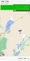
| Sat 14 Oct 2023 in 42,-119: 42.5873906, -119.9453599 geohashing.info google osm bing/os kml crox |
Location
Off of Hogback Road, north of Plush.
Participants
Expedition
From 2023-10-14 41 -117, my long two-day drive continued on Nevada Highway 140 until it became Oregon Highway 140. Eventually, I reached the Adel locality, where I turned and headed towards Plush on one of the relatively few Oregon roads I had never been on before.
My only real association with Plush has been the Plush graticule. Until this expedition, Plush has been the last major Oregon graticule (outside the ones shared with Idaho on the eastern border) that hasn't been hashed. But, it turns out that Plush itself is an unspeakably remote but surprisingly viable little village, with an operating general store and children hanging out on the tiny tiny main street on a warm fall evening. The official population is 39 but it seemed, heck, TWICE that size. I was kind of charmed.
Continuing north, the road turned to gravel and wound through the sagebrush until it got to the particular area of sagebrush I was interested im. I unpacked the bike and cycled a mile in down some tumbleweed-strewn ruts. Then, shinnying under some unposted fencelines (which is perfectly legal and customary in open range country) I tromped another half mile or so to the particular procedurally generated point which was the day's hashpoint in the Plush graticule. Why? We do what we must, because we can. After enjoying the moment, I hiked out, cycled back to the vehicle, and spent ten minutes pulling tumbleweed out of my bicycle gears and sharp seeds out of my shoes and socks.
You know it has been a long drive when you arrive in Burns, Oregon, and it seems too busy and urban to deal with. But after two days on the road, it was definitely nice to see a bed.
Photos
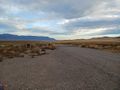
On the other side of the cattle guard, there are a pair of ruts...
Leaving behind the bicycle...
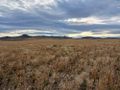
View southwest
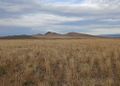
View northeast

Michael5000, Conqueror of the Plush Graticule
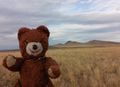
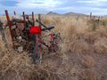
His trusty ursine hashcot
Strangely, I was the only one there


Achievements
Michael5000 earned the Graticule Unlocked Achievement
|
Michael5000 earned the Multihash Achievement
|
Michael5000 achieved level 5 of the Minesweeper Geohash achievement
|
Michael5000 achieved level 7 of the Minesweeper Geohash achievement
|
Michael5000 achieved level 7 of the Minesweeper Geohash achievement
|
Michael5000 achieved level 6 of the Minesweeper Geohash achievement
|
Michael5000 achieved level 5 of the Minesweeper Geohash achievement
|
Michael5000 achieved level 5 of the Minesweeper Geohash achievement
|