Difference between revisions of "2012-06-04 35 135"
imported>TdL |
m (per Renaming Proposal) |
||
| (12 intermediate revisions by 2 users not shown) | |||
| Line 14: | Line 14: | ||
== Expedition== | == Expedition== | ||
| − | + | killing two birds with one stone: today's hashpoint on the way to kyoto university. no GPS device available (like last time) so i orient myself by the google maps screenshot i memorized. easy though thanks to the fact that kyoto is organized like a chessboard and that i cycle the first 80% almost every day anyway. | |
| + | so i arrive there, and as suspected, the hashpoint lies on private property. no problem though: i accidentally run into yamazaki-san, a lovely 87 year old brisk lively woman, who (after i try to explain geohashing with my fucked up japanese) gladly shows me around on the first floor. keeps mentioning the war though. | ||
| + | however, now i'm here, so i might as well grab myself a drink and check out the temple complex nearby. happy :-) | ||
== Photos == | == Photos == | ||
<Gallery> | <Gallery> | ||
| − | File:2012- | + | File:2012-06-04_35_135-kamo.JPG|kamo river |
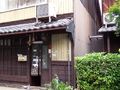
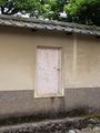
| − | File:2012- | + | File:2012-06-04_35_135-hashpoint street.JPG|view from the street towards the hashpoint |
| − | File:2012- | + | File:2012-06-04_35_135-children.jpg|children's drawings |
| − | File:2012- | + | File:2012-06-04_35_135-yamazaki-san.JPG|owner of the hashpoint - ms. yamazaki |
| − | File:2012- | + | File:2012-06-04_35_135-hashpoint.JPG|hashpoint |
| − | File:2012- | + | File:2012-06-04_35_135-temple.JPG|temple |
| − | File:2012- | + | File:2012-06-04_35_135-way.JPG|same temple |
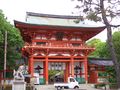
| − | File:2012- | + | File:2012-06-04_35_135-gate.JPG|hell of a gate |
| − | File:2012- | + | File:2012-06-04_35_135-stilbruch.JPG|break in style |
| − | File:2012- | + | File:2012-06-04_35_135-forest.jpg|bamboo forest |
| − | File:2012- | + | File:2012-06-04_35_135-temple3.JPG|more temples |
| − | File:2012- | + | File:2012-06-04_35_135-squishy.JPG|squishy |
| − | File:2012- | + | File:2012-06-04_35_135-7eleven.JPG|7-eleven |
| − | File:2012- | + | File:2012-06-04_35_135-7elevenmap.jpg|7-eleven map |
| − | File:2012- | + | File:2012-06-04_35_135-soccer.JPG|football game |
| − | File:2012- | + | File:2012-06-04_35_135-daimonji.JPG|大文字 |
| − | File:2012- | + | File:2012-06-04_35_135-google map.jpg|google map |
</Gallery> | </Gallery> | ||
== Achievements == | == Achievements == | ||
| − | {{ | + | {{Graticule unlocked |
| latitude = 35 | | latitude = 35 | ||
| Line 95: | Line 97: | ||
[[Category:Coordinates reached]] | [[Category:Coordinates reached]] | ||
[[Category:Expeditions with photos]] | [[Category:Expeditions with photos]] | ||
| + | {{location|JP|26}} | ||
Latest revision as of 05:37, 20 March 2024
| Mon 4 Jun 2012 in 35,135: 35.0458348, 135.7443343 geohashing.info google osm bing/os kml crox |
Location
shichiku seinancho in kamigyo ward, kyoto, kyoto prefecture, JAPAN
Participants
Expedition
killing two birds with one stone: today's hashpoint on the way to kyoto university. no GPS device available (like last time) so i orient myself by the google maps screenshot i memorized. easy though thanks to the fact that kyoto is organized like a chessboard and that i cycle the first 80% almost every day anyway. so i arrive there, and as suspected, the hashpoint lies on private property. no problem though: i accidentally run into yamazaki-san, a lovely 87 year old brisk lively woman, who (after i try to explain geohashing with my fucked up japanese) gladly shows me around on the first floor. keeps mentioning the war though. however, now i'm here, so i might as well grab myself a drink and check out the temple complex nearby. happy :-)
Photos
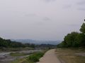
kamo river
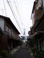
view from the street towards the hashpoint
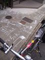
children's drawings
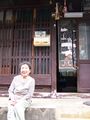
owner of the hashpoint - ms. yamazaki
hashpoint
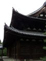
temple
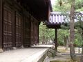
same temple
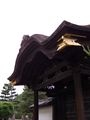
hell of a gate
break in style
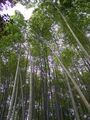
bamboo forest
more temples
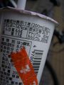
squishy
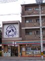
7-eleven
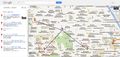
7-eleven map
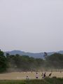
football game
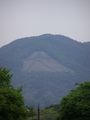
大文字
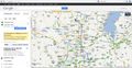
google map


Achievements
TdL earned the Graticule Unlocked Achievement
|
TdL earned the First Sip GeoSquishy Achievement
|
TdL earned the Ambassador achievement
|
TdL earned the No Batteries Geohash Achievement
|
TdL earned the Bicycle geohash achievement
|