Difference between revisions of "2011-09-05 53 -3"
From Geohashing
imported>Benjw (everything but the expedition report) |
m (per Renaming Proposal) |
||
| (2 intermediate revisions by 2 users not shown) | |||
| Line 40: | Line 40: | ||
| image = 2011-09-05 53 -3 panorama.jpg | | image = 2011-09-05 53 -3 panorama.jpg | ||
}} | }} | ||
| − | {{ | + | {{graticule unlocked |
| latitude = 53 | | latitude = 53 | ||
| longitude = -3 | | longitude = -3 | ||
| Line 51: | Line 51: | ||
[[Category:Expeditions with photos]] | [[Category:Expeditions with photos]] | ||
[[Category:Coordinates reached]] | [[Category:Coordinates reached]] | ||
| + | {{location|GB|CYM|CWY}} | ||
Latest revision as of 05:50, 20 March 2024

| Mon 5 Sep 2011 in Blackpool, UK: 53.1434668, -3.6587305 geohashing.info google osm bing/os kml crox |
Location
In a field east of Gwytherin, North Wales. The OS map shows a footpath running through the field, so the point itself is probably quite easily accessible.
Participants
Expedition
Photos
I walked over plenty of fields
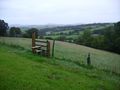
I climbed over plenty of stiles
I scared away plenty of sheep
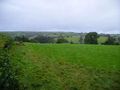
But the views were nice
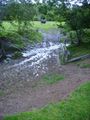
I crossed a stream, not realising I didn't have to
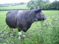
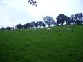
There were cows on the other side
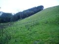
The hashpoint was up quite a steep hill
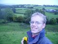
Happy - and a bit damp
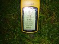
Proof that I made it (and that my GPS is waterproof)
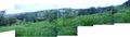
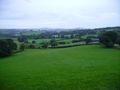
The view from the hashpoint


Achievements
Benjw earned the Land geohash achievement
|
Benjw earned the Graticule Unlocked Achievement
|