Difference between revisions of "2020-07-25 -37 145"
m (subst-ing) |
|||
| (4 intermediate revisions by 2 users not shown) | |||
| Line 10: | Line 10: | ||
--> | --> | ||
{{meetup graticule | {{meetup graticule | ||
| − | | lat= | + | | lat=-37 |
| − | | lon= | + | | lon=145 |
| − | | date= | + | | date=2020-07-25 |
}}<!-- edit as necessary --> | }}<!-- edit as necessary --> | ||
__NOTOC__ | __NOTOC__ | ||
== Location == | == Location == | ||
| − | + | Between two football ovals in Bulleen Park. | |
== Participants == | == Participants == | ||
| − | + | [[User:Stevage|Steve]]. | |
| − | + | == Expedition == | |
| + | I was already planning on doing a bike ride on some trails out this way. Melbourne is in lockdown so you're not supposed to go too far from home. This geohash was only 8km from my house, so pretty good luck! | ||
| + | |||
| + | I extended a route given to me by a friend, including lots of muddy mountain bike trails. Lots of people wearing masks (pretty new around here), including one lady walking holding one in her hand, who quickly put it up to her face as I approached. | ||
| + | |||
| + | The point itself was trivial to reach, you could ride right up to it. (Sadly, I couldn't remember which side of a low fence it was on, and guessed wrong, so I had to walk the last couple of metres). | ||
| − | + | Once I got there I realised just what a beautiful day it was, and wandered around in the sun a little bit. | |
| − | |||
| − | + | Soon, I saw a young man heading towards the hash, staring intently at his phone. Could be another hasher? Sadly, no, it looks like he was just picking some music, and then heading off for some jogging. | |
| − | |||
== Tracklog == | == Tracklog == | ||
| Line 40: | Line 43: | ||
== Achievements == | == Achievements == | ||
{{#vardefine:ribbonwidth|800px}} | {{#vardefine:ribbonwidth|800px}} | ||
| − | + | {{bicycle geohash | |
| − | + | | latitude=-37 | |
| − | + | | longitude=145 | |
| − | + | | date=2020-07-25 | |
| − | + | | name=Steve | |
| − | + | }} | |
| − | |||
| − | |||
| − | |||
| − | |||
| − | |||
| − | |||
| − | |||
| − | |||
| − | |||
[[Category:Expeditions]] | [[Category:Expeditions]] | ||
| − | |||
[[Category:Expeditions with photos]] | [[Category:Expeditions with photos]] | ||
| − | |||
| − | |||
| − | |||
| − | |||
[[Category:Coordinates reached]] | [[Category:Coordinates reached]] | ||
| − | + | {{location|AU|VIC|MN}} | |
| − | |||
| − | |||
| − | |||
| − | |||
| − | |||
| − | |||
| − | |||
| − | |||
| − | |||
| − | |||
| − | |||
| − | |||
| − | |||
| − | |||
| − | |||
| − | |||
| − | |||
Latest revision as of 20:19, 24 May 2024
| Sat 25 Jul 2020 in -37,145: -37.7735488, 145.0730584 geohashing.info google osm bing/os kml crox |
Location
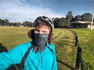
Between two football ovals in Bulleen Park.
Participants
Expedition
I was already planning on doing a bike ride on some trails out this way. Melbourne is in lockdown so you're not supposed to go too far from home. This geohash was only 8km from my house, so pretty good luck!
I extended a route given to me by a friend, including lots of muddy mountain bike trails. Lots of people wearing masks (pretty new around here), including one lady walking holding one in her hand, who quickly put it up to her face as I approached.
The point itself was trivial to reach, you could ride right up to it. (Sadly, I couldn't remember which side of a low fence it was on, and guessed wrong, so I had to walk the last couple of metres).
Once I got there I realised just what a beautiful day it was, and wandered around in the sun a little bit.
Soon, I saw a young man heading towards the hash, staring intently at his phone. Could be another hasher? Sadly, no, it looks like he was just picking some music, and then heading off for some jogging.
Tracklog
Photos
Achievements
Steve earned the Bicycle geohash achievement
|
