Difference between revisions of "2024-01-24 -37 144"
Felix Dance (talk | contribs) (An expedition message sent via Geohash Droid for Android.) |
(→Achievements) |
||
| (34 intermediate revisions by 6 users not shown) | |||
| Line 1: | Line 1: | ||
| − | + | [[Image:{{{image|PXL_20240124_075220022.jpg}}}|thumb|left]] | |
| − | + | {{meetup graticule | |
| − | |||
| − | |||
| − | |||
| − | |||
| − | |||
| − | |||
| lat=-37 | | lat=-37 | ||
| lon=144 | | lon=144 | ||
| date=2024-01-24 | | date=2024-01-24 | ||
| − | }} | + | }} |
== Location == | == Location == | ||
| − | + | This Geohash is located on a football oval in Essendon. | |
== Participants == | == Participants == | ||
| − | + | Expedition 1: | |
| − | -- | + | |
| + | * [[User:Felix Dance|Felix Dance]] | ||
| + | * [[user:james_c|James C]] | ||
| + | * [[User:Gretel|Gretel]] | ||
| + | |||
| + | Expedition 2: | ||
| + | |||
| + | * [[User:Johnwrw|John]] | ||
| + | |||
| + | Expedition 3: | ||
| + | |||
| + | * [[User:Stevage|Steve]] | ||
| + | * [[User:Lachie|Lachie]] | ||
| + | * [[User:EdBordin|Ed]] | ||
| + | * [[User:BarbaraTables|BarbaraTables]] | ||
| + | * [[User:pwc|Patrick]] | ||
| + | |||
| + | == Expeditions == | ||
| + | |||
| + | === Expedition 1 (Felix, James and Gretel) === | ||
| + | I got Gretel out of her first day of childcare in the afternoon, gave her a big, long sleep at home, then got her up just after 3pm for the geohash. We went on our brand new electric cargo bike, a Benno Boost EV4. | ||
| + | |||
| + | We zoomed off from home with the intention of meeting James on Albion St, but, sadly, my poor communication meant that he was only leaving his home when Gretel and I had reached the meetup location, so we left him to catch up - an activity James described as 'Geohash Pursuit'. | ||
| + | |||
| + | [[Image:2024-01-24_-37_144_Felix Dance_1706089829370.jpg|To the hash!|800px]] | ||
| + | |||
| + | It was very easy riding through the north-west suburbs. Gretel enjoyed the cooling temperature and the breeze on her face. We soon got to the oval and circled the hash, stopping at the location and cracking some tinnies James had brought. | ||
| + | |||
| + | [[Image:2024-01-24_-37_144_Felix Dance_1706089841731.jpg|Hash beers|800px]] | ||
| − | + | We left the hash and parted ways, but not before giving Gretel a congratulatory swing at the nearly co-located playground. An excellent hash, enjoyed by all. | |
| − | |||
| − | == | + | <gallery heights="300px" mode="packed"> |
| − | + | Image:2024-01-24_-37_144_Felix Dance_1706089856407.jpg|Gretel and Felix | |
| − | + | Image:2024-01-24_-37_144_Felix Dance_1706089876953.jpg|The hash from above | |
| − | |||
| − | + | Image:2024-01-24_-37_144_Felix Dance_1706089902782.jpg|Post-hash swing | |
| − | + | ||
| − | Image: | + | Image:2024-01-24_-37_144_Felix Dance_1706090115917.jpg|GPS proof |
| − | |||
| − | |||
</gallery> | </gallery> | ||
| + | |||
| + | ==== Tracklog ==== | ||
| + | |||
| + | {{ Tracklog | Geohash 2024-01-24 -37 144 Tracklog.gpx }} | ||
| + | |||
| + | === Expedition 2 (John) === | ||
| + | John is said to have run eight times around the hash as part of his hash-running. | ||
| + | |||
| + | [[Image:2024-01-24_-37_144_Felix Dance_1706091789286.jpg|John at the hash|800px]] | ||
| + | |||
| + | === Expedition 3 (Steve etc) === | ||
| + | |||
| + | Early this morning, I woke up and, like the mobile phone addicted person I am, grabbed for the phone to see what, if anything, exciting had happened over night. Well, on the Geohashing Discord, excitement had reigned in the form of a brand new Melburnian geohasher on the scene, who had burst in with enthusiastic questions galore, moments before today's coordinates were announced. | ||
| + | |||
| + | What luck for them that said coordinates were emminently achievable - on a football oval in Essendon, an inner northwest suburb of Melbourne. | ||
| + | |||
| + | What luck for me that after 15 years of geohashing, the stated promise of geohashing - meeting random strangers at random coordinates - might actually, for the first time, be fulfilled. | ||
| + | |||
| + | Lachie and Ed started an expedition plan that would see us get to the point at some time after 6pm. The random stranger - welcome, BarbaraTables! - was aiming for similar. The odds were looking good. | ||
| + | |||
| + | In my micro planning, I discovered that Hope St continues west through Brunswick much further than I'd imagined, and has its own cute little bridge over Citylink. I reached the rendezvous at rendezvous o'clock, and met Patrick for the first time. This geohash was truly over-delivering on the meeting fellow geohashers front! | ||
| + | |||
| + | Lachie arrived shortly after, while Ed did not. This gave us the chance to witness a car committing three traffic offences simultaneously: speeding, overtaking through double white lines, while looking at his phone. | ||
| + | |||
| + | Soon Lachie led the procession northwest, picking a flattish route through a hilly suburb, on account of his bike having 25 fewer gear combinations than mine. | ||
| + | |||
| + | We reached the point without difficulty and Lachie manifested a picnic, near to where a family was playing catch. They got the hint and shifted their game over a bit. | ||
| + | |||
| + | There were beers, there were chips, there was a picnic blanket. Hopefully sufficient for a picnic achievement. | ||
| + | |||
| + | Moments later, the eaglerly awaited Mx Tables arrived and there began a long discussion of all things geohashy, computer gamey, xkcdish and...well, really, those three topics covered most of it. | ||
| + | |||
| + | |||
| + | [[File:PXL_20240124_075220022.jpg|800px]] | ||
| + | |||
| + | |||
| + | Eventually the balmy evening turned a shade less balmy, and our fivesome disintegrated. Somehow I became expedition leader for the return trip for Patrick and Ed, which I delegated to Google. Further subdivisions took place until this member arrived home and started writing this report up. | ||
| + | |||
== Achievements == | == Achievements == | ||
{{#vardefine:ribbonwidth|100%}} | {{#vardefine:ribbonwidth|100%}} | ||
| − | |||
| − | + | {{Picnic|date=2024-01-24|latitude=-37|longitude=144|name=[[User:Stevage|Steve]], [[User:Lachie|Lachie]], [[User:EdBordin|Ed]], [[User:BarbaraTables|BarbaraTables]] and [[User:pwc|Patrick]]}} | |
| − | + | ||
| − | + | {{Meet-up | |
| − | [[ | + | |
| + | | latitude = -37 | ||
| + | | longitude = 144 | ||
| + | | date = 2024-01-24 | ||
| + | | name = [[User:Stevage|Steve]], [[User:Lachie|Lachie]], [[User:EdBordin|Ed]], [[User:BarbaraTables|BarbaraTables]] and [[User:pwc|Patrick]] | ||
| + | |||
| + | }} | ||
| + | |||
| + | {{land geohash | ||
| + | |||
| + | | latitude = -37 | ||
| + | | longitude = 144 | ||
| + | | date = 2024-01-24 | ||
| + | | name = [[User:Stevage|Steve]], [[User:Lachie|Lachie]], [[User:EdBordin|Ed]], [[User:BarbaraTables|BarbaraTables]] and [[User:pwc|Patrick]] | ||
| − | + | }} | |
| − | + | {{Public transport geohash | |
| − | |||
| − | |||
| − | |||
| − | + | | latitude = -37 | |
| + | | longitude = 144 | ||
| + | | date = 2024-01-24 | ||
| + | | busline = Tram Route 59 | ||
| + | | name = [[User:BarbaraTables|BarbaraTables]] | ||
| − | + | }} | |
| − | |||
| − | |||
| − | |||
| − | |||
| − | |||
| − | |||
| − | |||
| − | |||
| − | |||
| + | {{Two to the N achievement | ||
| − | -- | + | | count = 0 |
| − | + | | date = 2024-01-24 | |
| − | - | + | | latitude = -37 |
| − | + | | longitude = 144 | |
| − | [[ | + | | name = [[User:BarbaraTables|BarbaraTables]] |
| − | + | | reached = true | |
| − | |||
| − | |||
| − | + | }} | |
| − | |||
| − | |||
| − | |||
| − | |||
| − | + | __NOTOC__ | |
| + | [[Category:Expeditions]] | ||
| + | [[Category:Expeditions with photos]] | ||
| + | [[Category:Coordinates reached]] | ||
| + | {{location|AU|VIC|MV}} | ||
Latest revision as of 05:19, 16 June 2024
| Wed 24 Jan 2024 in -37,144: -37.7451619, 144.8972474 geohashing.info google osm bing/os kml crox |
Location
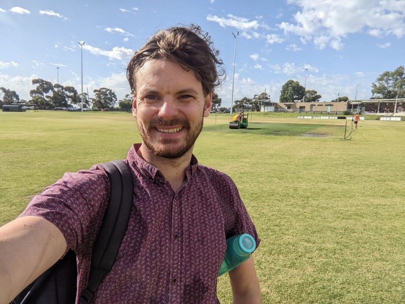
This Geohash is located on a football oval in Essendon.
Participants
Expedition 1:
Expedition 2:
Expedition 3:
Expeditions
Expedition 1 (Felix, James and Gretel)
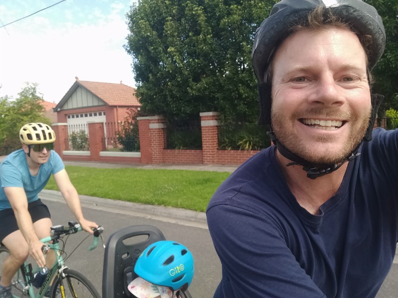
I got Gretel out of her first day of childcare in the afternoon, gave her a big, long sleep at home, then got her up just after 3pm for the geohash. We went on our brand new electric cargo bike, a Benno Boost EV4.
We zoomed off from home with the intention of meeting James on Albion St, but, sadly, my poor communication meant that he was only leaving his home when Gretel and I had reached the meetup location, so we left him to catch up - an activity James described as 'Geohash Pursuit'.
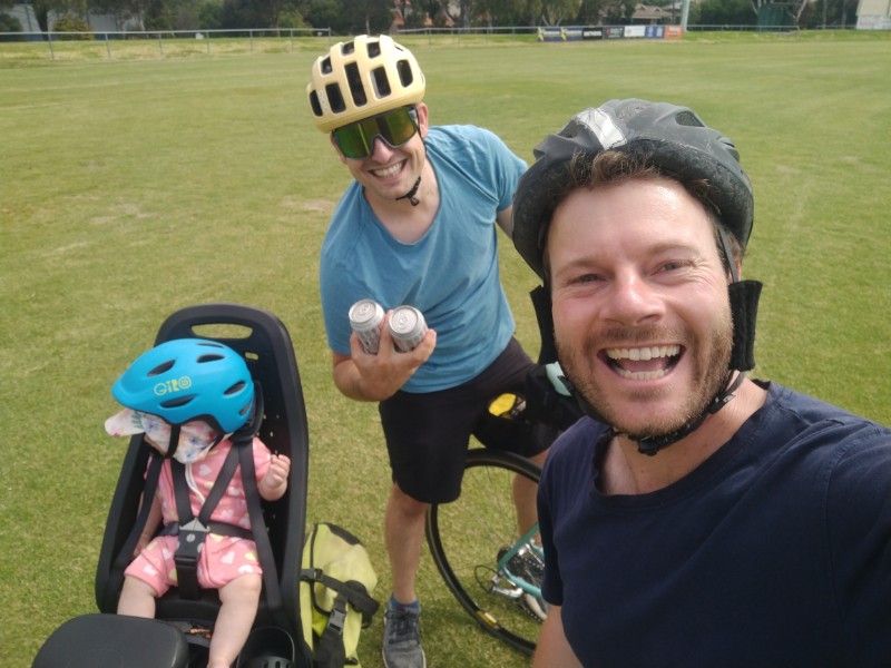
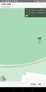
It was very easy riding through the north-west suburbs. Gretel enjoyed the cooling temperature and the breeze on her face. We soon got to the oval and circled the hash, stopping at the location and cracking some tinnies James had brought.
We left the hash and parted ways, but not before giving Gretel a congratulatory swing at the nearly co-located playground. An excellent hash, enjoyed by all.
Tracklog
Expedition 2 (John)
John is said to have run eight times around the hash as part of his hash-running.
Expedition 3 (Steve etc)
Early this morning, I woke up and, like the mobile phone addicted person I am, grabbed for the phone to see what, if anything, exciting had happened over night. Well, on the Geohashing Discord, excitement had reigned in the form of a brand new Melburnian geohasher on the scene, who had burst in with enthusiastic questions galore, moments before today's coordinates were announced.
What luck for them that said coordinates were emminently achievable - on a football oval in Essendon, an inner northwest suburb of Melbourne.
What luck for me that after 15 years of geohashing, the stated promise of geohashing - meeting random strangers at random coordinates - might actually, for the first time, be fulfilled.
Lachie and Ed started an expedition plan that would see us get to the point at some time after 6pm. The random stranger - welcome, BarbaraTables! - was aiming for similar. The odds were looking good.
In my micro planning, I discovered that Hope St continues west through Brunswick much further than I'd imagined, and has its own cute little bridge over Citylink. I reached the rendezvous at rendezvous o'clock, and met Patrick for the first time. This geohash was truly over-delivering on the meeting fellow geohashers front!
Lachie arrived shortly after, while Ed did not. This gave us the chance to witness a car committing three traffic offences simultaneously: speeding, overtaking through double white lines, while looking at his phone.
Soon Lachie led the procession northwest, picking a flattish route through a hilly suburb, on account of his bike having 25 fewer gear combinations than mine.
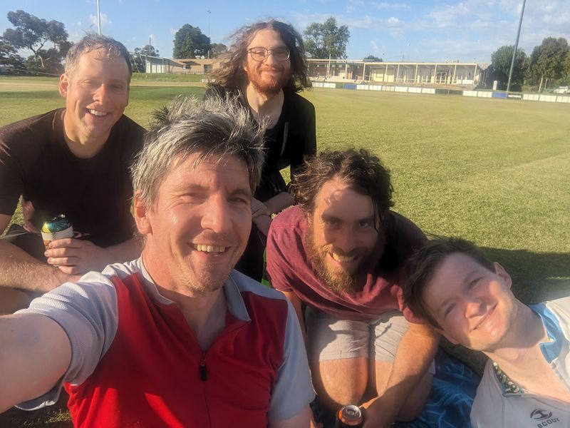
We reached the point without difficulty and Lachie manifested a picnic, near to where a family was playing catch. They got the hint and shifted their game over a bit.
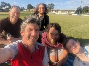
There were beers, there were chips, there was a picnic blanket. Hopefully sufficient for a picnic achievement.
Moments later, the eaglerly awaited Mx Tables arrived and there began a long discussion of all things geohashy, computer gamey, xkcdish and...well, really, those three topics covered most of it.
Eventually the balmy evening turned a shade less balmy, and our fivesome disintegrated. Somehow I became expedition leader for the return trip for Patrick and Ed, which I delegated to Google. Further subdivisions took place until this member arrived home and started writing this report up.
Achievements
Steve, Lachie, Ed, BarbaraTables and Patrick earned the Picnic achievement
|
Steve, Lachie, Ed, BarbaraTables and Patrick earned the Meet-up achievement
|
Steve, Lachie, Ed, BarbaraTables and Patrick earned the Land geohash achievement
|
BarbaraTables earned the Public transport geohash achievement
|
BarbaraTables earned the Two to the N achievement
|
