Difference between revisions of "2024-06-18 48 6"
From Geohashing
m (Location) |
(Coordinates reached) |
||
| Line 12: | Line 12: | ||
== Plans == | == Plans == | ||
[[User:Baarde|Baarde]] will take the train to Sarrebourg, then cycle to the coordinates. He expects to arrive around 15:45. | [[User:Baarde|Baarde]] will take the train to Sarrebourg, then cycle to the coordinates. He expects to arrive around 15:45. | ||
| + | |||
| + | == Expedition == | ||
| + | After a short ride from Sarrebourg to Langatte, I arrived near the hashpoint, which was located in an enclosed meadow. I left my bicycle by the side of the road, walked through the wide open gates, and reached the coordinates at 15:53. | ||
| + | |||
| + | After recording proof, I continued on the road a little bit, then followed the ''Canal de la Sarre'' and ''Canal de la Marne au Rhin'' back to Sarrebourg. | ||
| + | |||
| + | == Photos == | ||
| + | <gallery> | ||
| + | File:2024-06-18 48 6 01.jpg | In Langatte | ||
| + | File:2024-06-18 48 6 02.jpg | my bicycle near the coordinates | ||
| + | File:2024-06-18 48 6 03.png | Coordinates reached | ||
| + | File:2024-06-18 48 6 04.jpg | Surroundings (South-West) | ||
| + | File:2024-06-18 48 6 05.jpg | Surroundings (North-East) | ||
| + | File:2024-06-18 48 6 06.jpg | Stupid grin | ||
| + | </gallery> | ||
| + | |||
| + | == Achievements == | ||
| + | {{#vardefine:ribbonwidth|100%}} | ||
| + | {{land geohash | ||
| + | | latitude = 48 | ||
| + | | longitude = 6 | ||
| + | | date = 2024-06-18 | ||
| + | | name = [[User:Baarde|Baarde]] | ||
| + | }} | ||
__NOTOC__ | __NOTOC__ | ||
[[Category:Expeditions]] | [[Category:Expeditions]] | ||
| + | [[Category:Expeditions with photos]] | ||
| + | [[Category:Coordinates reached]] | ||
{{location|FR|57}} | {{location|FR|57}} | ||
Latest revision as of 16:08, 19 June 2024
| Tue 18 Jun 2024 in 48,6: 48.7649296, 6.9677099 geohashing.info google osm bing/os kml crox |
Location
In a meadow in Langatte.
Participants
Plans
Baarde will take the train to Sarrebourg, then cycle to the coordinates. He expects to arrive around 15:45.
Expedition
After a short ride from Sarrebourg to Langatte, I arrived near the hashpoint, which was located in an enclosed meadow. I left my bicycle by the side of the road, walked through the wide open gates, and reached the coordinates at 15:53.
After recording proof, I continued on the road a little bit, then followed the Canal de la Sarre and Canal de la Marne au Rhin back to Sarrebourg.
Photos

In Langatte
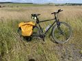
my bicycle near the coordinates
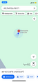
Coordinates reached
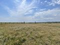
Surroundings (South-West)
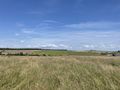
Surroundings (North-East)
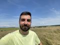
Stupid grin


Achievements
Baarde earned the Land geohash achievement
|