Difference between revisions of "2024-06-17 46 -71"
([live picture]My crocs on the hashpoint [https://openstreetmap.org/?mlat=46.80307778&mlon=-71.21118333&zoom=16 @46.8031,-71.2112]) |
m (Location) |
||
| (11 intermediate revisions by one other user not shown) | |||
| Line 10: | Line 10: | ||
== Location == | == Location == | ||
<!-- where you've surveyed the hash to be --> | <!-- where you've surveyed the hash to be --> | ||
| + | Beside a cannon in the the Plains of Abraham. | ||
== Participants == | == Participants == | ||
<!-- who attended: If you link to your wiki user name in this section, your expedition will be picked up by the various statistics generated for geohashing. You may use three tildes ~ as a shortcut to automatically insert the user signature of the account you are editing with. | <!-- who attended: If you link to your wiki user name in this section, your expedition will be picked up by the various statistics generated for geohashing. You may use three tildes ~ as a shortcut to automatically insert the user signature of the account you are editing with. | ||
--> | --> | ||
| + | * [[User:Gict|Gict]] | ||
| + | * Gict's boyfriend | ||
== Plans == | == Plans == | ||
<!-- what were the original plans --> | <!-- what were the original plans --> | ||
| + | I planned to go after work, it's a nice park for a evening walk. | ||
== Expedition == | == Expedition == | ||
<!-- how it all turned out. your narrative goes here. --> | <!-- how it all turned out. your narrative goes here. --> | ||
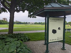
| + | Monday is always grocery day. So after putting together the menu of the week and writing the list down, we headed downtown for our walk. We parked in a parking that I knew and we started. [[Image:2024-06-17_46_-71_Gict_1718717385843.jpg|thumb|Entrance]] | ||
| + | |||
| + | The Plains of Abraham is a historic area within the Battlefields Park where the battle of the same name took place. Now it's the host of events and visitors and tourists come to relax or enjoy the views. The park is active when we arrive, people are running, biking, picnicking, etc. | ||
| + | |||
| + | We walk along a path for about 2km before getting to the hashpoint. Along the way, we observed trees and plants; many were identified with informational panels. So we tried to guess the type and species of some. We also saw a man digging a hole with his metal detector next to him... We didn't stay to see if he dug up something interesting but it was unusual. | ||
| + | |||
| + | [[Image:2024-06-17_46_-71_Gict_1718717402322.jpg|left|thumb|FEQ]] | ||
| + | The haspoint was next to a cannon at a clearing offering a view of the Saint-Lawrence River. Specifically, the haspoint was down an incline of the cannon; from the coordinates, you couldn't see the river. I got my pictures and we took in the view. The weather was nice. We enjoyed it knowing that a heatwave was announced for the next few days. | ||
| + | |||
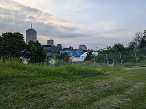
| + | On the way back we went around the park to the side share with the hotels and houses. We passed the freshly installed scene of the Festival d'été de Québec (FEQ), the third biggest outdoor musical event in Canada which will take place in a few weeks from July 4 to 14. We stopped to look at a garden and returned to the car to go grocery shopping. | ||
| + | |||
== Tracklog == | == Tracklog == | ||
<!-- if your GPS device keeps a log, you may use Template:Tracklog, post a link here, or both --> | <!-- if your GPS device keeps a log, you may use Template:Tracklog, post a link here, or both --> | ||
| + | {{tracklog|2024-06-17 46 -71 Gict Tracklog.gpx}} | ||
== Photos == | == Photos == | ||
| Line 31: | Line 47: | ||
Image:2024-06-17_46_-71_Gict_1718668514802.jpg|My crocs on the hashpoint [https://openstreetmap.org/?mlat=46.80307778&mlon=-71.21118333&zoom=16 @46.8031,-71.2112] | Image:2024-06-17_46_-71_Gict_1718668514802.jpg|My crocs on the hashpoint [https://openstreetmap.org/?mlat=46.80307778&mlon=-71.21118333&zoom=16 @46.8031,-71.2112] | ||
| + | |||
| + | Image:2024-06-17_46_-71_Gict_1718717179604.jpg|The cannon from the coordinates | ||
| + | |||
| + | Image:2024-06-17_46_-71_Gict_1718717223302.jpg|French explanation | ||
| + | |||
| + | Image:2024-06-17_46_-71_Gict_1718717260575.jpg|The cannon looking at the Saint-Lawrence River | ||
| + | |||
| + | Image:2024-06-17_46_-71_Gict_1718717323251.jpg|Levis on the other shore | ||
| + | |||
| + | Image:2024-06-17_46_-71_Gict_1718717366887.jpg|Proof | ||
| + | |||
</gallery> | </gallery> | ||
| Line 38: | Line 65: | ||
__NOTOC__ | __NOTOC__ | ||
| − | |||
| − | |||
| − | |||
| − | |||
| − | |||
| − | |||
| − | |||
| − | |||
| − | |||
| − | |||
[[Category:Expeditions]] | [[Category:Expeditions]] | ||
| − | |||
[[Category:Expeditions with photos]] | [[Category:Expeditions with photos]] | ||
| − | |||
| − | |||
| − | |||
| − | |||
[[Category:Coordinates reached]] | [[Category:Coordinates reached]] | ||
| − | + | {{location|CA|QC|03}} | |
| − | |||
| − | |||
| − | |||
| − | |||
| − | |||
| − | |||
| − | |||
| − | |||
| − | |||
| − | |||
| − | |||
| − | |||
| − | |||
Latest revision as of 14:42, 20 June 2024
| Mon 17 Jun 2024 in 46,-71: 46.8030592, -71.2111838 geohashing.info google osm bing/os kml crox |
Location
Beside a cannon in the the Plains of Abraham.
Participants
- Gict
- Gict's boyfriend
Plans
I planned to go after work, it's a nice park for a evening walk.
Expedition
Monday is always grocery day. So after putting together the menu of the week and writing the list down, we headed downtown for our walk. We parked in a parking that I knew and we started.
The Plains of Abraham is a historic area within the Battlefields Park where the battle of the same name took place. Now it's the host of events and visitors and tourists come to relax or enjoy the views. The park is active when we arrive, people are running, biking, picnicking, etc.
We walk along a path for about 2km before getting to the hashpoint. Along the way, we observed trees and plants; many were identified with informational panels. So we tried to guess the type and species of some. We also saw a man digging a hole with his metal detector next to him... We didn't stay to see if he dug up something interesting but it was unusual.
The haspoint was next to a cannon at a clearing offering a view of the Saint-Lawrence River. Specifically, the haspoint was down an incline of the cannon; from the coordinates, you couldn't see the river. I got my pictures and we took in the view. The weather was nice. We enjoyed it knowing that a heatwave was announced for the next few days.
On the way back we went around the park to the side share with the hotels and houses. We passed the freshly installed scene of the Festival d'été de Québec (FEQ), the third biggest outdoor musical event in Canada which will take place in a few weeks from July 4 to 14. We stopped to look at a garden and returned to the car to go grocery shopping.
Tracklog
Photos
My crocs on the hashpoint @46.8031,-71.2112


