Difference between revisions of "2023-05-21 52 1"
m (Location) |
PeterRoder (talk | contribs) m (→Expedition: typo) |
||
| (4 intermediate revisions by 2 users not shown) | |||
| Line 6: | Line 6: | ||
--> | --> | ||
{{meetup graticule | {{meetup graticule | ||
| − | | lat= | + | | lat=52 |
| − | | lon= | + | | lon=1 |
| − | | date= | + | | date=2023-05-21 |
}} | }} | ||
== Location == | == Location == | ||
| Line 48: | Line 48: | ||
...and then watched it leave. | ...and then watched it leave. | ||
| − | There were two hours until the next train. I briefly considered walking to another station that would have an earlier train back to Norwich, but (a) I didn't have wifi, so couldn't check whether that | + | There were two hours until the next train. I briefly considered walking to another station that would have an earlier train back to Norwich, but (a) I didn't have wifi, so couldn't check whether that would work, and (b) I don't think that would be covered by my ticket, so I'd have to spend extra on a new one. |
Instead, I stuck around to explore what little there is in Berney Arms. | Instead, I stuck around to explore what little there is in Berney Arms. | ||
| Line 73: | Line 73: | ||
== Tracklog == | == Tracklog == | ||
| − | + | {{Tracklog|2023-05-21 52 1.gpx}} | |
== Achievements == | == Achievements == | ||
{{#vardefine:ribbonwidth|100%}} | {{#vardefine:ribbonwidth|100%}} | ||
| − | + | {{Minesweeper geohash | |
| + | | graticule = 52,0 | ||
| + | | ranknumber = 3 | ||
| + | | e = true if graticule to the east has been hashed (optional) | ||
| + | | s = true if graticule to the south has been hashed (optional) | ||
| + | | w = true if graticule to the west has been hashed (optional) | ||
| + | | name = [[User:PeterRoder|Peter]] | ||
| + | }} | ||
| + | |||
| + | {{Geohashing Day | ||
| + | | latitude = 52 | ||
| + | | longitude = 1 | ||
| + | | year = 2023 | ||
| + | | coorddate= 2023-05-21 | ||
| + | | name = [[User:PeterRoder|Peter]] | ||
| + | }} | ||
__NOTOC__ | __NOTOC__ | ||
Latest revision as of 20:48, 6 July 2024
| Sun 21 May 2023 in 52,1: 52.5922794, 1.6138417 geohashing.info google osm bing/os kml crox |
Location
Near Berney Arms in the Norfolk Broads.
Participants
Plans
Take the train to Berney Arms station, arriving at 14:01, giving me 23 minutes to get to the hash and back for the return train.
Expedition
I took the 11:50 train from Cambridge, arriving in Norwich at 13:13 giving me time to stop at a local sandwich shop to purchase a chicken and bacon footlong, then caught the 13:36 to Barley Arms.
As the train approached the platform, I stood by the door, preparing for a speedy walk to the hash and back. Unfortunately, the platform was so small that only one door opened, and it wasn't the one I was at. This cost me about 20 seconds, walking through the train to the next carriage.
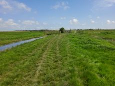
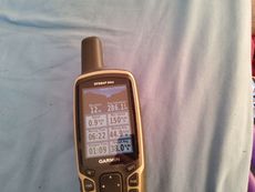
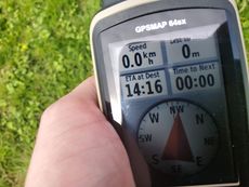 At the hash! |
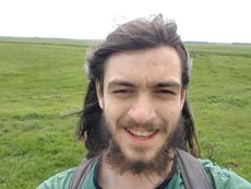 You can tell I was in a rush |
I headed off, along the route that I thought I could follow easily. (I'm used to geohashing around crop fields, where public footpaths are where crops aren't. Cow fields are more difficult.) I did manage to stay on track, although I paused at a few points to get my bearings.
As I approached the hash, I checked the time and realised that over half of it was gone. So I reached the hash, hurriedly took a few pictures, and then set of on a run, taking a slight shortcut for the first part of the return journey.
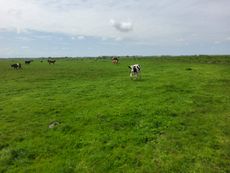
Running back was hindered by two things: my endurance, and the cows. These cows probably aren't very familiar with humans, so were watching me closely even when I walked past them, and some of them got up and looked intimidating at me when I tried to run through their field. So I slowed to a walk until I was away from that herd.
Soon after that, I saw my train pull into the station...
...and then watched it leave.
There were two hours until the next train. I briefly considered walking to another station that would have an earlier train back to Norwich, but (a) I didn't have wifi, so couldn't check whether that would work, and (b) I don't think that would be covered by my ticket, so I'd have to spend extra on a new one.
Instead, I stuck around to explore what little there is in Berney Arms.
Here's some stuff I learned, mostly from Wikipedia:
- Berney Arms station was sold to the rail company by Thomas Berney on the condition that they build a station there.
- After some legal proceedings, it was decided that they also had to serve the station.
- In the year from Apr 2019 to 2020, it was the least used station, but only because it was closed for a large portion of that time.
- Berney Arms is named after the pub, Berney Arms
- I was unable to determine whether Thomas Berney had a connection to the name of the pub, or whether it's a coincidence.
- The pub is closed.
- The windmill is currently closed, because of a 2018 storm.
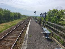
| Definitely the most rural train station I've ever seen | 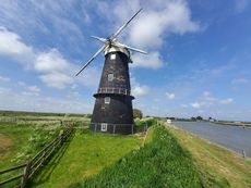 It's a windmill |
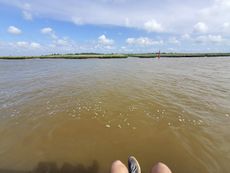 This is the river Yare. I saw 4 boats. |
After the 16:24 train arrived, the return journey was uneventful. I reached home shortly before 7pm.
Tracklog
Achievements
Peter achieved level 3 of the Minesweeper Geohash achievement
|
Peter earned the 2023 Geohashing Day achievement
|
