Difference between revisions of "2024-08-02 48 11"
From Geohashing
| (3 intermediate revisions by 2 users not shown) | |||
| Line 11: | Line 11: | ||
== Expedition == | == Expedition == | ||
| − | *[[User:Iqui|Iqui]]: When I first arrived at the hash location I thought it might be a restricted area due to construction fence that was built around the whole parking lot. Luckily there was an entrance and I also couldn't find any restriction signs or anything like that, so I took some photos of the location and made my way back home. I also wanted to get the [[Tron achievement]] though and had roughly planned out a route that I thought might work. The thing was, when I got on my bike to drive home I instantly realised I had already made a big mistake. Or rather not that big, as in order to not cross my route again I would have needed to switch sides of a street | + | *[[User:Iqui|Iqui]]: When I first arrived at the hash location I thought it might be a restricted area due to construction fence that was built around the whole parking lot. Luckily there was an entrance and I also couldn't find any restriction signs or anything like that, so I took some photos of the location and made my way back home. I also wanted to get the [[Tron achievement]] though and had roughly planned out a route that I thought might work. The thing was, when I got on my bike to drive home I instantly realised I had already made a big mistake. Or rather not that big, as in order to not cross my route again I would have needed to switch sides of a street and go around the circle the other way around (you can see it in the tracklog), so I couldn't get the achievement anymore. |
== Tracklog == | == Tracklog == | ||
| − | + | {{tracklog | 2024-08-02 48 11 Tracklog Iqui.gpx}} | |
== Photos == | == Photos == | ||
<gallery mode="packed" heights="250px"> | <gallery mode="packed" heights="250px"> | ||
| − | + | 2024-08-02 48 11 location.jpeg | location | |
| − | + | 2024-08-02 48 11 location with fence, also bicycle proof.jpeg | location with fence, also bicycle proof :) | |
| − | + | 2024-08-02 48 11 cool view along the way back.jpeg | cool view along the way back | |
| − | + | 2024-08-02 48 11 distance.jpeg | distance | |
| − | + | 2024-08-02 48 11 proof.png | gps proof | |
</gallery> | </gallery> | ||
Latest revision as of 15:14, 2 August 2024
| Fri 2 Aug 2024 in 48,11: 48.2432433, 11.4484304 geohashing.info google osm bing/os kml crox |
Location
On a parking lot in Dachau
Participants
Expedition
- Iqui: When I first arrived at the hash location I thought it might be a restricted area due to construction fence that was built around the whole parking lot. Luckily there was an entrance and I also couldn't find any restriction signs or anything like that, so I took some photos of the location and made my way back home. I also wanted to get the Tron achievement though and had roughly planned out a route that I thought might work. The thing was, when I got on my bike to drive home I instantly realised I had already made a big mistake. Or rather not that big, as in order to not cross my route again I would have needed to switch sides of a street and go around the circle the other way around (you can see it in the tracklog), so I couldn't get the achievement anymore.
Tracklog
Photos
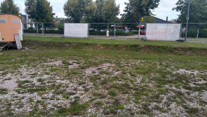
location
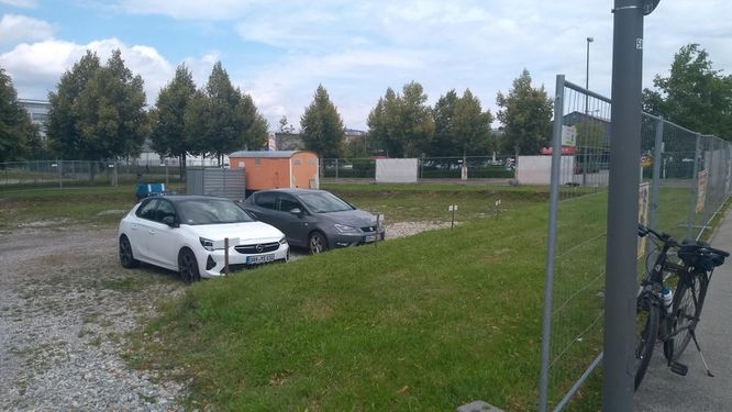
location with fence, also bicycle proof :)

cool view along the way back
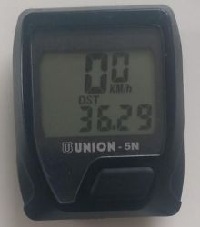
distance
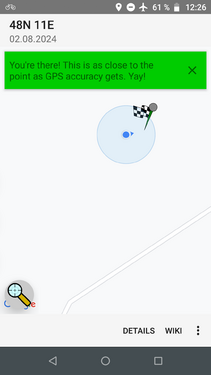
gps proof


Achievements
Iqui earned the Land geohash achievement
|
Iqui earned the Bicycle geohash achievement
|

Iqui earned the Two to the N achievement
by reaching 22 hashpoints on 2024-08-02 48 11 and is promoted to Level 2 (Coordinates reached).