Difference between revisions of "2024-11-09 58 5"
From Geohashing
(→Participants) |
(→Expedition) |
||
| (9 intermediate revisions by the same user not shown) | |||
| Line 8: | Line 8: | ||
And DON'T FORGET to add your expedition and the best photo you took to the gallery on the Main Page! We'd love to read your report, but that means we first have to discover it! :) | And DON'T FORGET to add your expedition and the best photo you took to the gallery on the Main Page! We'd love to read your report, but that means we first have to discover it! :) | ||
-->{{meetup graticule|date=2024-11-09|lat=58|lon=5}} | -->{{meetup graticule|date=2024-11-09|lat=58|lon=5}} | ||
| + | |||
| + | |||
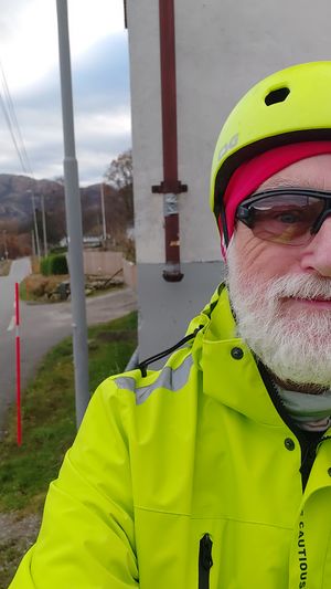
| + | [[Image:20241109_Me.jpg|thumb|left]] | ||
== Location == | == Location == | ||
<!-- where you've surveyed the hash to be --> | <!-- where you've surveyed the hash to be --> | ||
| Line 24: | Line 27: | ||
== Expedition == | == Expedition == | ||
<!-- how it all turned out. your narrative goes here. --> | <!-- how it all turned out. your narrative goes here. --> | ||
| + | |||
| + | The hash point was found without any problems. It was a nice day for a bike ride. Cloudy and 8 - 10 °C and no wind. Due to the fact that it was a nice day, the cycle trip was a little longer than planned, the trip was a total of 75.59 km. | ||
== Tracklog == | == Tracklog == | ||
<!-- if your GPS device keeps a log, you may use Template:Tracklog, post a link here, or both --> | <!-- if your GPS device keeps a log, you may use Template:Tracklog, post a link here, or both --> | ||
| + | |||
| + | {{tracklog |Activity 17496900603.gpx}} | ||
== Photos == | == Photos == | ||
| Line 35: | Line 42: | ||
Image:2024-11-09_58_5_Pica42_1731152675675.jpg|Haga [https://openstreetmap.org/?mlat=58.86598320&mlon=5.82626900&zoom=16 @58.8660,5.8263] | Image:2024-11-09_58_5_Pica42_1731152675675.jpg|Haga [https://openstreetmap.org/?mlat=58.86598320&mlon=5.82626900&zoom=16 @58.8660,5.8263] | ||
| + | Image:20241109 58 5 SW.jpg|thumb|View to the southwest | ||
| + | Image:20241109 58 5 NW.jpg|thumb|View to the northwest | ||
| + | Image:20241109 58 5 NE.jpg|thumb|View to the northeast | ||
| + | Image:20241109 58 5 SE.jpg|thumb|View to the southeast | ||
</gallery> | </gallery> | ||
| Line 41: | Line 52: | ||
<!-- Add any achievement ribbons you earned below, or remove this section --> | <!-- Add any achievement ribbons you earned below, or remove this section --> | ||
| − | + | {{land geohash |name=[[User:Pica42|Pica42]] |date=2024-11-09 |latitude=58 |longitude=5 }} | |
| − | |||
| − | |||
| − | [[ | ||
| − | |||
| − | |||
| − | |||
| − | |||
| − | |||
| − | |||
| − | |||
[[Category:Expeditions]] | [[Category:Expeditions]] | ||
| − | |||
[[Category:Expeditions with photos]] | [[Category:Expeditions with photos]] | ||
| − | |||
| − | |||
| − | |||
| − | |||
[[Category:Coordinates reached]] | [[Category:Coordinates reached]] | ||
| + | {{location|NO|11}} | ||
| − | -- | + | {{Bicycle geohash | latitude = 58 | longitude = 5 | date = 2024-11-09 | name = Pica42 }} |
| − | |||
| − | |||
| − | |||
| − | |||
| − | |||
| − | |||
| − | |||
| − | |||
| − | + | __NOTOC__ | |
Latest revision as of 19:50, 9 November 2024
| Sat 9 Nov 2024 in 58,5: 58.8658990, 5.8261858 geohashing.info google osm bing/os kml crox |
Location
Next to a barn at Haga in Sandnes municipality, Norway
Participants
Plans
Expedition
The hash point was found without any problems. It was a nice day for a bike ride. Cloudy and 8 - 10 °C and no wind. Due to the fact that it was a nice day, the cycle trip was a little longer than planned, the trip was a total of 75.59 km.
Tracklog
Photos
Haga @58.8660,5.8263
Achievements
Pica42 earned the Land geohash achievement
|
Pica42 earned the Bicycle geohash achievement
|


