Difference between revisions of "2024-12-15 58 5"
From Geohashing
(→Achievements) |
(→Expedition) |
||
| (17 intermediate revisions by 2 users not shown) | |||
| Line 7: | Line 7: | ||
And DON'T FORGET to add your expedition and the best photo you took to the gallery on the Main Page! We'd love to read your report, but that means we first have to discover it! :) | And DON'T FORGET to add your expedition and the best photo you took to the gallery on the Main Page! We'd love to read your report, but that means we first have to discover it! :) | ||
| − | -->{{meetup graticule|date=2024- | + | -->{{meetup graticule|date=2024-12-15|lat=58|lon=5}} |
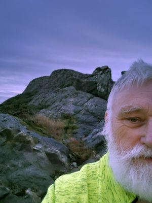
| + | [[Image:20241215 58 5 Me.jpg|thumb|left]] | ||
== Location == | == Location == | ||
<!-- where you've surveyed the hash to be --> | <!-- where you've surveyed the hash to be --> | ||
| + | |||
| + | In a construction site in Holmane, Hå municipality. | ||
== Participants == | == Participants == | ||
| Line 24: | Line 27: | ||
== Expedition == | == Expedition == | ||
| + | |||
| + | This was a windy and cold day, it also got dark early. I was very excited about how this trip would turn out because I had bought a new mobile phone. It went well to get to the zero point but I couldn't register the find in the Geohashing app. The solution was to mess it up somehow after I got home, so I was prepared for strong criticism. I haven't heard anything yet so I hope my logging is approved. | ||
| + | Now I'm looking forward to the next geohash to see if I can get the mobile phone to work the way I want and that I can register geohashes like I have done before. | ||
== Tracklog == | == Tracklog == | ||
| Line 34: | Line 40: | ||
<gallery perrow="5"> | <gallery perrow="5"> | ||
| − | Image:2024- | + | Image:2024-12-15_58_5_Pica42_1734281976412.jpg|Holmane [https://openstreetmap.org/?mlat=58.84246670&mlon=5.73143700&zoom=16 @58.8425,5.7314] |
| − | + | Image:20241215 58 5 S.jpg|thumb|View to the south | |
| + | Image:20241215 58 5 E.jpg|thumb|View to the east | ||
| + | Image:20241215 58 5 North.jpg|thumb|View to the north | ||
| + | Image:20241215 58 5 N.jpg|thumb|View to the West | ||
</gallery> | </gallery> | ||
| Line 42: | Line 51: | ||
<!-- Add any achievement ribbons you earned below, or remove this section --> | <!-- Add any achievement ribbons you earned below, or remove this section --> | ||
| − | + | {{land geohash |name=[[User:Pica42|Pica42]] |date=2024-12-15 |latitude=58 |longitude=5 }} | |
| + | [[Category:Expeditions]] | ||
| + | [[Category:Expeditions with photos]] | ||
| + | [[Category:Coordinates reached]] | ||
| + | {{location|NO|11}} | ||
__NOTOC__ | __NOTOC__ | ||
| + | {{location|NO|11}} | ||
Latest revision as of 17:18, 17 December 2024
| Sun 15 Dec 2024 in 58,5: 58.4828576, 5.8289724 geohashing.info google osm bing/os kml crox |
Location
In a construction site in Holmane, Hå municipality.
Participants
Plans
Expedition
This was a windy and cold day, it also got dark early. I was very excited about how this trip would turn out because I had bought a new mobile phone. It went well to get to the zero point but I couldn't register the find in the Geohashing app. The solution was to mess it up somehow after I got home, so I was prepared for strong criticism. I haven't heard anything yet so I hope my logging is approved. Now I'm looking forward to the next geohash to see if I can get the mobile phone to work the way I want and that I can register geohashes like I have done before.
Tracklog
Photos
Holmane @58.8425,5.7314
Achievements
Pica42 earned the Land geohash achievement
|


