Difference between revisions of "2008-08-18 49 -123"
imported>Thepiguy (consecutive geohash added) |
m (More specific location) |
||
| (One intermediate revision by one other user not shown) | |||
| Line 36: | Line 36: | ||
[[Category:Expeditions with photos]] | [[Category:Expeditions with photos]] | ||
[[Category:Coordinates reached]] | [[Category:Coordinates reached]] | ||
| + | {{location|CA|BC|MV}} | ||
Latest revision as of 22:41, 9 August 2020
| Mon 18 Aug 2008 in 49,-123: 49.0633078, -123.0248625 geohashing.info google osm bing/os kml crox |
Thepiguy procured a small group of friends and drove out to Tsawassen in the dark!
Details
The hash was located on the border (in the middle of a hedge actually) of two houses, but was fairly close to the road. Since I was busy all day, and it was too late to bike, I thought "My friends are all sick and tired of me talking about this weird geohashing thing, so why not bring them along!"
I picked up one person on the way, met a couple of other close by and then drove the van full of would-be geohashers to the site. Some of my associates were more helpful than others while others felt the need to point out every detail displayed on my "GPS locator device," or criticize me and google for choosing a non-optimal route.
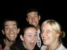
We pulled over on the side of the road, snapped an arms-length photo of the group, and then they all waited in the van as I stood there in the cold trying to get a picture of the GPS and the hash point in the dark.
We got within 50m of the point (pretty darn close) and were only stopped by a gigantic iron fence and a ditch that displayed many moat like properties.
All things told: an awesome geohash with some even awesomer friends! You guys rock!
Images
Consecutive Geohash
This geohash is part of a Consecutive Geohash by thepiguy. The complete list of geohashes is:


