Difference between revisions of "2008-11-10 51 11"
([Shmulik] Con mi ejercito de verdades) |
imported>FippeBot m (Location) |
||
| (10 intermediate revisions by 8 users not shown) | |||
| Line 23: | Line 23: | ||
[[Category:Expeditions]] | [[Category:Expeditions]] | ||
[[Category:Coordinates reached]] | [[Category:Coordinates reached]] | ||
| + | {{location|DE|TH|AP}} | ||
Latest revision as of 00:43, 8 August 2019
| Mon 10 Nov 2008 in 51,11: 51.0489859, 11.4943019 geohashing.info google osm bing/os kml crox |
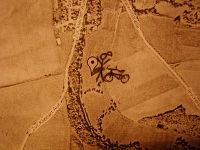
This geohash was so spontaneous that I didn't even know I would be going for it when I went off in the morning. The weather forecast had predicted lots of rain which completely failed to drop by (excuse the low pun). Anyway, it prevented my thinking of geohashing until lunch, but as there were still no huge clouds to be afraid of, I got the satellite picture printout and went off after work, of course having no camera (or, heaven forbid, a GPS!) with me. So the expedition clearly surpassed all past stupidity of my geohashes - why go to a rotten meadow when you can't even prove you were there? Just for the hell of it ;)
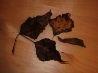
My project supervisor had detained me a little, so I couldn't go before five and it was already dark, of course. I rode my bike to Cospeda (where I watched a cute procession of children with lanterns - it's Martinmas!), Krippendorf, Hermstedt, Schöten and Apolda, just to make my peace with this way I had driven down one week before in the worst fog and darkness ever, and this time it was beautiful, the moon was almost full, stars were shining, I could have gone forever (sigh). From Apolda it wasn't far any more to Zottelstedt, I found the right way right away, passed the sports ground and found the group of trees amongst which the hash point of the day was. As I had no camera with me, at least I collected some of the tree's rotten leaves and a piece of its bark and took their picture at home. The meadow (very near to the river) was a little squishy and I always stepped on pillowy things which I dreaded to be cowpats, but the lamp on my bike assured me it was only soft soil. I didn't even find stones or anything remarkable to mark the spot... well, there's a big tree near it. I really wanted to climb it, but was too weak. I have no idea which kind of tree it was. Next time: how to recognize different types of tree from quite a long way away...
Way back went through the stars again, with a little stopping to inflate my tyre, and a fairly indirect route (as it was so warm and nice and beautiful, I just didn't want to go home). So believe it or not, another geohash was reached...
---Paintedhell
- Photo Gallery
Awards
As I am not able to submit any real proof this time, I will not claim any achievement. Had a great time anyway.

