Difference between revisions of "2008-12-06 37 -122"
(→Location) |
imported>FippeBot m (Location) |
||
| Line 90: | Line 90: | ||
[[Category:Expeditions with photos]] | [[Category:Expeditions with photos]] | ||
[[Category:Coordinates reached]] | [[Category:Coordinates reached]] | ||
| + | {{location|US|CA|SF}} | ||
Latest revision as of 00:57, 8 August 2019
| Sat 6 Dec 2008 in 37,-122: 37.7112022, -122.3223535 geohashing.info google osm bing/os kml crox |
More photos to come
Contents
Location
Smack dab in the middle of the bay, off of Hunter's Point
People
Larry
2 drag-alongs (I needed the crew and it was technically their boat... so they got to come along.)
The Tale
I was cruising the geohashing pages for the SF grat, and I was surprised that as much water as we had, it seemed we had no successful water geohash. So when the official saturday point turned up right in the middle of the bay, I knew it was time to break out the boat and change that. I posted a request on the mailing list, and within the hour had secured a crew. of one at least.
We met up at the launch point in Alameda at about noon. We were able to put the boat in the water without too much trouble, only to discover we didn't have a gas tank for the motor. Went to search one of the other boats for a gas tank and found a very high trailer with no way up. However, using the adjacent trailer and a little Tarzan inspiration, I was able to get on top... to a vantage point that let me point out the now obvious gas tank back on the ground beside the trailer >_<
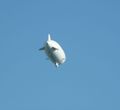
Gas tank secured and sails rigged up, we caught the wind and were on our way, albeit now much later than originally intended. As we sailed down the long channel towards open bay, we considered it a sign of impending success when we spotted the Zeppelin (!!!) circling overhead.
We took it as another sign when we reached the end of the channel, about an hour before we needed to turn back, with the GPS reading 5.25 miles to go and a steady clip of 5.2 m/hr. The sail out to the hash was a mostly uneventful 2.5 hours all told, during which we enjoyed some lunch and avoided ramming large cargo vessels.
We sailed directly through the point at about 3:40, trying our best to get a picture at just the right moment... with questionable success... and looked around the empty water hoping for maybe another xkcd boat. so we could board them.
Unfortunately it seemed we were the only crew out that day, and we turned about in hopes of making it back to dock before sunset. fat chance.
The sun set about a third of the way back. we got some nice shots of the sunset behind the SF skyline, and as we passed by, we considered attacking the naval base under cover of darkness. We decided against it when we spotted their aircraft carrier. As we made it back into the channel, we hit a surprise and powerful wake of an exiting homeland security boat, and we were no longer dry. The next obstacle to our return soon became apparent as the large cargo ship loomed into view... sideways completely across the channel. Luckily we were able to get around its bow as it turned. Now properly dark, we came across a boat-born holiday parade, and had to turn once again to our GPS to navigate the channel and find our dock.
We were even buzzed by harbor patrol for being out after dark without running lights, but as we were close and trying our darnedest to get back to shore, they let us off. We finally made it back, and had to try 5 times before managing to get the boat out of the water and back onto the trailer, but all told we had a wonderful time. Complete with stupid grins.
Achievements
Janowar and Larry earned the Water geohash achievement
|
Janowar and Larry earned the Police Geohash Achievement
|
Janowar earned the Drag-along achievement
|
we might arguably have a claim on lowest geohash as well, as Larry's GPS was reading -27' at the point, but I doubt it was calibrated correctly. It may have been low tide, but even I don't think it was 27 feet of low tide.


