Difference between revisions of "2008-12-27 57 -3"
imported>Damianc (Hash 2008-12-27 - Elgin, UK) |
imported>FippeBot m (Location) |
||
| (8 intermediate revisions by 5 users not shown) | |||
| Line 10: | Line 10: | ||
== About == | == About == | ||
| − | [[User:Smoulder|Smoulder]] and [[User:damianc|Damianc]] made this expedition, along with Emily, Lewis and Eric. | + | [[User:Smoulder|Smoulder]] and [[User:damianc|Damianc]] made this expedition, along with [[User:Emily|Emily]], [[User:Lewis|Lewis]] and [[User:Ericp|Eric]]. |
| − | The hashpoint is located just to the | + | The hashpoint is located just to the west of the A96, south of Fochabers. So far so good, it all looks pretty straightforward. |
| + | |||
| + | == Expedition == | ||
| + | |||
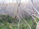
| + | A fairly uneventful drive before we parked up beside the forest near the geohash point. The terrain proved to be substantially trickier than we first suspected, being a 60 degree slope covered in decaying ash saplings and frozen woodrush resulting in as much falling as climbing. | ||
| + | |||
| + | Once in the woodland, we found that our apparent position using GPS can change by as much as a degree second while simply standing still. This was our first time using GPS and had such confidence in it that we didn't bring our map, simply using a compass to tell us which way to the coordinates. So the only way we were going to successfully achieve this geohash was to stumble about the woods in the vicinity of the hashpoint like a bunch of aimless numpties, which we duly did. | ||
| + | Under the circumstances, an empirical monte carlo approach seemed to be the only effective method. | ||
| + | |||
| + | We'll be better prepared and more thorough next time, not least because we would have circumnavigated a field rather than climbed down then up again on difficult terrain. But we still consider that the geohash was achieved and better than it would have been with compass bearings (no landmarks were visible). | ||
| + | |||
| + | == Achievements == | ||
| + | {{land geohash | ||
| + | |||
| + | | latitude = 57 | ||
| + | | longitude = -3 | ||
| + | | date = 2008-12-27 | ||
| + | |||
| + | }} | ||
| + | {{Template:Geotrash | ||
| + | |||
| + | | latitude = 57 | ||
| + | | longitude = -3 | ||
| + | | date = 2008-12-27 | ||
| + | }} | ||
| + | |||
| + | [[Category:Land geohash achievement]] | ||
| + | [[Category:Expeditions]] | ||
| + | [[Category:Expeditions with photos]] | ||
| + | [[Category:Coordinates reached]] | ||
| + | |||
| + | == Photographs == | ||
| + | |||
| + | <gallery widths="160px" align=center> | ||
| + | Image:2008_12_27_57_-3_forest.jpg|The somewhat tricky descent through decaying trees | ||
| + | Image:2008_12_27_57_-3_dcgrin.jpg|damianc: a sense of achievement | ||
| + | Image:2008_12_27_57_-3_elk.jpg|Emily: Elk impression | ||
| + | Image:2008_12_27_57_-3_lewis.jpg|Lewis: stupid grin | ||
| + | Image:2008_12_27_57_-3_oatcake.jpg| Eric: a well-earned oatcake | ||
| + | Image:2008_12_27_57_-3_gas.jpg|Smoulder: drinking carbonated water at below zero has side effects | ||
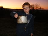
| + | Image:2008_12_27_57_-3_pans.jpg|Eric brings back some discarded pans and bottles, found buried in the leaf litter | ||
| + | Image:2008_12_27_57_-3_pan_a.jpg| Wanna buy a used pan? | ||
| + | </gallery> | ||
| + | {{location|GB|SCT|MRY}} | ||
Latest revision as of 01:09, 8 August 2019
| Sat 27 Dec 2008 in Elgin: 57.5988770, -3.0776342 geohashing.info google osm bing/os kml crox |
Contents
About
Smoulder and Damianc made this expedition, along with Emily, Lewis and Eric. The hashpoint is located just to the west of the A96, south of Fochabers. So far so good, it all looks pretty straightforward.
Expedition
A fairly uneventful drive before we parked up beside the forest near the geohash point. The terrain proved to be substantially trickier than we first suspected, being a 60 degree slope covered in decaying ash saplings and frozen woodrush resulting in as much falling as climbing.
Once in the woodland, we found that our apparent position using GPS can change by as much as a degree second while simply standing still. This was our first time using GPS and had such confidence in it that we didn't bring our map, simply using a compass to tell us which way to the coordinates. So the only way we were going to successfully achieve this geohash was to stumble about the woods in the vicinity of the hashpoint like a bunch of aimless numpties, which we duly did. Under the circumstances, an empirical monte carlo approach seemed to be the only effective method.
We'll be better prepared and more thorough next time, not least because we would have circumnavigated a field rather than climbed down then up again on difficult terrain. But we still consider that the geohash was achieved and better than it would have been with compass bearings (no landmarks were visible).
Achievements
This user earned the Land geohash achievement
|
This user earned the GeoTrash Geohash Achievement
|


