Difference between revisions of "2009-04-25 51 4"
imported>Jorisslob (New page: {{meetup graticule | map=<map lat="51" lon="4" date="2009-04-25" /> | lat=51 | lon=4 | date=2009-04-25 }} ==About== This Rotterdam,_Netherlands geohash was located in the Wouwse Plan...) |
m |
||
| (One intermediate revision by one other user not shown) | |||
| Line 44: | Line 44: | ||
</gallery> | </gallery> | ||
| − | + | [[Category:Expeditions]] | |
| + | [[Category:Expeditions with photos]] | ||
[[Category:Coordinates reached]] | [[Category:Coordinates reached]] | ||
| + | {{location|NL|NB}} | ||
Latest revision as of 17:40, 19 April 2021
| Sat 25 Apr 2009 in 51,4: 51.4809778, 4.3527699 geohashing.info google osm bing/os kml crox |
Contents
About
This Rotterdam,_Netherlands geohash was located in the Wouwse Plantage, an area used for growing different types of trees.
Expeditions
Jorisslob
This is my second geohashing trip. Like the previous trip, I was able to go a lot of the way by car. But the hash location was in the middle of a forest area. At first I was worried if I would be able to make the hash location this time. On Google Maps, there was an omnious blurred area nearby. Also, I was unsure how many walking trails would go through the Wouwse Plantage, and if I was allowed to go off those trails.
My heart sank when I was driving around the area of the hash location. I saw a lot of fences, areas with barbed wire and signs claiming that the area was off limits. Still, I parked the car at the nearest car park I could find, and started walking in the general direction of the hash location.
I had to circle around the area a bit, and took a picture of the 'off limits' signs. Suddenly there was a path which had no signs and no barbed wire. It looked quite nice, although I kept wondering if it was really alright to walk there.
Along the way I was stopped by a ferocious beast (see pictures!), that guarded the way to the hash location. I managed to stun it using my flash photography, and continued onwards.
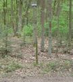
It was almost magical how there were always paths going in the correct direction of the geohash location. Finally I reached the location and made a lot of photos to make a panorama picture, so people can see what it looks like.
I tried to make a photo of my mobile phone showing my coordinates, but it turned out to be a very bad picture. I have done my best to enhance the contrast of the screen. I really hope it is readable.
Seeing nobody, I started constructing a marking for other geohashers that might arrive later. Almost forgot to make a picture of myself! Luckily I corrected that, and put no my most silly grin.
Nearby, I saw some garbage and picked it up (I have to admit, I did it with the ribbon in mind). While garbage collecting, I also found some evidence that someone might be able to claim the sex geohash ribbon. Although they were probably not aware of this fact.


