Difference between revisions of "2009-05-07 50 11"
(comment3, http://facingfortyforthrightly.com/ lamictal, http://xdljs.net/ levitra 10 pills, http://erikchua.com/ celebrex generic, http://cikguonline.com/ zolpidem smoking, http://santacruzac.com/ dox) |
imported>FippeBot m (Location) |
||
| (4 intermediate revisions by 4 users not shown) | |||
| Line 1: | Line 1: | ||
| − | + | {{meetup graticule | |
| + | | map=<map lat="50" lon="11" date="2009-05-07" /> | ||
| + | | lat=50 | ||
| + | | lon=11 | ||
| + | | date=2009-05-07 | ||
| + | }} | ||
| + | == Participants == | ||
| + | * [[user:Paintedhell|Juja]] | ||
| + | * [[user:Reinhard|Reinhard]] | ||
| + | |||
| + | == Expedition == | ||
| + | As I had a day off today and the weather was far beyond my expectations, I decided very spontaneously (after breakfast, and, in fact, having the choice between going or doing the washing-up) to visit this day's hash point, even it was at a distance of about 45km and would clearly take me to my limits. Of course I started by bike, going the cycleway to Jena Lobeda and from there on to Rutha, up the hill to Sulza and so on... I forgot that there might be mountains anywhere as soon as I leave the valley by the river (Saale), so they quite got me by surprise, but I had all the time in the world to get used to them during the next 40km. Anyway, as the noise became louder I knew I was close: I had finally reached A9 (the freeway) which I crossed twice on smaller streets, arriving at Dittersdorf at last. Only some 100m after the second crossing of the freeway there goes a nice way to the fields (and the numerous deer stands there and at the small pond in the middle). I could ride my bike until I reached the forest which was separated from the meadow by a small creek. So I left my bike at the meadow, jumped over, found the spot, took the necessary proof pictures and left again, already zonked. Anyway, I rode my bike "back home" (funny phrase considering there were 55km still to go) through such wonderful villages like Knau (great lake landscape!), Grobengereuth and Bodelwitz to Pößneck. I was hungry and there was food, so I did my bit and supported the first local restaurant to be found. From there, everything seemed easy: only 34km to do (according to road signs), and always through valleys without any stops to have a look at the map, because every sign was directing back home. I have never been as happy as this time to see the first houses of Jena... hooray, new record set! | ||
| + | ---[[User:Paintedhell|Paintedhell]] | ||
| + | |||
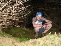
| + | Not knowing that Juja already did an expedition to this hash point, due to the nice weather I decided to ride my bike there after work, which I finished around 5:30 pm. Not having eaten too much this day, I bought a pair of sausages and ate it riding the bike from the northern part of Jena right through the city, not to lose even more time. I didn't choose the shortest way to the hash point, so I could record some new tracks for the [http://www.rennrad-tourenplaner.de/Tourenplaner/Tourenplaner quaeldich.de road bike trip planner]. The weather was really great, so I really enjoyed the tour. It was just before sunset, when I had to leave the road after 64 km for the last 500 m to the hash point. Mostly there was 40 cm deep grass, but possible to ride. For the last 30 m I had to bushwhack and finally took some pictures in the dark wood. Unfortunately, I didn't recognize Juja's xkcd marking. Of course, it got dark for the last two hours on my way back home to Jena-Cospeda, but I'm quite used to that and enjoy the different atmosphere and the silence of the night. Around 11:15 pm I got home - after 129 km, 1579 m total ascent and a ride time of 5:10 h. | ||
| + | ---[[User:Reinhard|Reinhard]] | ||
| + | |||
| + | <gallery caption="Photo Gallery" widths="200px" heights="200px" perrow="2"> | ||
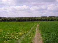
| + | Image:Geo_20090507_50_11_1.jpg|View to the hash point (in the forest). Green as a rice field ;) | ||
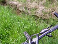
| + | Image:Geo_20090507_50_11_2.jpg|My bike at the Chasm Of Everfall. | ||
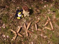
| + | Image:Geo_20090507_50_11_4.jpg|This time, they both marked the spot using pine cones. They aren't expecting any ribbons for that ;) | ||
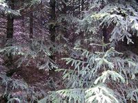
| + | Image:Geo_20090507_50_11_5.jpg|Deep, dark forest around the point. | ||
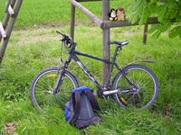
| + | Image:Geo_20090507_50_11_6.jpg|My bike and the hashcots having a break at one of the deer stands near the pond. | ||
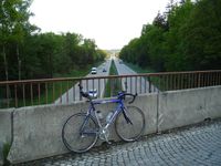
| + | Image:Geo_20090507_50_11_07.jpg|Crossing the A9 somewhere between Triptis and Dittersdorf. | ||
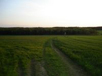
| + | Image:Geo_20090507_50_11_08.jpg|The same view to the hash point during sunset. | ||
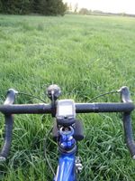
| + | Image:Geo_20090507_50_11_09.jpg|Who said road bikes were intended only for use on roads? | ||
| + | Image:Geo_20090507_50_11_10.jpg|Accurately planted rows of trees at the hash point. | ||
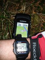
| + | Image:Geo_20090507_50_11_11.jpg|Date, time and position on the map. | ||
| + | Image:Geo_20090507_50_11_12.jpg|Reinhard at the hash point. | ||
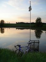
| + | Image:Geo_20090507_50_11_13.jpg|The little pond nearby and my trusty bike. | ||
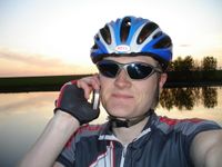
| + | Image:Geo_20090507_50_11_14.jpg|Telling [[User:Manu|Manu]], that I succeeded. | ||
| + | </gallery> | ||
| + | |||
| + | ==Achievements== | ||
| + | Not new, but my longest bicycle geohash... | ||
| + | {{Bicycle geohash | latitude=50 | longitude=11 | date=2009-05-07 | name=Juja}} | ||
| + | |||
| + | Same for me! :) | ||
| + | {{Bicycle geohash | latitude=50 | longitude=11 | date=2009-05-07 | name=Reinhard}} | ||
| + | |||
| + | [[Category:Expeditions]] | ||
| + | [[Category:Expeditions with photos]] | ||
| + | [[Category:Coordinates reached]] | ||
| + | {{location|DE|TH|SOK}} | ||
Latest revision as of 03:13, 8 August 2019
| Thu 7 May 2009 in 50,11: 50.6390393, 11.7938193 geohashing.info google osm bing/os kml crox |
Participants
Expedition
As I had a day off today and the weather was far beyond my expectations, I decided very spontaneously (after breakfast, and, in fact, having the choice between going or doing the washing-up) to visit this day's hash point, even it was at a distance of about 45km and would clearly take me to my limits. Of course I started by bike, going the cycleway to Jena Lobeda and from there on to Rutha, up the hill to Sulza and so on... I forgot that there might be mountains anywhere as soon as I leave the valley by the river (Saale), so they quite got me by surprise, but I had all the time in the world to get used to them during the next 40km. Anyway, as the noise became louder I knew I was close: I had finally reached A9 (the freeway) which I crossed twice on smaller streets, arriving at Dittersdorf at last. Only some 100m after the second crossing of the freeway there goes a nice way to the fields (and the numerous deer stands there and at the small pond in the middle). I could ride my bike until I reached the forest which was separated from the meadow by a small creek. So I left my bike at the meadow, jumped over, found the spot, took the necessary proof pictures and left again, already zonked. Anyway, I rode my bike "back home" (funny phrase considering there were 55km still to go) through such wonderful villages like Knau (great lake landscape!), Grobengereuth and Bodelwitz to Pößneck. I was hungry and there was food, so I did my bit and supported the first local restaurant to be found. From there, everything seemed easy: only 34km to do (according to road signs), and always through valleys without any stops to have a look at the map, because every sign was directing back home. I have never been as happy as this time to see the first houses of Jena... hooray, new record set! ---Paintedhell
Not knowing that Juja already did an expedition to this hash point, due to the nice weather I decided to ride my bike there after work, which I finished around 5:30 pm. Not having eaten too much this day, I bought a pair of sausages and ate it riding the bike from the northern part of Jena right through the city, not to lose even more time. I didn't choose the shortest way to the hash point, so I could record some new tracks for the quaeldich.de road bike trip planner. The weather was really great, so I really enjoyed the tour. It was just before sunset, when I had to leave the road after 64 km for the last 500 m to the hash point. Mostly there was 40 cm deep grass, but possible to ride. For the last 30 m I had to bushwhack and finally took some pictures in the dark wood. Unfortunately, I didn't recognize Juja's xkcd marking. Of course, it got dark for the last two hours on my way back home to Jena-Cospeda, but I'm quite used to that and enjoy the different atmosphere and the silence of the night. Around 11:15 pm I got home - after 129 km, 1579 m total ascent and a ride time of 5:10 h. ---Reinhard
- Photo Gallery
Telling Manu, that I succeeded.
Achievements
Not new, but my longest bicycle geohash...
Juja earned the Bicycle geohash achievement
|
Same for me! :)
Reinhard earned the Bicycle geohash achievement
|
